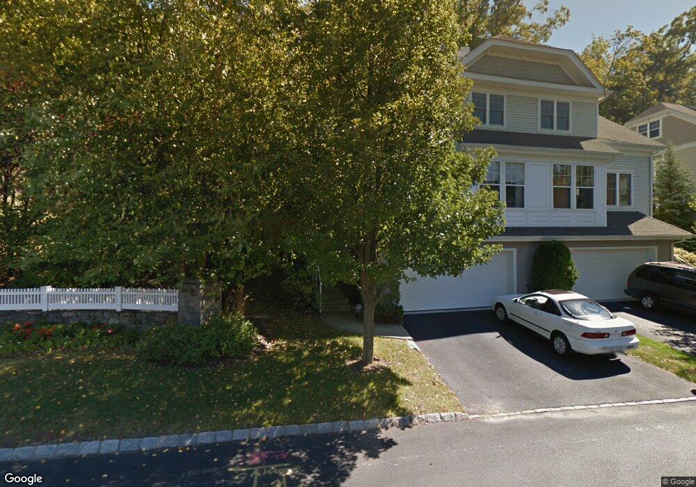
70 Briarbrook Dr Unit 70 Briarcliff Manor, NY 10510
Estimated Value: $902,000 - $941,000
3
Beds
4
Baths
3,011
Sq Ft
$306/Sq Ft
Est. Value
About This Home
This home is located at 70 Briarbrook Dr Unit 70, Briarcliff Manor, NY 10510 and is currently estimated at $921,960, approximately $306 per square foot. 70 Briarbrook Dr Unit 70 is a home located in Westchester County with nearby schools including Park School, Claremont School, and Roosevelt Elementary School.
Ownership History
Date
Name
Owned For
Owner Type
Purchase Details
Closed on
Dec 31, 2009
Sold by
Elliott Dennis D and Elliott Catherine A
Bought by
Graham Brian and Bendor Jane
Current Estimated Value
Purchase Details
Closed on
Jul 28, 2005
Sold by
Witkowski Michal Z and Raihl Margaret A
Bought by
Elliott Dennis D and Elliott Catherine A
Purchase Details
Closed on
Feb 20, 2002
Sold by
Ginsburg Development Llc
Bought by
Raihl Margaret A and Witowski Michal Z
Create a Home Valuation Report for This Property
The Home Valuation Report is an in-depth analysis detailing your home's value as well as a comparison with similar homes in the area
Home Values in the Area
Average Home Value in this Area
Purchase History
| Date | Buyer | Sale Price | Title Company |
|---|---|---|---|
| Graham Brian | $590,000 | None Available | |
| Elliott Dennis D | $725,000 | -- | |
| Raihl Margaret A | $434,045 | -- |
Source: Public Records
Tax History Compared to Growth
Tax History
| Year | Tax Paid | Tax Assessment Tax Assessment Total Assessment is a certain percentage of the fair market value that is determined by local assessors to be the total taxable value of land and additions on the property. | Land | Improvement |
|---|---|---|---|---|
| 2024 | $13,382 | $447,500 | $129,800 | $317,700 |
| 2023 | $13,000 | $433,700 | $129,000 | $304,700 |
| 2022 | $13,695 | $399,400 | $126,200 | $273,200 |
| 2021 | $13,335 | $385,400 | $125,100 | $260,300 |
| 2020 | $13,192 | $374,100 | $125,100 | $249,000 |
| 2019 | $13,266 | $362,100 | $125,100 | $237,000 |
| 2018 | $10,722 | $362,100 | $125,100 | $237,000 |
| 2017 | $1,738 | $346,500 | $124,300 | $222,200 |
| 2016 | $165,716 | $346,500 | $124,300 | $222,200 |
| 2015 | $7,432 | $19,606 | $6,823 | $12,783 |
| 2014 | $7,432 | $19,606 | $6,823 | $12,783 |
| 2013 | $7,432 | $19,606 | $6,823 | $12,783 |
Source: Public Records
Map
Nearby Homes
- 70 Briarbrook Dr
- 10 Briarbrook Dr
- 147 Charter Cir Unit 147
- 97 Charter Cir Unit 97
- 84 Charter Cir Unit 84
- 23 Liberty St
- 129 S Highland Ave Unit C-2
- 129 S Highland Ave Unit B6
- 123 S Highland Ave Unit B3
- 125 S Highland Ave Unit 4B
- 127 S Highland Ave Unit A4
- 155 Revolutionary Rd
- 608 Kemeys Cove Unit 6-08
- 7 Liberty St
- 16 Rockledge Ave Unit 7J
- 16 Rockledge Ave Unit 5B1
- 16 Rockledge Ave Unit 3E1
- 16 Rockledge Ave Unit 5L2
- 1 Agate Ave
- 3 Holbrook Rd
- 69 Briarbrook Dr
- 69 Briarbrook Dr Unit 69
- 71 Briarbrook Dr
- 68 Briarbrook Dr
- 66 Briarbrook Dr
- 66 Briarbrook Dr Unit 66
- 73 Briarbrook Dr
- 73 Briarbrook Dr Unit 73
- 9 Briarbrook Dr
- 74 Briarbrook Dr
- 62 Briarbrook Dr
- 61 Briarbrook Dr
- 75 Briarbrook Dr
- 75 Briarbrook Dr Unit 75
- 76 Briarbrook Dr
- 76 Briarbrook Dr Unit 76
- 411 Glenwood Dr
- 409 Glenwood Dr
- 60 Briarbrook Dr
- 12 Briarbrook Dr