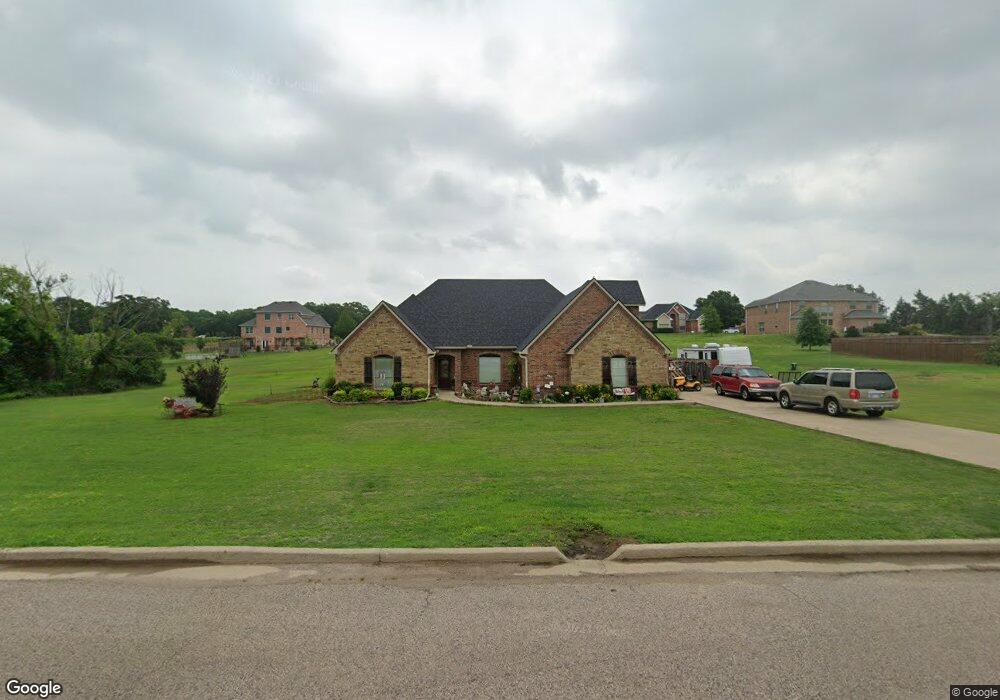
70 Brooke Ln Durant, OK 74701
Estimated Value: $401,000 - $437,828
3
Beds
2
Baths
2,733
Sq Ft
$154/Sq Ft
Est. Value
About This Home
This home is located at 70 Brooke Ln, Durant, OK 74701 and is currently estimated at $422,207, approximately $154 per square foot. 70 Brooke Ln is a home located in Bryan County with nearby schools including Silo Early Childhood Center, Silo Elementary School, and Silo Middle School.
Ownership History
Date
Name
Owned For
Owner Type
Purchase Details
Closed on
Feb 15, 2024
Sold by
Michael James Calvin and Michael Carol Diane
Bought by
James C Michael Ii And Carol Diane Michael Re
Current Estimated Value
Purchase Details
Closed on
Dec 3, 2008
Sold by
Ansiel Robert L
Bought by
Michael Ii James Calvin and Michael Carol Diane
Home Financials for this Owner
Home Financials are based on the most recent Mortgage that was taken out on this home.
Original Mortgage
$218,996
Interest Rate
5.99%
Mortgage Type
VA
Create a Home Valuation Report for This Property
The Home Valuation Report is an in-depth analysis detailing your home's value as well as a comparison with similar homes in the area
Home Values in the Area
Average Home Value in this Area
Purchase History
| Date | Buyer | Sale Price | Title Company |
|---|---|---|---|
| James C Michael Ii And Carol Diane Michael Re | -- | None Listed On Document | |
| Michael Ii James Calvin | $212,000 | None Available |
Source: Public Records
Mortgage History
| Date | Status | Borrower | Loan Amount |
|---|---|---|---|
| Previous Owner | Michael Ii James Calvin | $218,996 |
Source: Public Records
Tax History Compared to Growth
Tax History
| Year | Tax Paid | Tax Assessment Tax Assessment Total Assessment is a certain percentage of the fair market value that is determined by local assessors to be the total taxable value of land and additions on the property. | Land | Improvement |
|---|---|---|---|---|
| 2024 | $2,522 | $30,804 | $1,719 | $29,085 |
| 2023 | $2,522 | $29,907 | $1,719 | $28,188 |
| 2022 | $2,448 | $29,907 | $1,719 | $28,188 |
| 2021 | $2,388 | $29,907 | $1,719 | $28,188 |
| 2020 | $2,400 | $29,907 | $1,719 | $28,188 |
| 2019 | $2,464 | $30,223 | $1,719 | $28,504 |
| 2018 | $2,478 | $30,274 | $1,719 | $28,555 |
| 2017 | $2,126 | $28,876 | $1,714 | $27,162 |
| 2016 | $2,025 | $27,501 | $1,430 | $26,071 |
| 2015 | $1,717 | $23,320 | $3,300 | $20,020 |
| 2014 | $1,717 | $23,320 | $3,300 | $20,020 |
Source: Public Records
Map
Nearby Homes
- 19 Blake Ln
- 20 Blake Ln
- 0 Sand Trap Dr
- 18 Sandwedge
- 00 Sandstone
- 157 Lake Meadow Loop Rd
- 236 Grove Way
- 19 Skylark Ln
- 0 Santa Monica Ave
- 46 Aspen Cir
- 45 Aspen Cir
- 959 Knight Dr
- 175 Maple Leaf Dr
- 84 Maple Leaf Dr
- 93 Maple Leaf Dr
- 83 Maple Leaf Dr
- 94 Maple Leaf Dr
- 96 Maple Leaf Dr
- 97 Maple Leaf Dr
- 95 Maple Leaf Dr
- 84 Brooke Ln
- 0 Brooke Ln Unit 1724421
- 0 Brooke Ln Unit 1732152
- 45 Blake Ln
- 85 Brooke Ln
- 55 Brooke Ln
- 20 Brooke Ln
- 159 Brooke Ln
- 37 Brooke Ln
- 165 Blake Ln
- 110 Blake Ln
- 15 Brooke Ln
- 203 Hillcrest Heights Dr
- 181 Brooke Ln
- 165 Brooke Ln
- 82 Gap Wedge
- 150 Blake Ln
- 180 Brooke Ln
- 6 Greens Rd
- 17 Hillcrest Heights Dr