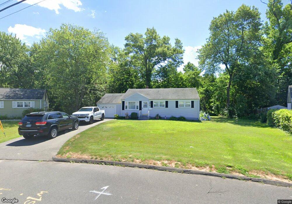
70 Brookside Cir Wethersfield, CT 06109
Estimated Value: $286,000 - $321,000
3
Beds
1
Bath
888
Sq Ft
$342/Sq Ft
Est. Value
About This Home
This home is located at 70 Brookside Cir, Wethersfield, CT 06109 and is currently estimated at $303,630, approximately $341 per square foot. 70 Brookside Cir is a home located in Hartford County with nearby schools including Emerson-Williams School, Silas Deane Middle School, and Wethersfield High School.
Ownership History
Date
Name
Owned For
Owner Type
Purchase Details
Closed on
May 18, 2017
Sold by
Schwartz Nancy and Estabrook Nancy E
Bought by
Scwartz Nancy
Current Estimated Value
Purchase Details
Closed on
Jul 1, 2005
Sold by
Costanzo Edith M
Bought by
Estabrooks Nancy E
Home Financials for this Owner
Home Financials are based on the most recent Mortgage that was taken out on this home.
Original Mortgage
$176,000
Interest Rate
5.73%
Mortgage Type
Purchase Money Mortgage
Purchase Details
Closed on
Mar 28, 2001
Sold by
Roswell Const
Bought by
Lemkey Roseann
Create a Home Valuation Report for This Property
The Home Valuation Report is an in-depth analysis detailing your home's value as well as a comparison with similar homes in the area
Home Values in the Area
Average Home Value in this Area
Purchase History
| Date | Buyer | Sale Price | Title Company |
|---|---|---|---|
| Scwartz Nancy | -- | -- | |
| Estabrooks Nancy E | $176,000 | -- | |
| Lemkey Roseann | $199,975 | -- |
Source: Public Records
Mortgage History
| Date | Status | Borrower | Loan Amount |
|---|---|---|---|
| Previous Owner | Lemkey Roseann | $174,055 | |
| Previous Owner | Lemkey Roseann | $16,953 | |
| Previous Owner | Lemkey Roseann | $176,000 |
Source: Public Records
Tax History
| Year | Tax Paid | Tax Assessment Tax Assessment Total Assessment is a certain percentage of the fair market value that is determined by local assessors to be the total taxable value of land and additions on the property. | Land | Improvement |
|---|---|---|---|---|
| 2025 | $6,862 | $166,480 | $63,760 | $102,720 |
| 2024 | $4,771 | $110,400 | $58,680 | $51,720 |
| 2023 | $4,613 | $110,400 | $58,680 | $51,720 |
| 2022 | $4,535 | $110,400 | $58,680 | $51,720 |
| 2021 | $4,490 | $110,400 | $58,680 | $51,720 |
| 2020 | $4,492 | $110,400 | $58,680 | $51,720 |
| 2019 | $4,498 | $110,400 | $58,680 | $51,720 |
| 2018 | $4,347 | $106,600 | $55,700 | $50,900 |
| 2017 | $4,239 | $106,600 | $55,700 | $50,900 |
| 2016 | $4,108 | $106,600 | $55,700 | $50,900 |
| 2015 | $4,071 | $106,600 | $55,700 | $50,900 |
| 2014 | $3,916 | $106,600 | $55,700 | $50,900 |
Source: Public Records
Map
Nearby Homes
- 97 Brussels Ave
- 19 Albert Ave
- 219 Jordan Ln Unit 221
- 90 Goodwin Park Rd
- 70 Stillman Rd
- 168 Hubbard Rd
- 704 Franklin Ave
- 72 Concord Cir
- 18 Avalon Place
- 12 Bates Place
- 60 Hubbard Rd
- 28 Bolton St
- 80 Cowles St
- 90 Salem St
- 116 Wells Farm Dr
- 43 Yale St
- 240 South St Unit 242
- 62 Freeman St
- 173 Timber Trail
- 273 Forest Dr
- 74 Brookside Cir
- 66 Brookside Cir
- 80 Brookside Cir
- 71 Brookside Cir
- 62 Brookside Cir
- 59 Brookside Cir
- 94 Brookside Cir
- 56 Brookside Cir
- 82 Brookside Cir
- 55 Brookside Cir
- 102 Brookside Cir
- 50 Brookside Cir
- 106 Brookside Cir
- 49 Brookside Cir
- 86 Brookside Cir
- 90 Brookside Cir
- 91 Brookside Cir
- 44 Brookside Cir
- 112 Brookside Cir
- 97 Brookside Cir
Your Personal Tour Guide
Ask me questions while you tour the home.