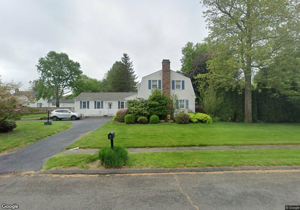
70 Debra Ln Agawam, MA 01001
Estimated Value: $502,000 - $636,000
5
Beds
3
Baths
1,965
Sq Ft
$288/Sq Ft
Est. Value
About This Home
This home is located at 70 Debra Ln, Agawam, MA 01001 and is currently estimated at $566,360, approximately $288 per square foot. 70 Debra Ln is a home located in Hampden County with nearby schools including Agawam Junior High School, Agawam High School, and Veritas Preparatory Charter School.
Ownership History
Date
Name
Owned For
Owner Type
Purchase Details
Closed on
Sep 19, 2003
Sold by
Mineo John J and Mineo Mary Ellen
Bought by
Croteau Robert P and Croteau Traci L
Current Estimated Value
Home Financials for this Owner
Home Financials are based on the most recent Mortgage that was taken out on this home.
Original Mortgage
$219,500
Outstanding Balance
$102,316
Interest Rate
6.31%
Mortgage Type
Purchase Money Mortgage
Estimated Equity
$464,044
Create a Home Valuation Report for This Property
The Home Valuation Report is an in-depth analysis detailing your home's value as well as a comparison with similar homes in the area
Home Values in the Area
Average Home Value in this Area
Purchase History
| Date | Buyer | Sale Price | Title Company |
|---|---|---|---|
| Croteau Robert P | $249,500 | -- |
Source: Public Records
Mortgage History
| Date | Status | Borrower | Loan Amount |
|---|---|---|---|
| Open | Croteau Robert P | $219,500 |
Source: Public Records
Tax History Compared to Growth
Tax History
| Year | Tax Paid | Tax Assessment Tax Assessment Total Assessment is a certain percentage of the fair market value that is determined by local assessors to be the total taxable value of land and additions on the property. | Land | Improvement |
|---|---|---|---|---|
| 2025 | $6,456 | $441,000 | $130,400 | $310,600 |
| 2024 | $6,259 | $430,500 | $130,400 | $300,100 |
| 2023 | $5,651 | $358,100 | $117,500 | $240,600 |
| 2022 | $5,384 | $334,200 | $117,500 | $216,700 |
| 2021 | $5,346 | $318,200 | $100,100 | $218,100 |
| 2020 | $5,221 | $310,200 | $98,100 | $212,100 |
| 2019 | $5,017 | $301,300 | $95,300 | $206,000 |
| 2018 | $4,779 | $287,700 | $95,300 | $192,400 |
| 2017 | $4,564 | $279,800 | $95,300 | $184,500 |
| 2016 | $4,338 | $268,100 | $95,300 | $172,800 |
| 2015 | $4,184 | $265,800 | $95,300 | $170,500 |
Source: Public Records
Map
Nearby Homes
- 23 Peros Dr
- 52 Peros Dr
- 68 Peros Dr
- 51 Merrell Dr
- 795 Main St
- 72 Plantation Dr
- 37 Corey Colonial
- 172 Beekman Dr Unit 172
- 174 Beekman Dr Unit 174
- 198 Beekman Dr
- 35 Birch Hill Rd
- 28 Meadow Ave
- 4H Mapleviewlane Unit 4H
- 18 Wildflower Ln
- 0 Silver St
- 36 Cottonwood Ln
- 50 Elmwood Ave
- 118 Field Rd
- 13 Castle Hills Rd Unit B
- 15 B Castle Hills Rd Unit B
- 56 Debra Ln
- 42 Sherwood Dr
- 67 Debra Ln
- 59 Debra Ln
- 34 Sherwood Dr
- 48 Debra Ln
- 51 Debra Ln
- 77 Debra Ln
- 75 Hampden Ln
- 22 Sherwood Dr
- 41 Debra Ln
- 38 Debra Ln
- 27 Sherwood Dr
- 80 Warren St
- 65 Hampden Ln
- 2 Sabrina Way Unit B
- 2 Sabrina Way Unit D
- 2 Sabrina Way Unit A
- 2 Sabrina Way Unit E
- 2 Sabrina Way Unit F