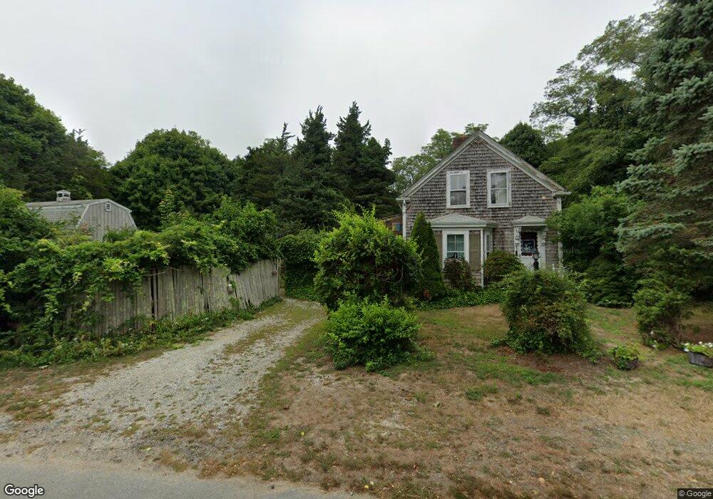
70 Depot Rd Eastham, MA 02642
Estimated Value: $531,847 - $685,000
3
Beds
2
Baths
936
Sq Ft
$627/Sq Ft
Est. Value
About This Home
This home is located at 70 Depot Rd, Eastham, MA 02642 and is currently estimated at $586,712, approximately $626 per square foot. 70 Depot Rd is a home located in Barnstable County with nearby schools including Eastham Elementary School, Nauset Regional Middle School, and Nauset Regional High School.
Ownership History
Date
Name
Owned For
Owner Type
Purchase Details
Closed on
Apr 29, 2008
Sold by
70 Depot Road Llc
Bought by
Warren Christina E
Current Estimated Value
Home Financials for this Owner
Home Financials are based on the most recent Mortgage that was taken out on this home.
Original Mortgage
$236,000
Outstanding Balance
$152,094
Interest Rate
6.22%
Mortgage Type
Purchase Money Mortgage
Estimated Equity
$434,618
Create a Home Valuation Report for This Property
The Home Valuation Report is an in-depth analysis detailing your home's value as well as a comparison with similar homes in the area
Home Values in the Area
Average Home Value in this Area
Purchase History
| Date | Buyer | Sale Price | Title Company |
|---|---|---|---|
| Warren Christina E | $296,000 | -- |
Source: Public Records
Mortgage History
| Date | Status | Borrower | Loan Amount |
|---|---|---|---|
| Open | Warren Christina E | $236,000 |
Source: Public Records
Tax History
| Year | Tax Paid | Tax Assessment Tax Assessment Total Assessment is a certain percentage of the fair market value that is determined by local assessors to be the total taxable value of land and additions on the property. | Land | Improvement |
|---|---|---|---|---|
| 2025 | $3,271 | $424,300 | $248,300 | $176,000 |
| 2024 | $2,890 | $412,200 | $241,000 | $171,200 |
| 2023 | $2,535 | $350,100 | $200,900 | $149,200 |
| 2022 | $2,458 | $286,500 | $179,400 | $107,100 |
| 2021 | $2,390 | $260,400 | $163,000 | $97,400 |
| 2020 | $2,868 | $257,500 | $166,400 | $91,100 |
| 2019 | $2,063 | $250,000 | $161,600 | $88,400 |
| 2018 | $2,614 | $244,100 | $156,900 | $87,200 |
| 2017 | $1,900 | $240,500 | $153,800 | $86,700 |
| 2016 | $1,914 | $257,300 | $170,900 | $86,400 |
| 2015 | $1,793 | $252,600 | $167,500 | $85,100 |
Source: Public Records
Map
Nearby Homes
- 2705 State Hwy
- 2705 State Hwy Unit 1-8
- 21 Locust Rd Unit 21
- 20 Stone Ct
- 50 Surrey Dr
- 300 School House Rd
- 70 Deerfield Ln
- 82 Old Orchard Rd
- 600 Kingsbury Beach Rd
- 55 Grandfathers Way
- 330 Hay Rd
- 60 Smith Heights Way
- 1061 State Hwy Unit 4
- 1061 State Hwy Unit 1061
- 25 Twin Rocks Dr
- 255 Massasoit Rd
- 10 Cartway N
- 20 Kittiwake Ln
- 10 Bradford Ln
- 46 Freeman Ln
Your Personal Tour Guide
Ask me questions while you tour the home.