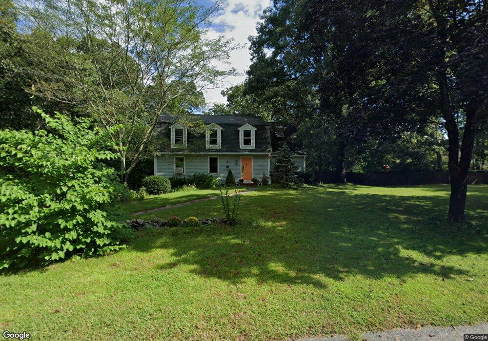
70 Desert Brook Rd Wrentham, MA 02093
Estimated Value: $702,000 - $948,000
3
Beds
3
Baths
2,074
Sq Ft
$370/Sq Ft
Est. Value
About This Home
This home is located at 70 Desert Brook Rd, Wrentham, MA 02093 and is currently estimated at $766,606, approximately $369 per square foot. 70 Desert Brook Rd is a home located in Norfolk County with nearby schools including Delaney Elementary School and Charles E Roderick.
Ownership History
Date
Name
Owned For
Owner Type
Purchase Details
Closed on
Jan 25, 2018
Sold by
Pillsbury Katherine S and Sogge Dale R
Bought by
Pillsbury Katherine S and Sogge Dale R
Current Estimated Value
Purchase Details
Closed on
Feb 27, 1992
Sold by
Morrill Tr Jeffrey L
Bought by
Pillsbury Katherine S
Home Financials for this Owner
Home Financials are based on the most recent Mortgage that was taken out on this home.
Original Mortgage
$180,000
Interest Rate
8.38%
Mortgage Type
Purchase Money Mortgage
Create a Home Valuation Report for This Property
The Home Valuation Report is an in-depth analysis detailing your home's value as well as a comparison with similar homes in the area
Purchase History
| Date | Buyer | Sale Price | Title Company |
|---|---|---|---|
| Pillsbury Katherine S | -- | -- | |
| Pillsbury Katherine S | $211,900 | -- |
Source: Public Records
Mortgage History
| Date | Status | Borrower | Loan Amount |
|---|---|---|---|
| Previous Owner | Pillsbury Katherine S | $183,000 | |
| Previous Owner | Pillsbury Katherine S | $180,000 | |
| Previous Owner | Pillsbury Katherine S | $117,000 |
Source: Public Records
Tax History
| Year | Tax Paid | Tax Assessment Tax Assessment Total Assessment is a certain percentage of the fair market value that is determined by local assessors to be the total taxable value of land and additions on the property. | Land | Improvement |
|---|---|---|---|---|
| 2025 | $7,659 | $660,800 | $374,500 | $286,300 |
| 2024 | $7,433 | $619,400 | $374,500 | $244,900 |
| 2023 | $7,306 | $578,900 | $340,500 | $238,400 |
| 2022 | $7,155 | $523,400 | $310,000 | $213,400 |
| 2021 | $7,318 | $520,100 | $310,000 | $210,100 |
| 2020 | $6,857 | $481,200 | $255,000 | $226,200 |
| 2019 | $6,795 | $481,200 | $255,000 | $226,200 |
| 2018 | $6,169 | $433,200 | $229,600 | $203,600 |
| 2017 | $5,825 | $408,800 | $225,100 | $183,700 |
| 2016 | $5,623 | $393,800 | $218,600 | $175,200 |
| 2015 | $5,463 | $364,700 | $210,200 | $154,500 |
| 2014 | $5,381 | $351,500 | $202,200 | $149,300 |
Source: Public Records
Map
Nearby Homes
- 10 Earle Stewart Ln Unit Lot 5
- 12 Earle Stewart Ln
- 2 Earle Stewart Ln
- 3 Earle Stewart Ln
- 135 Creek St Unit 2
- 440 Chestnut St
- 613 West St
- 500 Franklin St
- 955 Summer St
- 1222 South St
- 10 Nature View Dr
- 15 Nature View Dr
- 440 South St
- 0 Fall Ln
- 20 Field Cir
- 18 Huntington Ave
- 0 Berry St
- 50 Reed Fulton Ave Unit Lot 61
- 75 Jordan Rd
- 3 Oak View Terrace Unit 3
- 80 Desert Brook Rd
- 60 Desert Brook Rd
- 65 Desert Brook Rd
- 75 Desert Brook Rd
- 55 Desert Brook Rd
- 50 Desert Brook Rd
- 105 Desert Brook Rd
- 90 Desert Brook Rd
- 45 Desert Brook Rd
- 40 Desert Brook Rd
- 150 Bennett St
- 140 Bennett St
- 30 Desert Brook Rd
- 130 Bennett St
- 95 Desert Brook Rd
- 0 Wilkinson Way Unit 71896961
- 000 Great St
- 30 LOT Amber Dr
- Lot 2 Rockett Ln
- 24 LOT Amber Dr
Your Personal Tour Guide
Ask me questions while you tour the home.