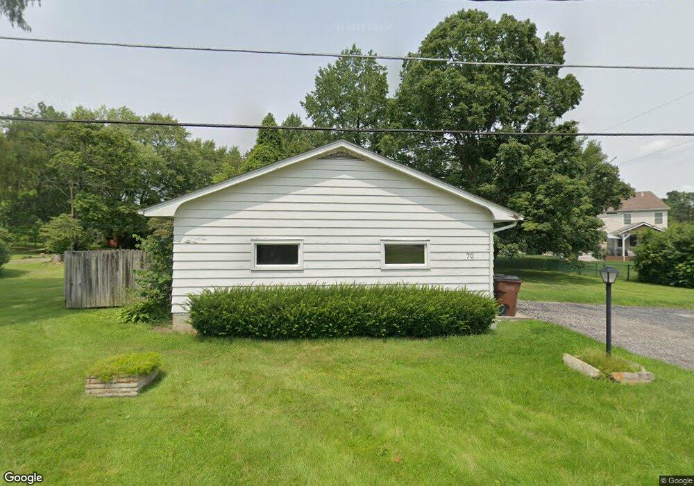
70 E Maple St Johnstown, OH 43031
Estimated Value: $203,882 - $287,000
3
Beds
1
Bath
1,124
Sq Ft
$223/Sq Ft
Est. Value
About This Home
This home is located at 70 E Maple St, Johnstown, OH 43031 and is currently estimated at $250,971, approximately $223 per square foot. 70 E Maple St is a home located in Licking County with nearby schools including Johnstown Middle School and Johnstown High School.
Ownership History
Date
Name
Owned For
Owner Type
Purchase Details
Closed on
Nov 21, 2022
Sold by
Mona Lynne Lowe Living Trust
Bought by
Lowe Mona Lynne and Lowe Richard Stuart
Current Estimated Value
Purchase Details
Closed on
Nov 16, 2010
Sold by
Lowe Mona Lynne and Lowe Richard Stuart
Bought by
Lowe Mona Lynne and Mona Lynn Lowe Living Trust
Purchase Details
Closed on
Sep 16, 1999
Sold by
Kennedy Henry J
Bought by
Lowe Richard S Mona L
Home Financials for this Owner
Home Financials are based on the most recent Mortgage that was taken out on this home.
Original Mortgage
$60,500
Interest Rate
7.93%
Mortgage Type
New Conventional
Purchase Details
Closed on
Apr 23, 1998
Sold by
Holmes James
Bought by
Kennedy Henry J Rose M
Home Financials for this Owner
Home Financials are based on the most recent Mortgage that was taken out on this home.
Original Mortgage
$39,000
Interest Rate
7.26%
Mortgage Type
New Conventional
Create a Home Valuation Report for This Property
The Home Valuation Report is an in-depth analysis detailing your home's value as well as a comparison with similar homes in the area
Home Values in the Area
Average Home Value in this Area
Purchase History
| Date | Buyer | Sale Price | Title Company |
|---|---|---|---|
| Lowe Mona Lynne | -- | None Listed On Document | |
| Lowe Mona Lynne | -- | Attorney | |
| Lowe Richard S Mona L | $85,000 | -- | |
| Kennedy Henry J Rose M | $39,000 | -- |
Source: Public Records
Mortgage History
| Date | Status | Borrower | Loan Amount |
|---|---|---|---|
| Previous Owner | Lowe Richard S Mona L | $60,500 | |
| Previous Owner | Kennedy Henry J Rose M | $39,000 |
Source: Public Records
Tax History
| Year | Tax Paid | Tax Assessment Tax Assessment Total Assessment is a certain percentage of the fair market value that is determined by local assessors to be the total taxable value of land and additions on the property. | Land | Improvement |
|---|---|---|---|---|
| 2024 | $2,129 | $60,800 | $15,890 | $44,910 |
| 2023 | $2,172 | $60,800 | $15,890 | $44,910 |
| 2022 | $1,083 | $32,970 | $9,520 | $23,450 |
| 2021 | $1,132 | $32,970 | $9,520 | $23,450 |
| 2020 | $1,145 | $32,970 | $9,520 | $23,450 |
| 2019 | $924 | $26,710 | $7,950 | $18,760 |
| 2018 | $929 | $0 | $0 | $0 |
| 2017 | $1,148 | $0 | $0 | $0 |
| 2016 | $1,343 | $0 | $0 | $0 |
| 2015 | $1,366 | $0 | $0 | $0 |
| 2014 | $2,446 | $0 | $0 | $0 |
| 2013 | $1,570 | $0 | $0 | $0 |
Source: Public Records
Map
Nearby Homes
- 101 Greenstick Way
- 40 W Maple St
- 111 Edwards Rd
- 270 N Oregon St
- 105 Maple Leaf Dr Unit 105
- 201 Willow Trail Dr Unit 201
- 93 W College Ave
- 306 Eagles Nest Ave
- 325 Green Acres Dr
- 130 Parkdale Dr
- 152 Elm St
- 528 Golden Pond
- 562 Cannondale Ave
- 557 Cannondale Ave
- 97 Crossing Place
- 9484 Johnstown Utica Rd
- 332 Bottecchia Blvd
- 500 Pheasant Ct
- 8001 Johnstown Alexandria Rd
- 7560 Clover Valley Rd NW
- 66 E Maple St
- 50 E Maple St
- 90 E Maple St
- 70 N Kasson St
- 70 Stevens Dr
- 66 N Kasson St
- 96 Sassafrass Place
- 79 Greenstick Way
- 69 Greenstick Way
- 56 Stevens Dr
- 49 E Maple St
- 108 Sassafrass Place
- 48 N Kasson St
- 39 E Maple St
- 41 Stevens Dr
- 40 Stevens Dr
- 33 E Maple St
- 64 Greenstick Way
- 120 Sassafrass Place
- 51 N Kasson St
Your Personal Tour Guide
Ask me questions while you tour the home.