D
Seller's Agent in 2025
Donna Pickenpaugh
Pickenpaugh & Ellington Realty
(740) 366-5533
11 in this area
54 Total Sales
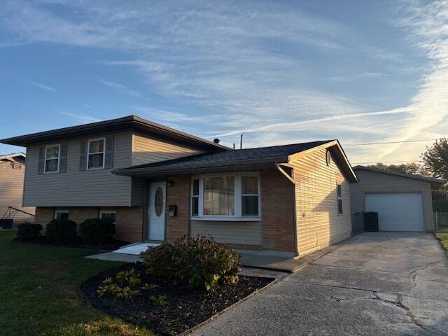
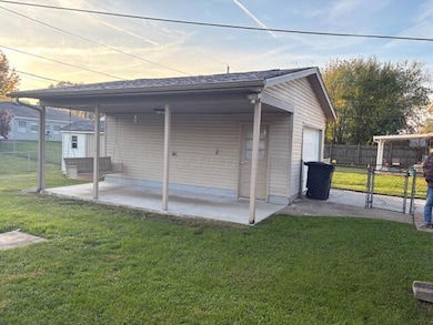
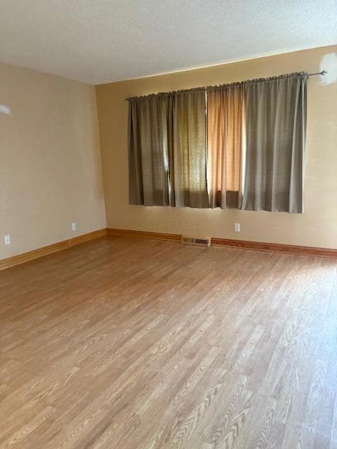
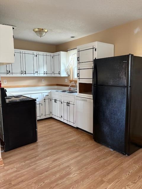
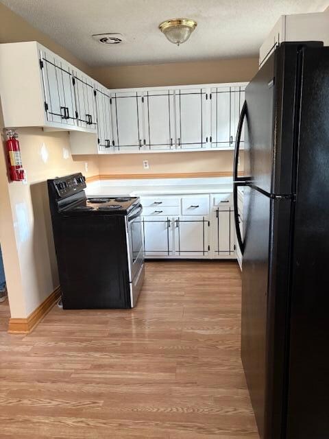
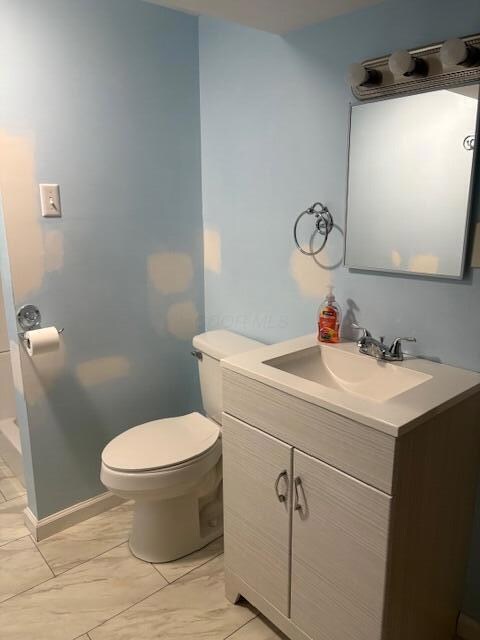

3 Level Split. 3 bedroom. 2 Bath. Fully appliances kitchen. Large living room. Vinyl flooring. Replacement windows. Dimensional roof. Detached 1 car garage with additional covered patio. Fenced yard . Large shed. This home has been well maintained. Brick and vinyl exterior. A nice family home.
Last Agent to Sell the Property
Pickenpaugh & Ellington Realty License #0000406140 Listed on: 11/02/2025
Last Buyer's Agent
Pickenpaugh & Ellington Realty License #0000406140 Listed on: 11/02/2025
| Date | Type | Sale Price | Title Company |
|---|---|---|---|
| Fiduciary Deed | $200,000 | None Listed On Document | |
| Interfamily Deed Transfer | -- | Park Title |
| Date | Status | Loan Amount | Loan Type |
|---|---|---|---|
| Previous Owner | $69,200 | New Conventional |
| Date | Event | Price | List to Sale | Price per Sq Ft |
|---|---|---|---|---|
| 11/11/2025 11/11/25 | Sold | $200,000 | -9.0% | $178 / Sq Ft |
| 11/02/2025 11/02/25 | Pending | -- | -- | -- |
| 11/02/2025 11/02/25 | For Sale | $219,900 | -- | $196 / Sq Ft |
| Year | Tax Paid | Tax Assessment Tax Assessment Total Assessment is a certain percentage of the fair market value that is determined by local assessors to be the total taxable value of land and additions on the property. | Land | Improvement |
|---|---|---|---|---|
| 2024 | $2,017 | $56,640 | $16,070 | $40,570 |
| 2023 | $2,262 | $56,640 | $16,070 | $40,570 |
| 2022 | $1,777 | $41,440 | $8,330 | $33,110 |
| 2021 | $1,813 | $41,440 | $8,330 | $33,110 |
| 2020 | $1,825 | $41,440 | $8,330 | $33,110 |
| 2019 | $1,437 | $34,940 | $10,400 | $24,540 |
| 2018 | $1,453 | $0 | $0 | $0 |
| 2017 | $1,296 | $0 | $0 | $0 |
| 2016 | $1,121 | $0 | $0 | $0 |
| 2015 | $1,140 | $0 | $0 | $0 |
| 2014 | $2,302 | $0 | $0 | $0 |
| 2013 | $1,138 | $0 | $0 | $0 |
D
Seller's Agent in 2025
Donna Pickenpaugh
Pickenpaugh & Ellington Realty
(740) 366-5533
11 in this area
54 Total Sales
Source: Columbus and Central Ohio Regional MLS
MLS Number: 225041574
APN: 030-095196-00.000
Disclaimer: Certain information contained herein is derived from information provided by parties other than Homes.com. All information provided is deemed reliable, but is not guaranteed to be accurate and should be independently verified.
![]() IDX information is provided exclusively for personal, non-commercial use, and may not be used for any purpose other than to identify prospective properties consumers may be interested in purchasing.
IDX information is provided exclusively for personal, non-commercial use, and may not be used for any purpose other than to identify prospective properties consumers may be interested in purchasing.
Information is deemed reliable but not guaranteed.
Ask me questions while you tour the home.
