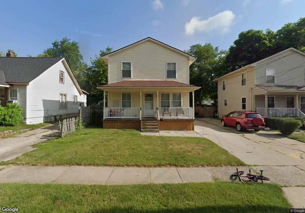
70 Forest St Pontiac, MI 48342
Estimated Value: $132,000 - $177,000
3
Beds
2
Baths
1,376
Sq Ft
$108/Sq Ft
Est. Value
About This Home
This home is located at 70 Forest St, Pontiac, MI 48342 and is currently estimated at $148,773, approximately $108 per square foot. 70 Forest St is a home located in Oakland County with nearby schools including Owen Elementary School, Pontiac Middle School, and Pontiac High School.
Ownership History
Date
Name
Owned For
Owner Type
Purchase Details
Closed on
Aug 7, 2012
Sold by
Rodgers Tyneshia and Mortgage Electronic Registrati
Bought by
Bank Of America Na
Current Estimated Value
Purchase Details
Closed on
Jul 26, 2005
Sold by
Venture Inc
Bought by
Rodgers Tyneshia
Home Financials for this Owner
Home Financials are based on the most recent Mortgage that was taken out on this home.
Original Mortgage
$84,448
Interest Rate
5.66%
Mortgage Type
FHA
Purchase Details
Closed on
Sep 3, 2002
Sold by
City Of Pontiac
Bought by
Economic Development Corp
Create a Home Valuation Report for This Property
The Home Valuation Report is an in-depth analysis detailing your home's value as well as a comparison with similar homes in the area
Home Values in the Area
Average Home Value in this Area
Purchase History
| Date | Buyer | Sale Price | Title Company |
|---|---|---|---|
| Bank Of America Na | $102,726 | None Available | |
| Rodgers Tyneshia | $114,200 | Greco | |
| Economic Development Corp | -- | -- |
Source: Public Records
Mortgage History
| Date | Status | Borrower | Loan Amount |
|---|---|---|---|
| Previous Owner | Rodgers Tyneshia | $84,448 |
Source: Public Records
Tax History Compared to Growth
Tax History
| Year | Tax Paid | Tax Assessment Tax Assessment Total Assessment is a certain percentage of the fair market value that is determined by local assessors to be the total taxable value of land and additions on the property. | Land | Improvement |
|---|---|---|---|---|
| 2024 | $987 | $46,440 | $0 | $0 |
| 2023 | $941 | $40,680 | $0 | $0 |
| 2022 | $977 | $35,140 | $0 | $0 |
| 2021 | $949 | $31,410 | $0 | $0 |
| 2020 | $855 | $32,240 | $0 | $0 |
| 2019 | $922 | $27,720 | $0 | $0 |
| 2018 | $886 | $23,350 | $0 | $0 |
| 2017 | $842 | $23,030 | $0 | $0 |
| 2016 | $867 | $22,530 | $0 | $0 |
| 2015 | -- | $21,000 | $0 | $0 |
| 2014 | -- | $18,990 | $0 | $0 |
| 2011 | -- | $25,950 | $0 | $0 |
Source: Public Records
Map
Nearby Homes
- 59 Forest St
- 73 Poplar Ave
- 130 Baldwin Ave
- 123 Adelaide St
- 111 Hamilton St
- 272 Cesar e Chavez Ave
- 217 Edison St
- 320 Cesar e Chavez Ave
- 78 Cadillac St
- 52 Whitfield St
- 0 Baldwin Rd Unit 20251027987
- 0 Baldwin Ave Unit 20240055811
- 124 Kemp St
- 48 Florence St
- 54 Hudson Ave
- 36 Clairmont Place
- 352 N Perry St
- 431 Perry St
- 388 N Perry St
- 11 Lexington Place