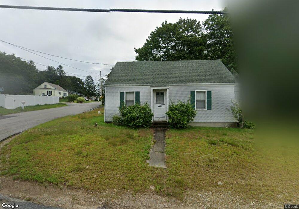
70 Gifford Rd Westport, MA 02790
North Westport NeighborhoodEstimated Value: $365,000 - $485,000
2
Beds
--
Bath
1,224
Sq Ft
$353/Sq Ft
Est. Value
About This Home
This home is located at 70 Gifford Rd, Westport, MA 02790 and is currently estimated at $432,124, approximately $353 per square foot. 70 Gifford Rd is a home located in Bristol County with nearby schools including Alice A. Macomber Primary School, Westport Elementary School, and Westport Middle-High School.
Create a Home Valuation Report for This Property
The Home Valuation Report is an in-depth analysis detailing your home's value as well as a comparison with similar homes in the area
Home Values in the Area
Average Home Value in this Area
Tax History Compared to Growth
Tax History
| Year | Tax Paid | Tax Assessment Tax Assessment Total Assessment is a certain percentage of the fair market value that is determined by local assessors to be the total taxable value of land and additions on the property. | Land | Improvement |
|---|---|---|---|---|
| 2025 | $2,368 | $317,900 | $164,200 | $153,700 |
| 2024 | $2,292 | $296,500 | $145,800 | $150,700 |
| 2023 | $2,258 | $276,700 | $132,800 | $143,900 |
| 2022 | $2,006 | $255,800 | $132,800 | $123,000 |
| 2021 | $3,389 | $232,700 | $109,700 | $123,000 |
| 2020 | $0 | $228,300 | $105,300 | $123,000 |
| 2019 | $5,020 | $221,900 | $105,300 | $116,600 |
| 2018 | $0 | $190,600 | $105,100 | $85,500 |
| 2017 | $2,554 | $188,500 | $101,800 | $86,700 |
| 2016 | $1,464 | $185,100 | $98,400 | $86,700 |
| 2015 | $1,461 | $184,300 | $100,700 | $83,600 |
Source: Public Records
Map
Nearby Homes
- 116 Gifford Rd
- 20 Faulkner St
- 9 Kyle Jacob Rd
- 100 D Dr
- 0 Van Buren St
- 15 S Breault St
- 16 S Berryman St
- 3 Diane Way
- 565 Highland Ave
- 9 Register Ave
- 92 Benoit St
- 1276 Old Fall River Rd
- 33 William St
- 771 Sanford Rd
- 6 Beaulieu St
- 25 Beaulieu St
- 27 Dias Ave
- 19 Charles Joseph Dr
- 2 Donna Marie Dr
- 128 Old Bedford Rd