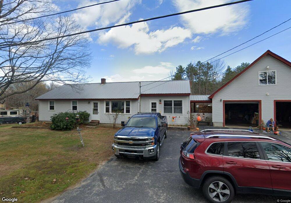
70 High Rd Cornish, ME 04020
Estimated Value: $347,135 - $416,000
3
Beds
1
Bath
1,912
Sq Ft
$199/Sq Ft
Est. Value
About This Home
This home is located at 70 High Rd, Cornish, ME 04020 and is currently estimated at $379,712, approximately $198 per square foot. 70 High Rd is a home located in York County.
Create a Home Valuation Report for This Property
The Home Valuation Report is an in-depth analysis detailing your home's value as well as a comparison with similar homes in the area
Home Values in the Area
Average Home Value in this Area
Tax History
| Year | Tax Paid | Tax Assessment Tax Assessment Total Assessment is a certain percentage of the fair market value that is determined by local assessors to be the total taxable value of land and additions on the property. | Land | Improvement |
|---|---|---|---|---|
| 2025 | $3,629 | $384,000 | $82,000 | $302,000 |
| 2024 | $3,274 | $355,900 | $91,700 | $264,200 |
| 2023 | $3,140 | $219,600 | $64,000 | $155,600 |
| 2022 | $3,030 | $219,600 | $64,000 | $155,600 |
| 2021 | $2,965 | $219,600 | $64,000 | $155,600 |
| 2020 | $2,943 | $219,600 | $64,000 | $155,600 |
| 2019 | $2,943 | $219,600 | $64,000 | $155,600 |
| 2018 | $2,965 | $219,600 | $64,000 | $155,600 |
| 2016 | $2,831 | $219,600 | $64,000 | $155,600 |
| 2015 | $2,833 | $219,600 | $64,000 | $155,600 |
| 2014 | $2,608 | $202,200 | $64,000 | $138,200 |
Source: Public Records
Map
Nearby Homes
- 20 Main St
- 4 Bridge St
- 96 Maple St
- Lot #3 Jordan Heights Rd
- Lot #2 Jordan Heights Rd
- Lot #8 Jordan Heights Rd
- Lot #4 Jordan Heights Rd
- 6-13 Main St
- 490 S Hiram Rd
- 0 Durgintown Rd
- 992 Pequawket Trail
- 198 Senator Black Rd
- TBD Sokokis Trail N
- 174 Marston Rd
- 5 Kimball Hill Rd
- 12 Main St
- 50AC Sawyer Mountain Rd
- 482 Ossipee Trail
- 8 Graffam Rd
- 8 - A Graffam Rd
Your Personal Tour Guide
Ask me questions while you tour the home.