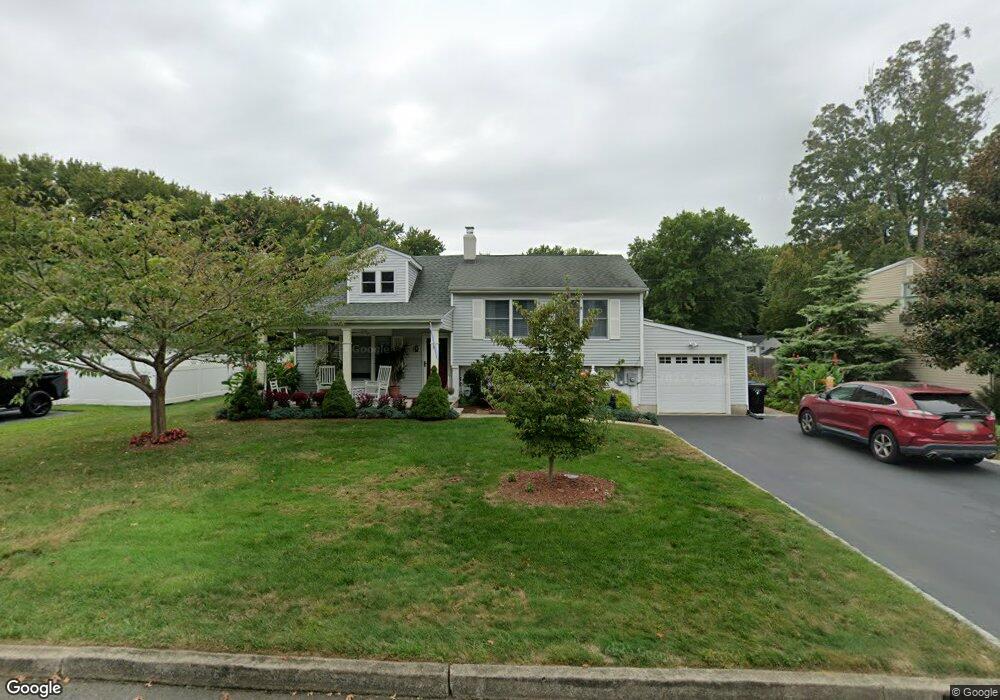
70 Libby Place Middletown, NJ 07748
New Monmouth NeighborhoodEstimated Value: $703,000 - $738,000
4
Beds
2
Baths
1,855
Sq Ft
$387/Sq Ft
Est. Value
About This Home
This home is located at 70 Libby Place, Middletown, NJ 07748 and is currently estimated at $718,079, approximately $387 per square foot. 70 Libby Place is a home located in Monmouth County with nearby schools including New Monmouth Elementary School, Thorne Middle School, and Middletown High School North.
Ownership History
Date
Name
Owned For
Owner Type
Purchase Details
Closed on
May 14, 1987
Bought by
Carrigg Frederick and Mary Jane
Current Estimated Value
Create a Home Valuation Report for This Property
The Home Valuation Report is an in-depth analysis detailing your home's value as well as a comparison with similar homes in the area
Home Values in the Area
Average Home Value in this Area
Purchase History
| Date | Buyer | Sale Price | Title Company |
|---|---|---|---|
| Carrigg Frederick | $171,000 | -- |
Source: Public Records
Tax History Compared to Growth
Tax History
| Year | Tax Paid | Tax Assessment Tax Assessment Total Assessment is a certain percentage of the fair market value that is determined by local assessors to be the total taxable value of land and additions on the property. | Land | Improvement |
|---|---|---|---|---|
| 2025 | $8,967 | $593,100 | $390,600 | $202,500 |
| 2024 | $7,592 | $545,100 | $346,300 | $198,800 |
| 2023 | $7,592 | $436,800 | $286,600 | $150,200 |
| 2022 | $7,257 | $403,200 | $239,400 | $163,800 |
| 2021 | $7,257 | $361,400 | $206,200 | $155,200 |
| 2020 | $7,335 | $343,100 | $192,500 | $150,600 |
| 2019 | $7,183 | $340,100 | $192,500 | $147,600 |
| 2018 | $6,986 | $322,400 | $181,600 | $140,800 |
| 2017 | $6,359 | $299,400 | $181,600 | $117,800 |
| 2016 | $6,318 | $296,500 | $181,600 | $114,900 |
| 2015 | $6,329 | $296,300 | $181,600 | $114,700 |
| 2014 | $6,269 | $286,400 | $181,600 | $104,800 |
Source: Public Records
Map
Nearby Homes