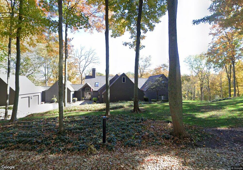
70 Locust Hill Rd Cincinnati, OH 45245
Estimated Value: $846,000 - $1,050,530
5
Beds
5
Baths
5,340
Sq Ft
$180/Sq Ft
Est. Value
About This Home
This home is located at 70 Locust Hill Rd, Cincinnati, OH 45245 and is currently estimated at $959,843, approximately $179 per square foot. 70 Locust Hill Rd is a home located in Clermont County with nearby schools including Locust Corner Elementary School, New Richmond Middle School, and New Richmond High School.
Ownership History
Date
Name
Owned For
Owner Type
Purchase Details
Closed on
Jul 17, 2025
Sold by
Fenno Terri Jill and Fenno Robert Anthony
Bought by
Fenno Family Trust and Fenno
Current Estimated Value
Purchase Details
Closed on
Mar 17, 2006
Sold by
Fifth Third Bank
Bought by
Fenno Robert A and Fenno Terri Jo
Home Financials for this Owner
Home Financials are based on the most recent Mortgage that was taken out on this home.
Original Mortgage
$417,000
Interest Rate
6.48%
Mortgage Type
Purchase Money Mortgage
Purchase Details
Closed on
Aug 10, 2004
Sold by
Albertson Curt L and Albertson Teresa A
Bought by
Fifth Third Bank
Create a Home Valuation Report for This Property
The Home Valuation Report is an in-depth analysis detailing your home's value as well as a comparison with similar homes in the area
Home Values in the Area
Average Home Value in this Area
Purchase History
| Date | Buyer | Sale Price | Title Company |
|---|---|---|---|
| Fenno Family Trust | -- | None Listed On Document | |
| Fenno Family Trust | -- | None Listed On Document | |
| Fenno Robert A | $545,000 | Advanced Land Title Agency | |
| Fifth Third Bank | -- | -- |
Source: Public Records
Mortgage History
| Date | Status | Borrower | Loan Amount |
|---|---|---|---|
| Previous Owner | Fenno Robert A | $417,000 |
Source: Public Records
Tax History Compared to Growth
Tax History
| Year | Tax Paid | Tax Assessment Tax Assessment Total Assessment is a certain percentage of the fair market value that is determined by local assessors to be the total taxable value of land and additions on the property. | Land | Improvement |
|---|---|---|---|---|
| 2024 | $11,584 | $284,730 | $78,160 | $206,570 |
| 2023 | $11,582 | $284,730 | $78,160 | $206,570 |
| 2022 | $9,085 | $178,640 | $48,440 | $130,200 |
| 2021 | $8,935 | $178,640 | $48,440 | $130,200 |
| 2020 | $8,910 | $178,640 | $48,440 | $130,200 |
| 2019 | $6,497 | $146,270 | $48,300 | $97,970 |
| 2018 | $6,499 | $146,270 | $48,300 | $97,970 |
| 2017 | $6,807 | $146,270 | $48,300 | $97,970 |
| 2016 | $6,807 | $140,640 | $46,450 | $94,190 |
| 2015 | $6,261 | $140,640 | $46,450 | $94,190 |
| 2014 | $6,261 | $140,640 | $46,450 | $94,190 |
| 2013 | $6,197 | $138,250 | $53,270 | $84,980 |
Source: Public Records
Map
Nearby Homes
- 3238 Alpine Terrace
- 0 Alpine Terrace Unit 1827302
- 2625 Stonehaven Dr
- 863 Grand Cypress Ct
- 931 Winged Foot Way
- 891 Cypresspoint Ct
- 8410 Old Kellogg Rd
- 8322 Old Kellogg Rd
- 8525 Steamboat Dr
- 3440 Gleneagles Cir
- 3366 Wagner Rd
- 3910 9 Mile Rd
- 6436 Vineyard Ln
- 3098 Nelp Rd
- 541 Davis Rd
- 539 Davis Rd
- 537 Davis Rd
- 463 Lenkenann Dr
- 3775 Prestwick Cir
- 464 Lenkenann Dr
- 69 Locust Hill Rd
- 72 Locust Hill Rd
- 71 Locust Hill Rd
- 68 Locust Hill Rd
- 22 Locust Hill Rd
- 67 Locust Hill Rd
- 79 Locust Hill Rd
- 20 Locust Hill Rd
- 73 Locust Hill Rd
- 74 Locust Hill Rd
- 65 Locust Hill Rd
- 18 Locust Hill Rd
- 24 Locust Hill Rd
- 63 Locust Hill Rd
- 57 Locust Hill Rd
- 10 Locust Hill Rd
- 595 Locust Corner Rd
- 558 Old Us Highway 52
- 8 Locust Hill Rd
- 44 Locust Hill Rd