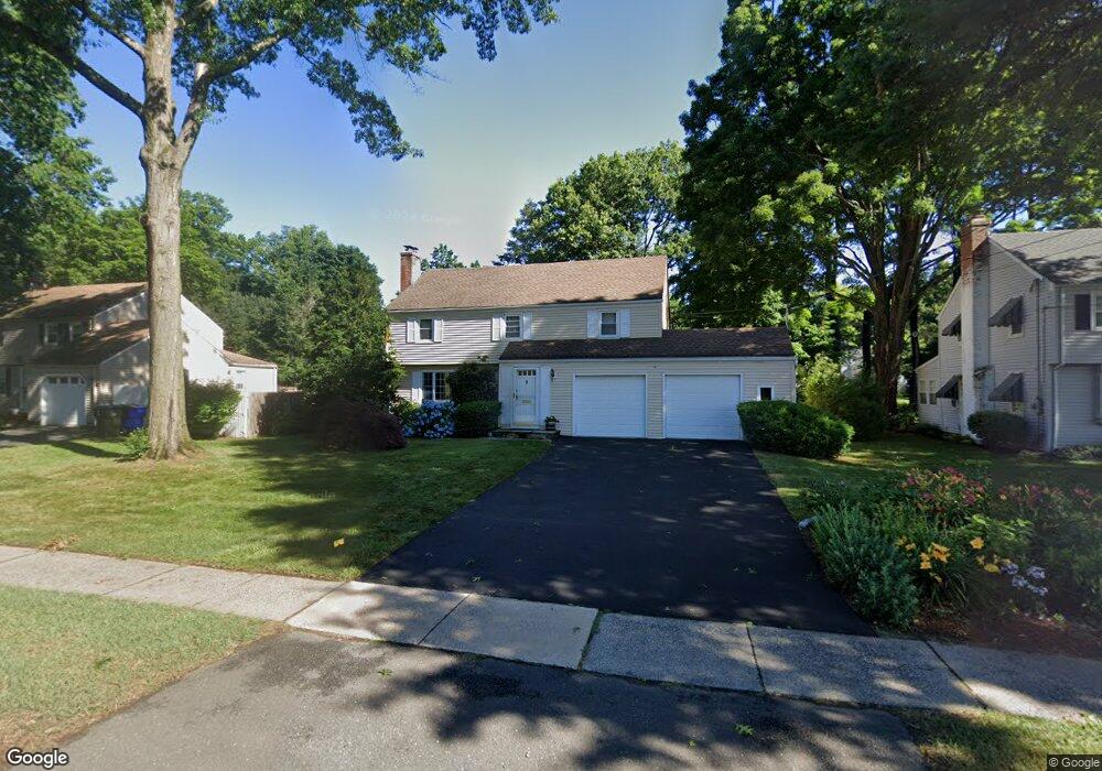
70 Longlane Rd West Hartford, CT 06117
Estimated Value: $695,000 - $812,000
4
Beds
3
Baths
2,736
Sq Ft
$277/Sq Ft
Est. Value
About This Home
This home is located at 70 Longlane Rd, West Hartford, CT 06117 and is currently estimated at $758,606, approximately $277 per square foot. 70 Longlane Rd is a home located in Hartford County with nearby schools including Norfeldt School, King Philip Middle School, and Hall High School.
Ownership History
Date
Name
Owned For
Owner Type
Purchase Details
Closed on
May 8, 2025
Sold by
Berlinsky Mark
Bought by
Berlinsky Eva
Current Estimated Value
Purchase Details
Closed on
Apr 29, 1994
Sold by
Mintz Paul and Mintz Henrietta
Bought by
Berlinsky Mark and Berlinsky Eva
Create a Home Valuation Report for This Property
The Home Valuation Report is an in-depth analysis detailing your home's value as well as a comparison with similar homes in the area
Home Values in the Area
Average Home Value in this Area
Purchase History
| Date | Buyer | Sale Price | Title Company |
|---|---|---|---|
| Berlinsky Eva | -- | None Available | |
| Berlinsky Eva | -- | None Available | |
| Berlinsky Mark | $166,000 | -- | |
| Berlinsky Mark | $166,000 | -- |
Source: Public Records
Mortgage History
| Date | Status | Borrower | Loan Amount |
|---|---|---|---|
| Previous Owner | Berlinsky Mark | $110,000 | |
| Previous Owner | Berlinsky Mark | $163,951 | |
| Previous Owner | Berlinsky Mark | $170,000 |
Source: Public Records
Tax History Compared to Growth
Tax History
| Year | Tax Paid | Tax Assessment Tax Assessment Total Assessment is a certain percentage of the fair market value that is determined by local assessors to be the total taxable value of land and additions on the property. | Land | Improvement |
|---|---|---|---|---|
| 2025 | $13,482 | $301,070 | $96,670 | $204,400 |
| 2024 | $12,750 | $301,070 | $96,670 | $204,400 |
| 2023 | $12,320 | $301,070 | $96,670 | $204,400 |
| 2022 | $12,248 | $301,070 | $96,670 | $204,400 |
| 2021 | $11,634 | $274,260 | $92,960 | $181,300 |
| 2020 | $11,113 | $265,860 | $84,350 | $181,510 |
| 2019 | $11,113 | $265,860 | $84,350 | $181,510 |
| 2018 | $10,900 | $265,860 | $84,350 | $181,510 |
| 2017 | $10,911 | $265,860 | $84,350 | $181,510 |
| 2016 | $10,048 | $254,310 | $79,940 | $174,370 |
| 2015 | $9,743 | $254,310 | $79,940 | $174,370 |
| 2014 | $9,485 | $253,820 | $79,940 | $173,880 |
Source: Public Records
Map
Nearby Homes
- 14 Gledhill Ln
- 2645 Albany Ave
- 53 Whitehill Dr
- 100 Richmond Ln
- 35 W Ridge Dr
- 6 Old Oak Rd
- 30 Farmstead Ln
- 2581 Albany Ave
- 592 Mountain Rd Unit A
- 64 Harvest Ln
- 64 Avondale Rd
- 62 Blue Ridge Ln
- 2 Ferncliff Dr
- 8 Tanglewood Rd
- 124 Ferncliff Dr
- 51 Sky View Dr Unit 4
- 105 Hilldale Rd
- 1 King Philip Dr Unit 207
- 7 Mountainside Rd
- 139 Mohawk Dr