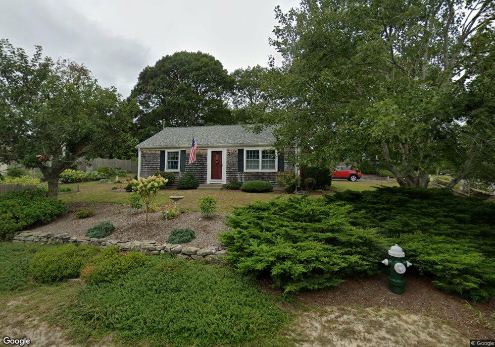
70 Lower Brook Rd South Yarmouth, MA 02664
South Yarmouth NeighborhoodEstimated Value: $517,000 - $536,000
2
Beds
1
Bath
1,001
Sq Ft
$522/Sq Ft
Est. Value
About This Home
This home is located at 70 Lower Brook Rd, South Yarmouth, MA 02664 and is currently estimated at $522,439, approximately $521 per square foot. 70 Lower Brook Rd is a home located in Barnstable County with nearby schools including Dennis-Yarmouth Regional High School, Sturgis Charter Public School, and St. Pius X. School.
Ownership History
Date
Name
Owned For
Owner Type
Purchase Details
Closed on
Aug 23, 2002
Sold by
Burston Marjorie N
Bought by
Ducharme Denise M
Current Estimated Value
Home Financials for this Owner
Home Financials are based on the most recent Mortgage that was taken out on this home.
Original Mortgage
$158,900
Interest Rate
6.57%
Mortgage Type
Purchase Money Mortgage
Purchase Details
Closed on
Mar 20, 2000
Sold by
Lacouture William J and Lacouture Dorothy F
Bought by
Burston Marjorie N
Home Financials for this Owner
Home Financials are based on the most recent Mortgage that was taken out on this home.
Original Mortgage
$118,150
Interest Rate
8.24%
Mortgage Type
Purchase Money Mortgage
Purchase Details
Closed on
Jul 27, 1992
Sold by
Churchill Emily B
Bought by
Cape Cod Coop Bk
Create a Home Valuation Report for This Property
The Home Valuation Report is an in-depth analysis detailing your home's value as well as a comparison with similar homes in the area
Home Values in the Area
Average Home Value in this Area
Purchase History
| Date | Buyer | Sale Price | Title Company |
|---|---|---|---|
| Ducharme Denise M | $214,000 | -- | |
| Burston Marjorie N | $139,000 | -- | |
| Cape Cod Coop Bk | $104,000 | -- |
Source: Public Records
Mortgage History
| Date | Status | Borrower | Loan Amount |
|---|---|---|---|
| Open | Cape Cod Coop Bk | $146,220 | |
| Closed | Ducharme Denise M | $158,900 | |
| Closed | Cape Cod Coop Bk | $21,400 | |
| Previous Owner | Burston Marjorie N | $118,150 |
Source: Public Records
Tax History Compared to Growth
Tax History
| Year | Tax Paid | Tax Assessment Tax Assessment Total Assessment is a certain percentage of the fair market value that is determined by local assessors to be the total taxable value of land and additions on the property. | Land | Improvement |
|---|---|---|---|---|
| 2025 | $3,291 | $464,800 | $179,300 | $285,500 |
| 2024 | $3,053 | $413,700 | $151,600 | $262,100 |
| 2023 | $2,950 | $363,700 | $131,200 | $232,500 |
| 2022 | $2,790 | $303,900 | $119,300 | $184,600 |
| 2021 | $2,632 | $275,300 | $119,300 | $156,000 |
| 2020 | $2,582 | $258,200 | $119,300 | $138,900 |
| 2019 | $2,402 | $237,800 | $119,300 | $118,500 |
| 2018 | $2,265 | $220,100 | $101,600 | $118,500 |
| 2017 | $2,161 | $215,700 | $97,200 | $118,500 |
| 2016 | $2,064 | $206,800 | $88,300 | $118,500 |
| 2015 | $2,021 | $201,300 | $88,300 | $113,000 |
Source: Public Records
Map
Nearby Homes
- 48 Captain Dore Rd
- 18 Captain Stanley Rd
- 35 Captain Percival Rd
- 24 Fast Brook Rd
- 3 Saturn Ln
- 11 Bob-O-link Ln
- 68 Bob-O-link Ln
- 147 Captain Bacon Rd
- 49 Captain Besse Rd
- 33 Lake Rd
- 21 Hazelmoor Rd
- 23 Circuit Rd N
- 17 South St
- 22 Powhatan Rd
- 72 Quartermaster Row
- 15 Sharon Rd
- 745 Willow St
- 7 Sunset Pines Rd
- 844 Route 28 Unit 2A
- 844 Route 28 Unit 9B
- 10 Spinning Brook Rd
- 71 Lower Brook Rd
- 67 Lower Brook Rd
- 12 Village Brook Rd
- 20 Village Brook Rd
- 23 Village Brook Rd
- 16 Spinning Brook Rd
- 1 Spinning Brook Rd
- 7 Spinning Brook Rd
- 61 Lower Brook Rd
- 43 Autumn Dr
- 11 Spinning Brook Rd
- 29 Village Brook Rd
- 24 Spinning Brook Rd
- 54 Lower Brook Rd
- 17 Spinning Brook Rd
- 30 Village Brook Rd
- 121 Rebecca Ln
- 16 Still Brook Rd
- 21 Spinning Brook Rd