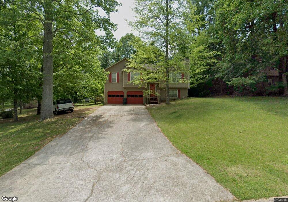
70 Mill Trace Unit 19 Carrollton, GA 30116
Estimated Value: $238,000 - $288,000
5
Beds
3
Baths
3,330
Sq Ft
$77/Sq Ft
Est. Value
About This Home
This home is located at 70 Mill Trace Unit 19, Carrollton, GA 30116 and is currently estimated at $256,780, approximately $77 per square foot. 70 Mill Trace Unit 19 is a home located in Carroll County with nearby schools including Central Elementary School, Central Middle School, and Central High School.
Ownership History
Date
Name
Owned For
Owner Type
Purchase Details
Closed on
Mar 13, 2018
Sold by
Hancock Katrina
Bought by
Reese Shalamar
Current Estimated Value
Home Financials for this Owner
Home Financials are based on the most recent Mortgage that was taken out on this home.
Original Mortgage
$133,838
Outstanding Balance
$114,188
Interest Rate
4.38%
Mortgage Type
New Conventional
Estimated Equity
$142,593
Purchase Details
Closed on
May 21, 2015
Sold by
The Bank Of New York Mello
Bought by
Hancock Katrina
Home Financials for this Owner
Home Financials are based on the most recent Mortgage that was taken out on this home.
Original Mortgage
$78,059
Interest Rate
4.75%
Mortgage Type
FHA
Purchase Details
Closed on
Nov 12, 2014
Sold by
Jackson Michael O and Jackson Deborah
Bought by
Bank Of New York Mellon
Purchase Details
Closed on
Sep 3, 1991
Bought by
Jackson Michael
Create a Home Valuation Report for This Property
The Home Valuation Report is an in-depth analysis detailing your home's value as well as a comparison with similar homes in the area
Home Values in the Area
Average Home Value in this Area
Purchase History
| Date | Buyer | Sale Price | Title Company |
|---|---|---|---|
| Reese Shalamar | $132,500 | -- | |
| Hancock Katrina | $79,500 | -- | |
| Bank Of New York Mellon | $114,300 | -- | |
| The Bank Of New York Mellon Tr | $114,333 | -- | |
| Jackson Michael | $47,900 | -- |
Source: Public Records
Mortgage History
| Date | Status | Borrower | Loan Amount |
|---|---|---|---|
| Open | Reese Shalamar | $133,838 | |
| Previous Owner | Hancock Katrina | $78,059 |
Source: Public Records
Tax History
| Year | Tax Paid | Tax Assessment Tax Assessment Total Assessment is a certain percentage of the fair market value that is determined by local assessors to be the total taxable value of land and additions on the property. | Land | Improvement |
|---|---|---|---|---|
| 2025 | $1,789 | $96,127 | $8,000 | $88,127 |
| 2024 | $1,810 | $96,127 | $8,000 | $88,127 |
| 2023 | $1,844 | $88,164 | $8,000 | $80,164 |
| 2022 | $1,568 | $72,378 | $8,000 | $64,378 |
| 2021 | $1,440 | $63,214 | $8,000 | $55,214 |
| 2020 | $1,325 | $56,750 | $8,000 | $48,750 |
| 2019 | $1,268 | $52,996 | $8,000 | $44,996 |
| 2018 | $1,184 | $45,105 | $8,000 | $37,105 |
| 2017 | $1,178 | $44,705 | $8,000 | $36,705 |
| 2016 | $838 | $44,705 | $8,000 | $36,705 |
| 2015 | $879 | $31,420 | $6,000 | $25,421 |
| 2014 | $770 | $31,421 | $6,000 | $25,421 |
Source: Public Records
Map
Nearby Homes
- 1265 Horsley Mill Rd
- 116 Camilla Dr
- 971 Horsley Mill Rd
- 103 River Birch Dr
- 1005 Oak Mountain Rd
- 214 Asher Dr
- 1281 Eagles Nest Cir
- 103 Birkdale Blvd
- 409 Reids Mill Way
- 120 National Way
- 240 Knob Dr
- 109 National Way
- 680 Horsley Mill Rd
- 5 Knob Dr
- 211 Castleman Rd
- 126 Pinehurst Way
- TRACT 8 Horsley Mill Rd
- 981 Horsley Mill Rd
- TRACT 9 Horsley Mill Rd
- 52 Castleman Rd
- 70 Mill Trace
- 15 Mill Hollow
- 82 Mill Trace
- 15 Mill Hollow Rd
- 12 Mill Hollow Rd
- 65 Mill Trace
- 94 Mill Trace
- 53 Mill Trace
- 23 Mill Hollow Rd
- 28 Mill Hollow Rd
- 87 Mill Trace
- 87 Mill Trace
- 40 Mill Trace
- 39 Mill Trace
- 106 Mill Trace
- 103 Mill Trace
- 35 Mill Hollow Rd
- 97 Mill Trace
- 42 Mill Hollow
- 42 Mill Hollow Rd
Your Personal Tour Guide
Ask me questions while you tour the home.