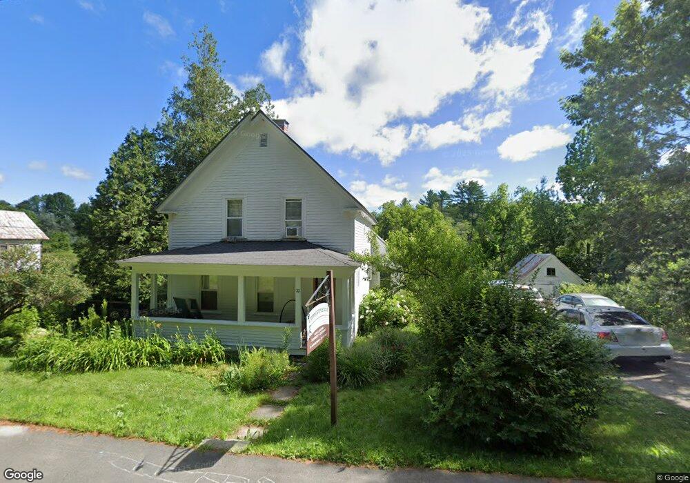
70 N Main St North Monmouth, ME 04265
Estimated Value: $283,965 - $332,000
4
Beds
2
Baths
1,541
Sq Ft
$201/Sq Ft
Est. Value
About This Home
This home is located at 70 N Main St, North Monmouth, ME 04265 and is currently estimated at $309,741, approximately $201 per square foot. 70 N Main St is a home located in Kennebec County with nearby schools including Hall-Dale Elementary School, Dresden Elementary School, and Marcia Buker School.
Ownership History
Date
Name
Owned For
Owner Type
Purchase Details
Closed on
Dec 8, 2010
Sold by
Gauthier Philip J
Bought by
Chasse Jonah M and Chasse Lisa J
Current Estimated Value
Home Financials for this Owner
Home Financials are based on the most recent Mortgage that was taken out on this home.
Original Mortgage
$110,200
Outstanding Balance
$72,881
Interest Rate
4.24%
Mortgage Type
Purchase Money Mortgage
Estimated Equity
$236,860
Create a Home Valuation Report for This Property
The Home Valuation Report is an in-depth analysis detailing your home's value as well as a comparison with similar homes in the area
Home Values in the Area
Average Home Value in this Area
Purchase History
| Date | Buyer | Sale Price | Title Company |
|---|---|---|---|
| Chasse Jonah M | -- | -- |
Source: Public Records
Mortgage History
| Date | Status | Borrower | Loan Amount |
|---|---|---|---|
| Open | Chasse Jonah M | $110,200 |
Source: Public Records
Tax History Compared to Growth
Tax History
| Year | Tax Paid | Tax Assessment Tax Assessment Total Assessment is a certain percentage of the fair market value that is determined by local assessors to be the total taxable value of land and additions on the property. | Land | Improvement |
|---|---|---|---|---|
| 2024 | $2,875 | $140,600 | $30,900 | $109,700 |
| 2023 | $2,545 | $140,600 | $30,900 | $109,700 |
| 2022 | $2,385 | $122,300 | $26,900 | $95,400 |
| 2021 | $2,299 | $122,300 | $26,900 | $95,400 |
| 2020 | $2,220 | $122,300 | $26,900 | $95,400 |
| 2018 | $2,146 | $122,300 | $26,900 | $95,400 |
| 2017 | $2,146 | $122,300 | $26,900 | $95,400 |
| 2016 | $2,421 | $146,300 | $27,000 | $119,300 |
| 2015 | $2,282 | $146,300 | $27,000 | $119,300 |
| 2013 | $2,111 | $145,100 | $27,000 | $118,100 |
Source: Public Records
Map
Nearby Homes
- 61 Highland Terrace
- 147 N Main St
- 51 Sandy Dr
- 33 Sandy Dr
- 643 Mount Pisgah Rd
- 25 Hansons Wood Rd
- 200 Back St
- 251 Annabessacook Rd
- Lot 42B Fire Road A-3
- 427 Mount Pisgah Rd
- 35002 Waugan Rd
- 297 Norris Hill Rd
- 87 Annabessacook Rd
- 172-B Annabessacook Rd
- 172 Annabessacook Rd
- 256 Blue Rd
- 316 Hardscrabble Rd
- 57 Neal Ln
- Lot 6 Holmes Brook Ln
- 18 Gray Mill Rd