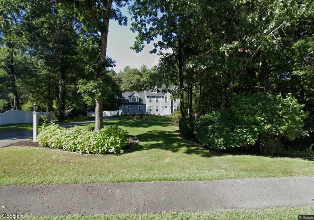
70 Oxbow Rd Canton, MA 02021
Estimated Value: $1,359,000 - $1,614,000
4
Beds
4
Baths
3,800
Sq Ft
$379/Sq Ft
Est. Value
About This Home
This home is located at 70 Oxbow Rd, Canton, MA 02021 and is currently estimated at $1,438,557, approximately $378 per square foot. 70 Oxbow Rd is a home located in Norfolk County with nearby schools including Canton High School.
Ownership History
Date
Name
Owned For
Owner Type
Purchase Details
Closed on
Jan 26, 2021
Sold by
Marinilli Edward E
Bought by
Oxbow 70 Nt
Current Estimated Value
Purchase Details
Closed on
Oct 13, 2011
Sold by
Larlee Peter D and Larlee Karan L
Bought by
Marinilli Edward E
Purchase Details
Closed on
Mar 20, 2003
Sold by
Fujinaga Jon and Fujinaga Kristina A
Bought by
Larlee Karan L and Larlee Peter D
Home Financials for this Owner
Home Financials are based on the most recent Mortgage that was taken out on this home.
Original Mortgage
$688,000
Interest Rate
5.9%
Mortgage Type
Purchase Money Mortgage
Purchase Details
Closed on
Jun 20, 2001
Sold by
Dinkin Geraldine D and Dinkin Gary T
Bought by
Fujinaga Kristina A and Fujinaga Jon
Home Financials for this Owner
Home Financials are based on the most recent Mortgage that was taken out on this home.
Original Mortgage
$430,000
Interest Rate
7.09%
Mortgage Type
Purchase Money Mortgage
Purchase Details
Closed on
Jun 3, 1997
Sold by
Waldron Daniel B and Waldron Darlene G
Bought by
Dinkin Gary T and Dinkin Geraldine D
Purchase Details
Closed on
Aug 1, 1995
Sold by
Pride Rt
Bought by
Wldron Daniel B and Waldron Darlene G
Create a Home Valuation Report for This Property
The Home Valuation Report is an in-depth analysis detailing your home's value as well as a comparison with similar homes in the area
Home Values in the Area
Average Home Value in this Area
Purchase History
| Date | Buyer | Sale Price | Title Company |
|---|---|---|---|
| Oxbow 70 Nt | -- | None Available | |
| Marinilli Edward E | $750,000 | -- | |
| Larlee Karan L | $860,000 | -- | |
| Fujinaga Kristina A | $765,000 | -- | |
| Dinkin Gary T | $449,900 | -- | |
| Wldron Daniel B | $397,500 | -- |
Source: Public Records
Mortgage History
| Date | Status | Borrower | Loan Amount |
|---|---|---|---|
| Previous Owner | Larlee Karan L | $688,000 | |
| Previous Owner | Wldron Daniel B | $430,000 | |
| Previous Owner | Wldron Daniel B | $574,400 | |
| Previous Owner | Wldron Daniel B | $110,000 |
Source: Public Records
Tax History
| Year | Tax Paid | Tax Assessment Tax Assessment Total Assessment is a certain percentage of the fair market value that is determined by local assessors to be the total taxable value of land and additions on the property. | Land | Improvement |
|---|---|---|---|---|
| 2025 | $11,412 | $1,153,900 | $370,200 | $783,700 |
| 2024 | $11,066 | $1,109,900 | $356,000 | $753,900 |
| 2023 | $10,530 | $996,200 | $356,000 | $640,200 |
| 2022 | $10,506 | $925,600 | $339,000 | $586,600 |
| 2021 | $10,215 | $837,300 | $308,100 | $529,200 |
| 2020 | $9,758 | $797,900 | $293,500 | $504,400 |
| 2019 | $9,715 | $783,500 | $266,700 | $516,800 |
| 2018 | $9,644 | $776,500 | $279,300 | $497,200 |
| 2017 | $9,821 | $767,900 | $273,900 | $494,000 |
| 2016 | $9,664 | $755,600 | $267,200 | $488,400 |
| 2015 | $9,427 | $735,300 | $259,400 | $475,900 |
Source: Public Records
Map
Nearby Homes
- 1831 Turnpike St
- 555 Page St Unit 105
- 50 Indian Ln
- 106 Indian Ln
- Lot 43 Pondview Ln
- Lot 2 Pondview Ln
- 79 Gold St
- 17 Mazzeo Dr
- 43 Emily Jeffers Rd
- 19 Camelot Ct
- 47 Trowbridge Cir
- 140 York St
- 159 Bittersweet Ln Unit 107
- 59 Highland Glen Dr Unit 328
- 888 Turnpike St
- 71 Cole Terrace
- 54 Highland Glen Dr
- 153 West St
- 195 High St
- 33 Hemlock Terrace
- 60 Oxbow Rd
- 21 Woodcliff Rd
- 90 York Brook Rd
- 19 Woodcliff Rd
- 85 Oxbow Rd
- 2 Rockwood Rd
- 80 York Brook Rd
- 17 Woodcliff Rd
- 50 Oxbow Rd
- 75 Oxbow Rd
- 70 York Brook Rd
- 20 Woodcliff Rd
- 15 Woodcliff Rd
- 25 Woodcliff Rd
- 22 Woodcliff Rd
- 14 Woodcliff Rd
- 75 York Brook Rd
- 4 Stonewood Dr
- 4 Stonewood Dr Unit 103
- 4 Stonewood Dr Unit 101
Your Personal Tour Guide
Ask me questions while you tour the home.