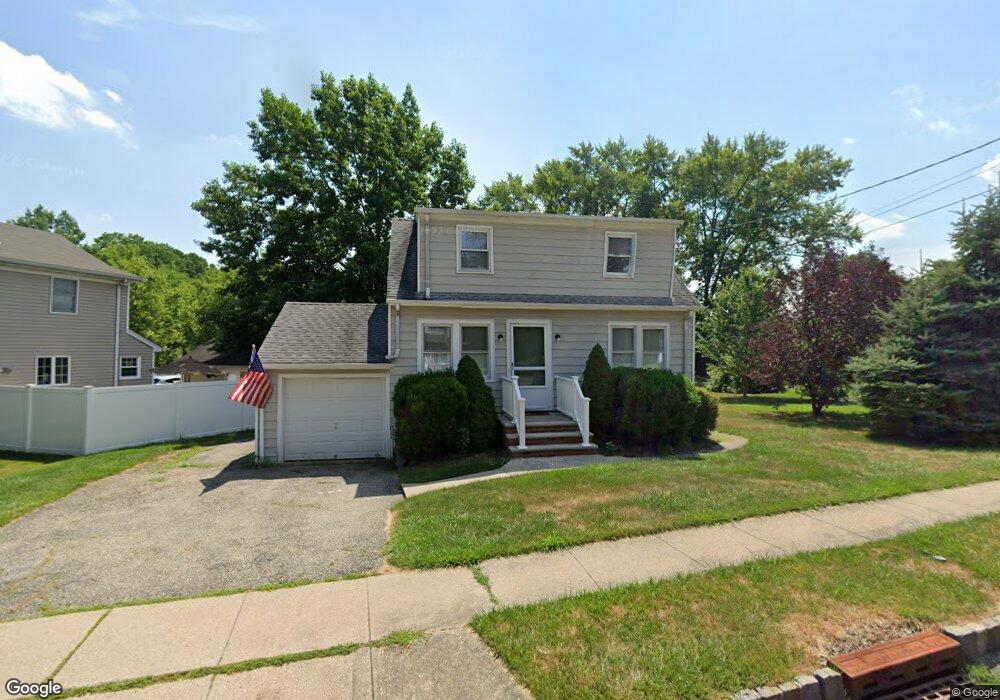
70 Reynolds Ave Whippany, NJ 07981
Estimated Value: $419,000 - $587,000
--
Bed
--
Bath
1,086
Sq Ft
$479/Sq Ft
Est. Value
About This Home
This home is located at 70 Reynolds Ave, Whippany, NJ 07981 and is currently estimated at $520,437, approximately $479 per square foot. 70 Reynolds Ave is a home located in Morris County with nearby schools including Whippany Park High School, Arrow Academy, and The Morristown-Beard School.
Ownership History
Date
Name
Owned For
Owner Type
Purchase Details
Closed on
Mar 6, 2013
Sold by
Woytas John R and Dubee Carolyn
Bought by
D W Properties Llc
Current Estimated Value
Purchase Details
Closed on
Feb 1, 2013
Sold by
Dean Elaine
Bought by
Woytas John R and Dubee Carolyn
Purchase Details
Closed on
Sep 24, 2010
Sold by
Woytas John R
Bought by
Woytas John R and Dubee Carolyn
Create a Home Valuation Report for This Property
The Home Valuation Report is an in-depth analysis detailing your home's value as well as a comparison with similar homes in the area
Home Values in the Area
Average Home Value in this Area
Purchase History
| Date | Buyer | Sale Price | Title Company |
|---|---|---|---|
| D W Properties Llc | -- | None Available | |
| Woytas John R | $93,333 | None Available | |
| Woytas John R | -- | None Available |
Source: Public Records
Tax History Compared to Growth
Tax History
| Year | Tax Paid | Tax Assessment Tax Assessment Total Assessment is a certain percentage of the fair market value that is determined by local assessors to be the total taxable value of land and additions on the property. | Land | Improvement |
|---|---|---|---|---|
| 2025 | $5,382 | $255,300 | $170,300 | $85,000 |
| 2024 | $5,359 | $255,300 | $170,300 | $85,000 |
| 2023 | $5,359 | $255,300 | $170,300 | $85,000 |
| 2022 | $4,902 | $255,300 | $170,300 | $85,000 |
| 2021 | $4,902 | $255,300 | $170,300 | $85,000 |
| 2020 | $4,815 | $255,300 | $170,300 | $85,000 |
| 2019 | $4,830 | $255,300 | $170,300 | $85,000 |
| 2018 | $4,746 | $255,300 | $170,300 | $85,000 |
| 2017 | $4,606 | $255,300 | $170,300 | $85,000 |
| 2016 | $4,539 | $255,300 | $170,300 | $85,000 |
| 2015 | $4,358 | $255,300 | $170,300 | $85,000 |
| 2014 | $4,264 | $255,300 | $170,300 | $85,000 |
Source: Public Records
Map
Nearby Homes
- 45 Polhemus Terrace
- 11 Nemic Ln
- 39 Lefke Ln
- 26 David Dr
- 96 Parsippany Rd
- 67 Parsippany Rd
- 92 Sunrise Dr
- 26 Gladstone Ct
- 34 Gladstone Ct
- 14 Gladstone Ct
- 23 Gladstone Ct
- 42 Gladstone Ct
- Monterey Plan at The Grove - The Monterey Collection
- Pershing Plan at The Grove - The Pershing Collection
- 7 Berkshire St
- 304 Beaverbrook Terrace Unit 304
- 16 Nantes Rd
- 12 Sunrise Dr
- 2 Dunkirk Dr
- 3306 Appleton Way
- 9 Fischer Place
- 66 Reynolds Ave
- 74 Reynolds Ave
- 64 Reynolds Ave
- 7 Fischer Place
- 69 Reynolds Ave
- 67 Reynolds Ave
- 76 Reynolds Ave
- 63 Reynolds Ave
- 62 Reynolds Ave
- 75 Reynolds Ave
- 5 Fischer Place
- 10 Fischer Place
- 61 Reynolds Ave
- 8 Fischer Place
- 60 Reynolds Ave
- 82 Reynolds Ave
- 79 Reynolds Ave
- 8 Joseph St
- 6 Fischer Place