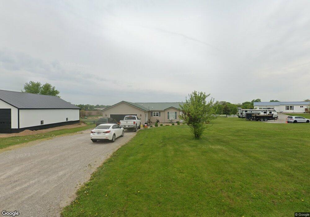
70 S 100 E Lagrange, IN 46761
Estimated Value: $238,000 - $291,000
Studio
--
Bath
1,664
Sq Ft
$160/Sq Ft
Est. Value
About This Home
This home is located at 70 S 100 E, Lagrange, IN 46761 and is currently estimated at $265,418, approximately $159 per square foot. 70 S 100 E is a home with nearby schools including Lakeland Jr/Sr High School, East Yoder School, and Southeast Clay School.
Ownership History
Date
Name
Owned For
Owner Type
Purchase Details
Closed on
Nov 8, 2021
Sold by
Wiese Kristen A
Bought by
Freed Austin J
Current Estimated Value
Purchase Details
Closed on
Oct 2, 2017
Sold by
Knisley Jennifer L
Bought by
Wiese Kristen A and Wiese Dustin Lacey
Home Financials for this Owner
Home Financials are based on the most recent Mortgage that was taken out on this home.
Original Mortgage
$136,481
Interest Rate
3.86%
Mortgage Type
Construction
Create a Home Valuation Report for This Property
The Home Valuation Report is an in-depth analysis detailing your home's value as well as a comparison with similar homes in the area
Home Values in the Area
Average Home Value in this Area
Purchase History
| Date | Buyer | Sale Price | Title Company |
|---|---|---|---|
| Freed Austin J | $200,000 | Lakeland Title Company | |
| Wiese Kristen A | $137,845 | Attorney Only |
Source: Public Records
Mortgage History
| Date | Status | Borrower | Loan Amount |
|---|---|---|---|
| Previous Owner | Wiese Kristen A | $136,481 |
Source: Public Records
Tax History
| Year | Tax Paid | Tax Assessment Tax Assessment Total Assessment is a certain percentage of the fair market value that is determined by local assessors to be the total taxable value of land and additions on the property. | Land | Improvement |
|---|---|---|---|---|
| 2025 | $654 | $195,900 | $29,700 | $166,200 |
| 2024 | $654 | $202,200 | $29,700 | $172,500 |
| 2023 | $577 | $194,800 | $28,600 | $166,200 |
| 2022 | $630 | $178,000 | $24,900 | $153,100 |
| 2021 | $468 | $151,100 | $22,600 | $128,500 |
| 2020 | $476 | $145,100 | $22,500 | $122,600 |
| 2019 | $429 | $134,100 | $22,500 | $111,600 |
| 2018 | $455 | $129,100 | $22,500 | $106,600 |
| 2017 | $431 | $123,200 | $22,400 | $100,800 |
| 2016 | $184 | $80,900 | $22,200 | $58,700 |
| 2014 | $177 | $80,000 | $22,200 | $57,800 |
| 2013 | $177 | $80,600 | $22,200 | $58,400 |
Source: Public Records
Map
Nearby Homes
- 314 E Michigan St
- 207 S Poplar St
- 602 N Maple St
- 202 W Central Ave
- 109 E Factory St
- 307 N Detroit St
- 217-219 Church St
- 737 N Canal St
- 217 N Sherman St
- 270 N 035 W
- 920 N 00ew
- 1400 N 200 E
- 2200 S State Road 9 Hwy
- 2930 N 080 E
- 1575 W 195 N
- 3650 Indiana 9
- 1055 S 495 E
- 1630 S 485 E
- 2200 S 460 E
- 2375 S 460 E
- 120 S 100 E
- 30 S 100 E
- 150 S 100 E
- 930 E Us Highway 20
- 930 E Hwy 20
- 930 E Highway 20 (W 20 Acres)
- 930 E Highway 20 (W 5 Acres)
- 1090 Us-20 E
- 2 N 100 E
- 170 S 100 E
- 890 E Us Highway 20
- 220 S 100 E
- 220 S 100 E
- 25 N 100 E
- 860 E Us Highway 20
- 260 S 100 E
- 830 E Us Highway 20
- 50 N 100 E
- 145 S 100 E
- 95 N 100 E
Your Personal Tour Guide
Ask me questions while you tour the home.