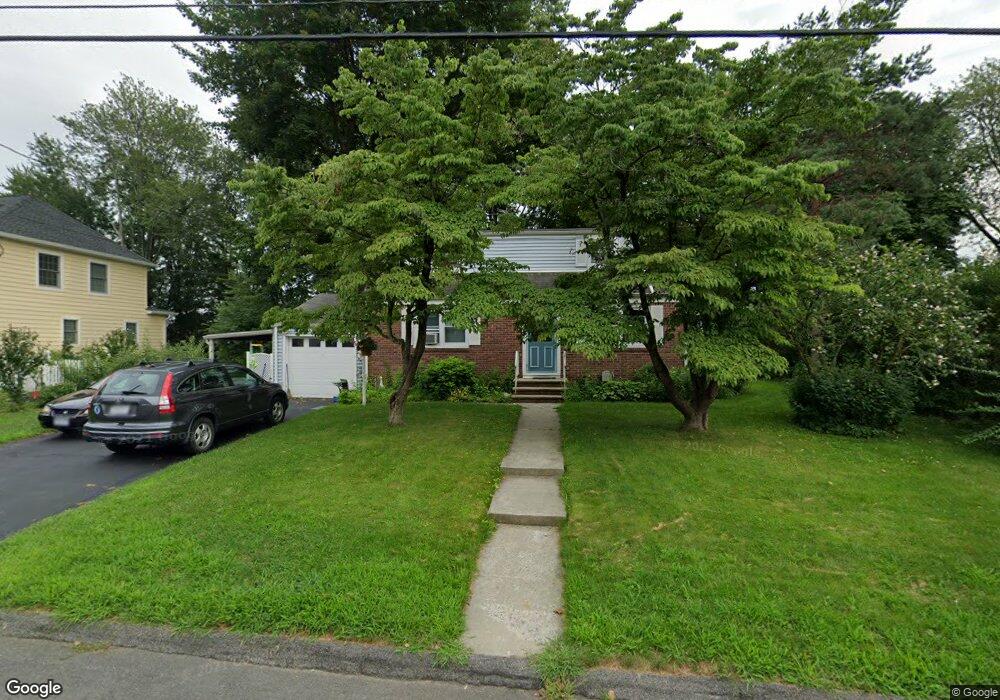
70 Secor Blvd Pearl River, NY 10965
Estimated Value: $625,000 - $646,617
4
Beds
2
Baths
1,476
Sq Ft
$430/Sq Ft
Est. Value
About This Home
This home is located at 70 Secor Blvd, Pearl River, NY 10965 and is currently estimated at $634,404, approximately $429 per square foot. 70 Secor Blvd is a home located in Rockland County with nearby schools including Pearl River High School and St Margaret School.
Ownership History
Date
Name
Owned For
Owner Type
Purchase Details
Closed on
Nov 16, 2005
Sold by
Schimmel Ursula R and Lawrence Ursula M
Bought by
Murray Thomas James and Murray Julie Marie
Current Estimated Value
Home Financials for this Owner
Home Financials are based on the most recent Mortgage that was taken out on this home.
Original Mortgage
$324,000
Outstanding Balance
$177,851
Interest Rate
6.07%
Mortgage Type
Fannie Mae Freddie Mac
Estimated Equity
$456,553
Create a Home Valuation Report for This Property
The Home Valuation Report is an in-depth analysis detailing your home's value as well as a comparison with similar homes in the area
Home Values in the Area
Average Home Value in this Area
Purchase History
| Date | Buyer | Sale Price | Title Company |
|---|---|---|---|
| Murray Thomas James | $454,000 | First Amer Title Ins Co Ny |
Source: Public Records
Mortgage History
| Date | Status | Borrower | Loan Amount |
|---|---|---|---|
| Open | Murray Thomas James | $324,000 |
Source: Public Records
Tax History Compared to Growth
Tax History
| Year | Tax Paid | Tax Assessment Tax Assessment Total Assessment is a certain percentage of the fair market value that is determined by local assessors to be the total taxable value of land and additions on the property. | Land | Improvement |
|---|---|---|---|---|
| 2024 | $10,720 | $134,100 | $39,200 | $94,900 |
| 2023 | $10,720 | $134,100 | $39,200 | $94,900 |
| 2022 | $3,460 | $134,100 | $39,200 | $94,900 |
| 2021 | $8,981 | $134,100 | $39,200 | $94,900 |
| 2020 | $8,310 | $134,100 | $39,200 | $94,900 |
| 2019 | $3,194 | $134,100 | $39,200 | $94,900 |
| 2018 | $7,810 | $134,100 | $39,200 | $94,900 |
| 2017 | $7,522 | $134,100 | $39,200 | $94,900 |
| 2016 | $7,287 | $134,100 | $39,200 | $94,900 |
| 2015 | -- | $134,100 | $39,200 | $94,900 |
| 2014 | -- | $134,100 | $39,200 | $94,900 |
Source: Public Records
Map
Nearby Homes
- 110 Orchid Dr
- 4 Brown Dr
- 432 Somerset Dr Unit M
- 452 Somerset Dr Unit F
- 854 E Crooked Hill Rd Unit 854
- 165 Forest Ave
- 250 Blauvelt Rd
- 87 Pinto Rd
- 352 Holt Dr
- 14 Staubitz Ave
- 26 E George Ave
- 46 Cara Dr
- 73 Bogert Ave
- 137 Blauvelt Rd
- 20 E Palisades Ave
- 15 Pacific Ave
- 86 Braunsdorf Rd
- 24 Moore Ave
- 99 E Washington Ave
- 84 Highview Ave
- 78 Secor Blvd
- 62 Secor Blvd
- 71 Veterans Pkwy
- 79 Veterans Pkwy
- 63 Veterans Pkwy
- 84 Secor Blvd
- 56 Secor Blvd
- 69 Secor Blvd
- 77 Secor Blvd
- 61 Secor Blvd
- 85 Veterans Pkwy
- 57 Veterans Pkwy
- 83 Secor Blvd
- 55 Secor Blvd
- 50 Secor Blvd
- 90 Secor Blvd
- 91 Veterans Pkwy
- 72 Veterans Pkwy
- 51 Veterans Pkwy
- 60 Veterans Pkwy