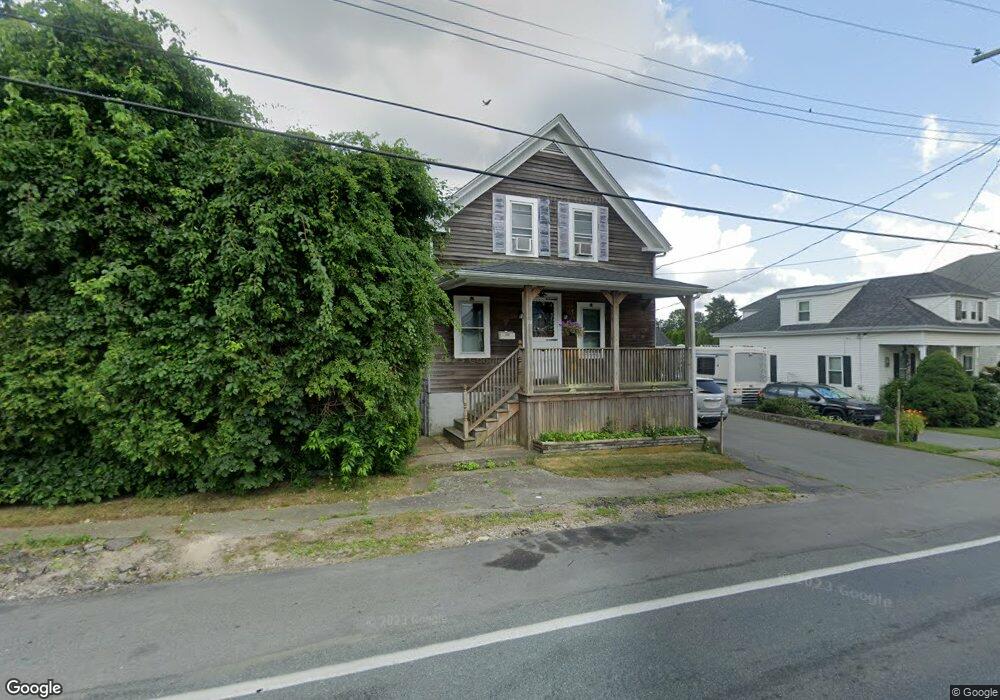
70 Slocum St Acushnet, MA 02743
Estimated Value: $254,000 - $451,000
3
Beds
1
Bath
180
Sq Ft
$1,993/Sq Ft
Est. Value
About This Home
This home is located at 70 Slocum St, Acushnet, MA 02743 and is currently estimated at $358,666, approximately $1,992 per square foot. 70 Slocum St is a home located in Bristol County with nearby schools including Acushnet Elementary School, Albert F Ford Middle School, and Alma Del Mar Charter School.
Ownership History
Date
Name
Owned For
Owner Type
Purchase Details
Closed on
Mar 30, 2000
Sold by
Paradis Roger H and Paradis Rolande D
Bought by
Galas Christopher M and Galas Wendy S
Current Estimated Value
Create a Home Valuation Report for This Property
The Home Valuation Report is an in-depth analysis detailing your home's value as well as a comparison with similar homes in the area
Home Values in the Area
Average Home Value in this Area
Purchase History
| Date | Buyer | Sale Price | Title Company |
|---|---|---|---|
| Galas Christopher M | $122,500 | -- |
Source: Public Records
Mortgage History
| Date | Status | Borrower | Loan Amount |
|---|---|---|---|
| Open | Galas Christopher M | $9,000 | |
| Open | Galas Christopher M | $207,000 | |
| Closed | Galas Christopher M | $187,500 |
Source: Public Records
Tax History
| Year | Tax Paid | Tax Assessment Tax Assessment Total Assessment is a certain percentage of the fair market value that is determined by local assessors to be the total taxable value of land and additions on the property. | Land | Improvement |
|---|---|---|---|---|
| 2025 | $19 | $174,400 | $91,400 | $83,000 |
| 2024 | $1,845 | $161,700 | $87,100 | $74,600 |
| 2023 | $1,740 | $145,000 | $78,600 | $66,400 |
| 2022 | $1,807 | $136,200 | $74,400 | $61,800 |
| 2021 | $2,147 | $125,200 | $74,400 | $50,800 |
| 2020 | $2,018 | $125,200 | $74,400 | $50,800 |
| 2019 | $1,920 | $115,000 | $65,900 | $49,100 |
| 2018 | $3,129 | $113,300 | $65,900 | $47,400 |
| 2017 | $1,503 | $104,100 | $65,900 | $38,200 |
| 2016 | $1,492 | $102,700 | $65,900 | $36,800 |
| 2015 | $1,467 | $102,700 | $65,900 | $36,800 |
Source: Public Records
Map
Nearby Homes
Your Personal Tour Guide
Ask me questions while you tour the home.