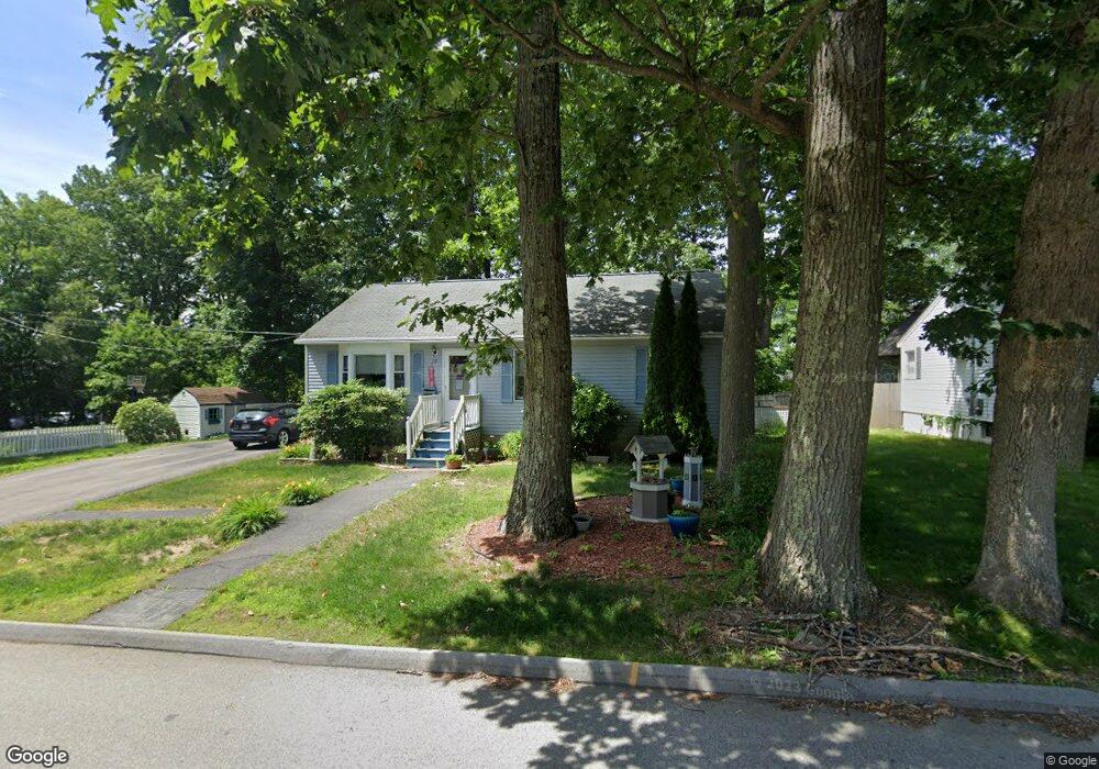
70 Tennyson St Worcester, MA 01610
North Quinsigamond Village NeighborhoodEstimated Value: $360,000 - $401,000
3
Beds
2
Baths
960
Sq Ft
$405/Sq Ft
Est. Value
About This Home
This home is located at 70 Tennyson St, Worcester, MA 01610 and is currently estimated at $388,787, approximately $404 per square foot. 70 Tennyson St is a home located in Worcester County with nearby schools including Quinsigamond School, Jacob Hiatt Magnet School, and Chandler Magnet.
Ownership History
Date
Name
Owned For
Owner Type
Purchase Details
Closed on
Sep 27, 1994
Sold by
Schulman Markj
Bought by
Dipilla Anthony and Dipilla Valerie
Current Estimated Value
Create a Home Valuation Report for This Property
The Home Valuation Report is an in-depth analysis detailing your home's value as well as a comparison with similar homes in the area
Home Values in the Area
Average Home Value in this Area
Purchase History
| Date | Buyer | Sale Price | Title Company |
|---|---|---|---|
| Dipilla Anthony | $92,900 | -- |
Source: Public Records
Mortgage History
| Date | Status | Borrower | Loan Amount |
|---|---|---|---|
| Open | Dipilla Anthony | $10,475 | |
| Open | Dipilla Anthony | $121,600 | |
| Closed | Dipilla Anthony | $117,013 |
Source: Public Records
Tax History
| Year | Tax Paid | Tax Assessment Tax Assessment Total Assessment is a certain percentage of the fair market value that is determined by local assessors to be the total taxable value of land and additions on the property. | Land | Improvement |
|---|---|---|---|---|
| 2025 | $4,806 | $364,400 | $117,800 | $246,600 |
| 2024 | $4,708 | $342,400 | $117,800 | $224,600 |
| 2023 | $4,549 | $317,200 | $102,400 | $214,800 |
| 2022 | $4,029 | $264,900 | $81,900 | $183,000 |
| 2021 | $3,863 | $237,300 | $65,500 | $171,800 |
| 2020 | $3,774 | $222,000 | $65,500 | $156,500 |
| 2019 | $3,546 | $197,000 | $58,900 | $138,100 |
| 2018 | $3,436 | $181,700 | $58,900 | $122,800 |
| 2017 | $3,444 | $179,200 | $58,900 | $120,300 |
| 2016 | $3,347 | $162,400 | $42,900 | $119,500 |
| 2015 | $3,259 | $162,400 | $42,900 | $119,500 |
| 2014 | $3,173 | $162,400 | $42,900 | $119,500 |
Source: Public Records
Map
Nearby Homes
- 68 Tennyson St
- 132 Whipple St
- 67 Tennyson St
- 116 Whipple St
- 66 Tennyson St
- 129 Whipple St
- 134 Whipple St
- 65 Tennyson St
- 62 Tennyson St
- 116 Epworth St
- 114 Epworth St
- 118 Epworth St
- 61 Tennyson St
- 17 Pearlbush Path
- 15 Pearlbush Path
- 13 Pearlbush Path
- 11 Pearlbush Path
- 110 Epworth St
- 19 Pearlbush Path
- 133 Whipple St
Your Personal Tour Guide
Ask me questions while you tour the home.