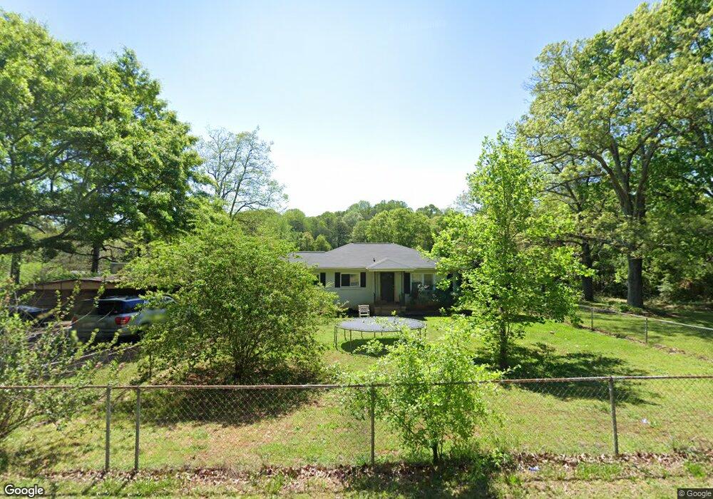
70 W Tyger Bridge Rd Taylors, SC 29687
Estimated Value: $177,865 - $201,000
2
Beds
1
Bath
1,048
Sq Ft
$182/Sq Ft
Est. Value
About This Home
This home is located at 70 W Tyger Bridge Rd, Taylors, SC 29687 and is currently estimated at $190,216, approximately $181 per square foot. 70 W Tyger Bridge Rd is a home located in Greenville County with nearby schools including Mountain View Elementary School, Blue Ridge Middle School, and Blue Ridge High School.
Ownership History
Date
Name
Owned For
Owner Type
Purchase Details
Closed on
Nov 15, 2022
Sold by
Brewington Michael L
Bought by
Brewington Michael L and Brewington Donna J
Current Estimated Value
Purchase Details
Closed on
Nov 3, 2022
Sold by
Brewington Michael L
Bought by
Brewington Michael L and Brewington Donna J
Purchase Details
Closed on
Aug 18, 2004
Sold by
Federal National Mortgage Association
Bought by
Brewington Michael L
Purchase Details
Closed on
Jun 11, 2004
Sold by
Golightly Roger
Bought by
Federal National Mortgage Association
Purchase Details
Closed on
Apr 1, 2003
Sold by
Butler Linda Marie Trustee
Bought by
Golightly Roger
Create a Home Valuation Report for This Property
The Home Valuation Report is an in-depth analysis detailing your home's value as well as a comparison with similar homes in the area
Home Values in the Area
Average Home Value in this Area
Purchase History
| Date | Buyer | Sale Price | Title Company |
|---|---|---|---|
| Brewington Michael L | -- | -- | |
| Brewington Michael L | -- | -- | |
| Brewington Michael L | -- | -- | |
| Brewington Michael L | $50,000 | -- | |
| Federal National Mortgage Association | $60,710 | -- | |
| Golightly Roger | $82,000 | -- |
Source: Public Records
Tax History Compared to Growth
Tax History
| Year | Tax Paid | Tax Assessment Tax Assessment Total Assessment is a certain percentage of the fair market value that is determined by local assessors to be the total taxable value of land and additions on the property. | Land | Improvement |
|---|---|---|---|---|
| 2024 | $1,303 | $3,860 | $1,710 | $2,150 |
| 2023 | $1,264 | $3,860 | $1,710 | $2,150 |
| 2022 | $1,180 | $3,860 | $1,710 | $2,150 |
| 2021 | $1,157 | $3,860 | $1,710 | $2,150 |
| 2020 | $1,073 | $3,360 | $1,260 | $2,100 |
| 2019 | $1,070 | $3,360 | $1,260 | $2,100 |
| 2018 | $1,049 | $3,360 | $1,260 | $2,100 |
| 2017 | $1,018 | $3,360 | $1,260 | $2,100 |
| 2016 | $980 | $56,020 | $21,000 | $35,020 |
| 2015 | $980 | $56,020 | $21,000 | $35,020 |
| 2014 | $1,000 | $57,704 | $19,107 | $38,597 |
Source: Public Records
Map
Nearby Homes
- 6025 Mountain View Rd
- 10 Ed Few Rd
- 151 Hammond Dr
- 1502A Groce Meadow Rd
- 326 Thompson Rd
- 6830 Mountain View Rd
- 6840 Mountain View Rd
- 724 Keller Rd
- 716 Keller Rd
- 740 Keller Rd
- 732 Keller Rd
- 15 Gerru Ct
- 27 King Eider Way
- 6550 Mountain View Rd
- 20 Gerru Ct
- 323 Bass Cove Dr
- 50 Waldrop Rd
- 201 King Eider Way
- 125 Lake Robinson Point
- 125 Lake Robinson Pointe
- 80 W Tyger Bridge Rd
- 75 W Tyger Bridge Rd
- 45 W Tyger Bridge Rd
- 55 W Tyger Bridge Rd
- 1982 Groce Meadow Rd
- 2004 Groce Meadow Rd
- 1970 Groce Meadow Rd
- 1986 Groce Meadow Rd
- 0 W Tyger Bridge Rd
- 1991 Groce Meadow Rd
- 2050 Groce Meadow Rd
- 1978 Groce Meadow Rd
- 113 W Tyger Bridge Rd
- 2005 Groce Meadow Rd
- 10 Raynes Ct
- 6 Raynes Ct
- 14 Raynes Ct
- 2 Raynes Ct
- 2 Groce Meadow Rd
- 1950 Groce Meadow Rd