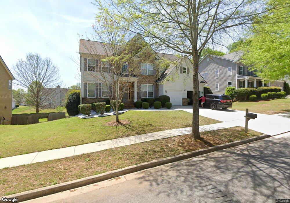
70 Wellstone Place Covington, GA 30014
Estimated Value: $390,950 - $455,000
--
Bed
3
Baths
3,267
Sq Ft
$128/Sq Ft
Est. Value
About This Home
This home is located at 70 Wellstone Place, Covington, GA 30014 and is currently estimated at $419,238, approximately $128 per square foot. 70 Wellstone Place is a home located in Newton County with nearby schools including East Newton Elementary School, Cousins Middle School, and Eastside High School.
Ownership History
Date
Name
Owned For
Owner Type
Purchase Details
Closed on
Jun 16, 2006
Sold by
Manjin Michael K
Bought by
Manjin Michael K and Manjin Nancy G
Current Estimated Value
Home Financials for this Owner
Home Financials are based on the most recent Mortgage that was taken out on this home.
Original Mortgage
$208,228
Outstanding Balance
$121,872
Interest Rate
6.49%
Mortgage Type
New Conventional
Estimated Equity
$297,366
Create a Home Valuation Report for This Property
The Home Valuation Report is an in-depth analysis detailing your home's value as well as a comparison with similar homes in the area
Home Values in the Area
Average Home Value in this Area
Purchase History
| Date | Buyer | Sale Price | Title Company |
|---|---|---|---|
| Manjin Michael K | -- | -- | |
| Manjin Michael K | $260,300 | -- |
Source: Public Records
Mortgage History
| Date | Status | Borrower | Loan Amount |
|---|---|---|---|
| Open | Manjin Michael K | $208,228 |
Source: Public Records
Tax History Compared to Growth
Tax History
| Year | Tax Paid | Tax Assessment Tax Assessment Total Assessment is a certain percentage of the fair market value that is determined by local assessors to be the total taxable value of land and additions on the property. | Land | Improvement |
|---|---|---|---|---|
| 2024 | $4,062 | $161,760 | $21,600 | $140,160 |
| 2023 | $4,323 | $160,880 | $10,000 | $150,880 |
| 2022 | $3,435 | $128,160 | $10,000 | $118,160 |
| 2021 | $3,326 | $111,520 | $10,000 | $101,520 |
| 2020 | $3,298 | $100,520 | $10,000 | $90,520 |
| 2019 | $3,292 | $98,880 | $10,000 | $88,880 |
| 2018 | $3,051 | $91,240 | $10,000 | $81,240 |
| 2017 | $3,236 | $96,640 | $11,200 | $85,440 |
| 2016 | $2,294 | $69,200 | $9,000 | $60,200 |
| 2015 | $1,983 | $60,280 | $3,200 | $57,080 |
| 2014 | $1,978 | $60,280 | $0 | $0 |
Source: Public Records
Map
Nearby Homes
- 30 Asteria Trail
- Tucker Plan at River Walk Farm
- Jodeco 2 Story Bay Plan at River Walk Farm
- Jodeco Front Porch Plan at River Walk Farm
- Hemingway Plan at River Walk Farm
- Jodeco Box Bay Plan at River Walk Farm
- Madison Plan at River Walk Farm
- 115 Sagebrush Trail
- 30 Craines View
- 690 Egrets Landing Unit 61
- 690 Egrets Landing
- 30 Snapdragon Ln
- 80 Dearing Woods Ct
- 345 River Walk Farm Pkwy Lot 5
- 295 River Walk Farm Pkwy
- 368 River Walk Farm Pkwy Lot 70
- 0 Briarpatch Dr Unit 7614077
- 0 Briarpatch Dr Unit 10562648
- 685 Egrets Landing Unit 58
- 370 Granary Walk
- 60 Wellstone Place
- 80 Wellstone Place
- 50 Bunting Place
- 40 Bunting Place
- 50 Wellstone Place
- 65 Wellstone Place
- 90 Wellstone Place Unit 1
- 0 Wellstone Place Unit 8550930
- 0 Wellstone Place Unit 8226417
- 0 Wellstone Place Unit 7077863
- 0 Wellstone Place Unit 8433820
- 0 Wellstone Place Unit 8297103
- 0 Wellstone Place Unit 7505190
- 0 Wellstone Place Unit 7022919
- 0 Wellstone Place Unit 7061284
- 0 Wellstone Place Unit 8738526
- 0 Wellstone Place Unit 8771950
- 0 Wellstone Place Unit 8856902
- 0 Wellstone Place Unit 8923045
- 0 Wellstone Place Unit 3132222