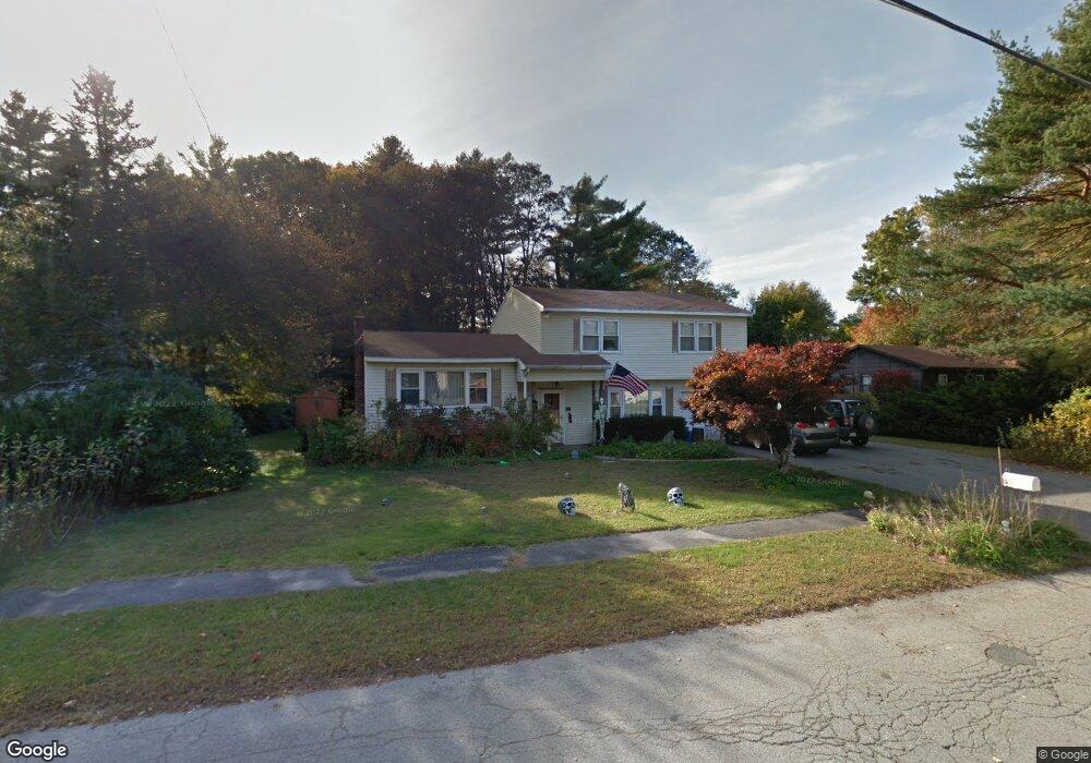
70 Westfield Dr Holliston, MA 01746
Estimated Value: $578,000 - $662,000
4
Beds
3
Baths
1,901
Sq Ft
$327/Sq Ft
Est. Value
About This Home
This home is located at 70 Westfield Dr, Holliston, MA 01746 and is currently estimated at $620,993, approximately $326 per square foot. 70 Westfield Dr is a home located in Middlesex County with nearby schools including Miller Elementary School, Robert H. Adams Middle School, and Holliston High School.
Create a Home Valuation Report for This Property
The Home Valuation Report is an in-depth analysis detailing your home's value as well as a comparison with similar homes in the area
Home Values in the Area
Average Home Value in this Area
Tax History Compared to Growth
Tax History
| Year | Tax Paid | Tax Assessment Tax Assessment Total Assessment is a certain percentage of the fair market value that is determined by local assessors to be the total taxable value of land and additions on the property. | Land | Improvement |
|---|---|---|---|---|
| 2025 | $6,811 | $464,900 | $259,900 | $205,000 |
| 2024 | $6,488 | $430,800 | $259,900 | $170,900 |
| 2023 | $6,522 | $423,500 | $259,900 | $163,600 |
| 2022 | $6,662 | $383,300 | $259,900 | $123,400 |
| 2021 | $6,458 | $361,800 | $238,400 | $123,400 |
| 2020 | $6,462 | $342,800 | $235,600 | $107,200 |
| 2019 | $5,879 | $312,200 | $205,000 | $107,200 |
| 2018 | $5,829 | $312,200 | $205,000 | $107,200 |
| 2017 | $5,667 | $306,000 | $197,200 | $108,800 |
| 2016 | $5,267 | $280,300 | $172,500 | $107,800 |
| 2015 | $5,019 | $259,000 | $155,200 | $103,800 |
Source: Public Records
Map
Nearby Homes
- 54 Westfield Dr
- 56 Roy Ave
- 32 Colonial Way
- 150 Westfield Dr
- 11 Francine Dr
- 160 Winter St
- 195 High St
- 133 Brooksmont Dr Unit 43
- 95 Brooksmont Dr Unit 26
- 131 Jennings Rd
- 59 Turner Rd
- 43 Bittersweet Cir Unit 43
- 152 Turner Rd Unit 43
- 152 Turner Rd Unit 14
- 147 Turner Rd Unit 80
- 151 Mohawk Path
- 74 Meeting House Path
- 72 Meeting House Path
- 97 Meeting House Path Unit 97
- 8 Raymond Way