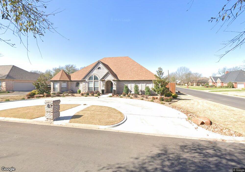
700 Amanda Ln Cleburne, TX 76033
Estimated Value: $389,000 - $421,000
4
Beds
3
Baths
2,652
Sq Ft
$153/Sq Ft
Est. Value
About This Home
This home is located at 700 Amanda Ln, Cleburne, TX 76033 and is currently estimated at $406,466, approximately $153 per square foot. 700 Amanda Ln is a home located in Johnson County with nearby schools including Gerard Elementary School, Lowell Smith Jr. Middle School, and Cleburne High School.
Ownership History
Date
Name
Owned For
Owner Type
Purchase Details
Closed on
Dec 14, 2020
Sold by
Ward Dale L and Ward Dana E
Bought by
Meeks Jeffrey Blaine and Meeks Nikki Lavon
Current Estimated Value
Purchase Details
Closed on
Dec 19, 2014
Sold by
Philp Ruth Y
Bought by
Ward Dale L and Ward Dana E
Home Financials for this Owner
Home Financials are based on the most recent Mortgage that was taken out on this home.
Original Mortgage
$182,700
Interest Rate
4.04%
Mortgage Type
VA
Purchase Details
Closed on
Dec 7, 2011
Sold by
Philp Ruth Y and Philp Larry G
Bought by
Philp Ruth Y
Create a Home Valuation Report for This Property
The Home Valuation Report is an in-depth analysis detailing your home's value as well as a comparison with similar homes in the area
Home Values in the Area
Average Home Value in this Area
Purchase History
| Date | Buyer | Sale Price | Title Company |
|---|---|---|---|
| Meeks Jeffrey Blaine | -- | Trinity Title | |
| Ward Dale L | -- | Providence Title Co | |
| Philp Ruth Y | -- | None Available |
Source: Public Records
Mortgage History
| Date | Status | Borrower | Loan Amount |
|---|---|---|---|
| Previous Owner | Ward Dale L | $182,700 |
Source: Public Records
Tax History
| Year | Tax Paid | Tax Assessment Tax Assessment Total Assessment is a certain percentage of the fair market value that is determined by local assessors to be the total taxable value of land and additions on the property. | Land | Improvement |
|---|---|---|---|---|
| 2025 | $7,954 | $426,123 | $65,000 | $361,123 |
| 2024 | $9,501 | $426,123 | $65,000 | $361,123 |
| 2023 | $7,238 | $426,123 | $65,000 | $361,123 |
| 2022 | $8,923 | $356,539 | $65,000 | $291,539 |
| 2021 | $8,496 | $325,644 | $56,000 | $269,644 |
| 2020 | $7,381 | $266,380 | $30,000 | $236,380 |
| 2019 | $7,422 | $258,877 | $30,000 | $228,877 |
| 2018 | $6,750 | $228,360 | $30,000 | $198,360 |
| 2017 | $6,385 | $228,360 | $30,000 | $198,360 |
| 2016 | $5,804 | $197,174 | $30,000 | $167,174 |
| 2015 | $2,797 | $197,174 | $30,000 | $167,174 |
| 2014 | $2,797 | $180,303 | $30,000 | $150,303 |
Source: Public Records
Map
Nearby Homes
- 703 Brandon Dr
- 1608 Quail Hollow
- 1607 W Westhill Dr
- 703 Dripping Springs Ln
- 810 Chestnut Grove Dr
- 400 Meadow View Dr
- 1907 Heritage Ct
- 1605 Heather Ct
- 812 Sugar Hill Ave
- 904 Meadow View Dr
- 906 Chestnut Grove Dr
- 1900 W Westhill Dr
- 1902 W Westhill Dr
- 1503 W Westhill Dr
- 912 Meadow View Dr
- 1813 Golden Meadow Ct
- 1004 Canyon Ct
- 1805 Sudbury Dr
- 705 Broken Bow Ln
- 701 Broken Bow Ln
- 702 Amanda Ln
- 701 Brandon Dr
- 1700 Quail Hollow
- 701 Amanda Ln
- 703 Amanda Ln
- 1702 Quail Hollow
- 704 Amanda Ln
- 1606 Quail Hollow
- 705 Amanda Ln
- 1704 Quail Hollow
- 620 Quail Walk
- 700 Quail Walk
- 700 Brandon Dr
- 1611 Danny Ray Dr
- 702 Quail Walk
- 702 Brandon Dr
- 1604 Quail Hollow
- 1613 Danny Ray Dr
- 1609 Danny Ray Dr
- 708 Amanda Ln
Your Personal Tour Guide
Ask me questions while you tour the home.