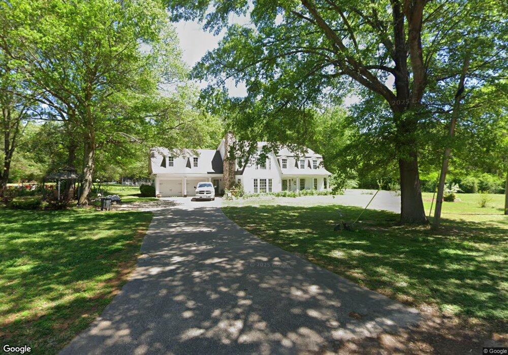
700 Cherokee Trail Texarkana, AR 71854
Estimated Value: $302,122 - $391,000
--
Bed
3
Baths
3,272
Sq Ft
$105/Sq Ft
Est. Value
About This Home
This home is located at 700 Cherokee Trail, Texarkana, AR 71854 and is currently estimated at $342,781, approximately $104 per square foot. 700 Cherokee Trail is a home located in Miller County with nearby schools including Arkansas High School and Washington Academy.
Ownership History
Date
Name
Owned For
Owner Type
Purchase Details
Closed on
Nov 19, 2012
Sold by
Larey Caron J and Larey Richard M
Bought by
Wooten Timothy S and Roach Sharon
Current Estimated Value
Home Financials for this Owner
Home Financials are based on the most recent Mortgage that was taken out on this home.
Original Mortgage
$189,000
Outstanding Balance
$82,818
Interest Rate
3.4%
Mortgage Type
Purchase Money Mortgage
Estimated Equity
$259,963
Purchase Details
Closed on
May 7, 2009
Sold by
Westmoreland Lynn and Westmoreland Charlott A
Bought by
Larey Caron J
Home Financials for this Owner
Home Financials are based on the most recent Mortgage that was taken out on this home.
Original Mortgage
$170,000
Interest Rate
4.76%
Mortgage Type
Future Advance Clause Open End Mortgage
Purchase Details
Closed on
Nov 18, 2003
Bought by
Westmoreland Lynn and Westmoreland Charlott
Purchase Details
Closed on
Aug 25, 1987
Bought by
Musgrove Daniel and Musgrove Cynthia
Create a Home Valuation Report for This Property
The Home Valuation Report is an in-depth analysis detailing your home's value as well as a comparison with similar homes in the area
Home Values in the Area
Average Home Value in this Area
Purchase History
| Date | Buyer | Sale Price | Title Company |
|---|---|---|---|
| Wooten Timothy S | $195,000 | None Available | |
| Larey Caron J | $200,000 | None Available | |
| Westmoreland Lynn | $172,000 | -- | |
| Musgrove Daniel | -- | -- |
Source: Public Records
Mortgage History
| Date | Status | Borrower | Loan Amount |
|---|---|---|---|
| Open | Wooten Timothy S | $189,000 | |
| Previous Owner | Larey Caron J | $170,000 |
Source: Public Records
Tax History Compared to Growth
Tax History
| Year | Tax Paid | Tax Assessment Tax Assessment Total Assessment is a certain percentage of the fair market value that is determined by local assessors to be the total taxable value of land and additions on the property. | Land | Improvement |
|---|---|---|---|---|
| 2024 | $1,896 | $41,750 | $1,720 | $40,030 |
| 2023 | $1,867 | $41,750 | $1,720 | $40,030 |
| 2022 | $1,882 | $41,750 | $1,720 | $40,030 |
| 2021 | $1,784 | $41,750 | $1,720 | $40,030 |
| 2020 | $1,687 | $41,750 | $1,720 | $40,030 |
| 2019 | $1,576 | $35,540 | $1,720 | $33,820 |
| 2018 | $1,601 | $35,540 | $1,720 | $33,820 |
| 2017 | $1,601 | $35,540 | $1,720 | $33,820 |
| 2016 | $1,601 | $35,540 | $1,720 | $33,820 |
| 2015 | $1,577 | $35,102 | $1,720 | $33,382 |
| 2014 | $1,485 | $33,430 | $1,700 | $31,730 |
Source: Public Records
Map
Nearby Homes
- 6323 E 9th St
- 1147 Vanderbilt Rd
- 400 Paige Ln
- 1539 Vanderbilt Rd
- 2301 N Mosley Rd
- 1135 Cook Rd
- 526 Shell
- TBD U S Highway 82
- 0 Arkansas 196
- TBD Old Post Rd
- 0 Old Post Rd Unit 24065762
- 719 Meadows Rd
- 409 Meadows Rd
- 225 Marguerite Dr
- 6112 Genoa Rd
- 4302 E 9th St
- TBD Mc 65
- TBD Mandeville Rd
- 4406 Magee Dr
- 0 E 54th St
- 701 Ward Rd
- 544 Cherokee Trail
- 7150 Plantation Bend
- 7151 Plantation Bend
- 736 Woodhill Rd
- 536 Appaloosa Trail
- 516 Ward Rd
- 747 Ward Rd
- 724 Woodhill Rd
- 559 Appaloosa Trail
- 636 Ward Rd
- 7141 Cactus Ln
- 548 Ward Rd
- 525 Ward Rd
- 705 Woodhill Rd
- 515 Appaloosa Trail
- 443 Ward Rd
- 835 Ward Rd
- 756 Ward Rd
- 804 Woodhill Rd