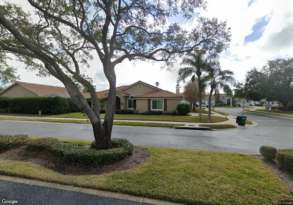
700 Chevy Chase Dr Safety Harbor, FL 34695
Estimated Value: $759,000 - $818,000
--
Bed
1
Bath
2,230
Sq Ft
$354/Sq Ft
Est. Value
About This Home
This home is located at 700 Chevy Chase Dr, Safety Harbor, FL 34695 and is currently estimated at $789,148, approximately $353 per square foot. 700 Chevy Chase Dr is a home located in Pinellas County with nearby schools including Safety Harbor Elementary School, Countryside High School, and Safety Harbor Middle School.
Ownership History
Date
Name
Owned For
Owner Type
Purchase Details
Closed on
Dec 24, 1998
Sold by
Nenstiel Gregory A and Silva Linda C
Bought by
Merz Clifford R and Merz Michelle H
Current Estimated Value
Home Financials for this Owner
Home Financials are based on the most recent Mortgage that was taken out on this home.
Original Mortgage
$137,000
Interest Rate
6.94%
Mortgage Type
New Conventional
Create a Home Valuation Report for This Property
The Home Valuation Report is an in-depth analysis detailing your home's value as well as a comparison with similar homes in the area
Home Values in the Area
Average Home Value in this Area
Purchase History
| Date | Buyer | Sale Price | Title Company |
|---|---|---|---|
| Merz Clifford R | $197,000 | -- |
Source: Public Records
Mortgage History
| Date | Status | Borrower | Loan Amount |
|---|---|---|---|
| Open | Merz Clifford R | $130,000 | |
| Closed | Merz Clifford R | $137,000 |
Source: Public Records
Tax History Compared to Growth
Tax History
| Year | Tax Paid | Tax Assessment Tax Assessment Total Assessment is a certain percentage of the fair market value that is determined by local assessors to be the total taxable value of land and additions on the property. | Land | Improvement |
|---|---|---|---|---|
| 2024 | $3,824 | $269,828 | -- | -- |
| 2023 | $3,824 | $261,969 | $0 | $0 |
| 2022 | $3,716 | $254,339 | $0 | $0 |
| 2021 | $3,765 | $246,931 | $0 | $0 |
| 2020 | $3,757 | $243,522 | $0 | $0 |
| 2019 | $3,691 | $238,047 | $0 | $0 |
| 2018 | $3,640 | $233,608 | $0 | $0 |
| 2017 | $3,610 | $228,803 | $0 | $0 |
| 2016 | $3,581 | $224,097 | $0 | $0 |
| 2015 | $3,656 | $222,539 | $0 | $0 |
| 2014 | $3,638 | $220,773 | $0 | $0 |
Source: Public Records
Map
Nearby Homes
- 1205 Hounds Run
- 720 Earls Ct
- 1209 Roxbury Dr
- 910 Kingscote Ct
- 1103 Kensington Ct
- 1119 Huntington Ln
- 1005 Chatham Ct
- 1009 Wyndham Way
- 603 Baldwin Ave Unit B
- 2363 Flanders Way Unit C
- 511 Longfellow Ct Unit D
- 2368 Flanders Way Unit D
- 1111 Chatham Ct
- 647 Fairmont Ave Unit C
- 612 Fairmont Ave Unit D
- 3321 Meander Ln
- 615 Fairmont Ave Unit C
- 1014 Bramblewood Ct
- 2208 Hampstead Ct
- 2225 Windsong Ct
- 1117 Archers Bend
- 1126 Hounds Run
- 1115 Archers Bend
- 1125 Hounds Run
- 1113 Archers Bend
- 1124 Hounds Run
- 1200 Hounds Run Unit 1200
- 1200 Hounds Run Unit 106
- 1200 Hounds Run
- 1206 Hounds Run Unit 103
- 1208 Hounds Run
- 1210 Hounds Run Unit 101
- 1111 Archers Bend
- 701 Archers Bend
- 1118 Hounds Run
- 703 Archers Bend
- 1205 Hounds Run Unit 1205
- 1211 Hounds Run
- 1209 Hounds Run Unit 1704
- 1205 Hounds Run Unit 1702