Estimated Value: $357,000 - $360,000
4
Beds
2
Baths
1,645
Sq Ft
$218/Sq Ft
Est. Value
About This Home
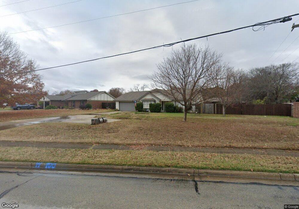
This home is located at 700 Martin Rd, Hurst, TX 76054 and is currently estimated at $358,586, approximately $217 per square foot. 700 Martin Rd is a home located in Tarrant County with nearby schools including W.A. Porter Elementary School, Smithfield Middle School, and Birdville High School.
Ownership History
Date
Name
Owned For
Owner Type
Purchase Details
Closed on
Feb 25, 2022
Sold by
Go Hard Properties Llc
Bought by
Big Ticket Properties Llc
Current Estimated Value
Home Financials for this Owner
Home Financials are based on the most recent Mortgage that was taken out on this home.
Original Mortgage
$264,000
Outstanding Balance
$245,610
Interest Rate
3.55%
Mortgage Type
New Conventional
Estimated Equity
$112,976
Purchase Details
Closed on
Aug 12, 2021
Sold by
Smith James Donald and Smith Robbie
Bought by
Go Hard Properties Llc
Home Financials for this Owner
Home Financials are based on the most recent Mortgage that was taken out on this home.
Original Mortgage
$235,000
Interest Rate
2.9%
Mortgage Type
Purchase Money Mortgage
Purchase Details
Closed on
Aug 10, 2016
Sold by
Smith Alicia C
Bought by
Smith James Donald
Purchase Details
Closed on
Sep 7, 2001
Sold by
Barnett Homes Ltd
Bought by
Smith Alicia C
Home Financials for this Owner
Home Financials are based on the most recent Mortgage that was taken out on this home.
Original Mortgage
$110,550
Interest Rate
9.75%
Purchase Details
Closed on
May 4, 2001
Sold by
Talbot Bobbie Jo
Bought by
Johnson Paul
Home Financials for this Owner
Home Financials are based on the most recent Mortgage that was taken out on this home.
Original Mortgage
$96,000
Interest Rate
6.81%
Purchase Details
Closed on
May 2, 2001
Sold by
Johnson Paul W
Bought by
Harnett Homes Ltd
Home Financials for this Owner
Home Financials are based on the most recent Mortgage that was taken out on this home.
Original Mortgage
$96,000
Interest Rate
6.81%
Purchase Details
Closed on
Aug 6, 1993
Sold by
Talbot Virginia Anne
Bought by
Talbot Bobbie Jo
Home Financials for this Owner
Home Financials are based on the most recent Mortgage that was taken out on this home.
Original Mortgage
$77,450
Interest Rate
7.23%
Mortgage Type
FHA
Create a Home Valuation Report for This Property
The Home Valuation Report is an in-depth analysis detailing your home's value as well as a comparison with similar homes in the area
Home Values in the Area
Average Home Value in this Area
Purchase History
| Date | Buyer | Sale Price | Title Company |
|---|---|---|---|
| Big Ticket Properties Llc | $351,120 | New Title Company Name | |
| Big Ticket Properties Llc | -- | New Title Company Name | |
| Go Hard Properties Llc | -- | Alamo Title | |
| Smith James Donald | -- | None Available | |
| Smith Alicia C | -- | Metroplex Title Inc | |
| Johnson Paul | -- | American Title Co | |
| Harnett Homes Ltd | -- | American Title Co | |
| Talbot Bobbie Jo | -- | Stewart Title North Texas |
Source: Public Records
Mortgage History
| Date | Status | Borrower | Loan Amount |
|---|---|---|---|
| Open | Big Ticket Properties Llc | $264,000 | |
| Closed | Big Ticket Properties Llc | $264,000 | |
| Previous Owner | Go Hard Properties Llc | $235,000 | |
| Previous Owner | Smith Alicia C | $110,550 | |
| Previous Owner | Harnett Homes Ltd | $96,000 | |
| Previous Owner | Talbot Bobbie Jo | $77,450 | |
| Closed | Smith Alicia C | $12,300 |
Source: Public Records
Tax History
| Year | Tax Paid | Tax Assessment Tax Assessment Total Assessment is a certain percentage of the fair market value that is determined by local assessors to be the total taxable value of land and additions on the property. | Land | Improvement |
|---|---|---|---|---|
| 2025 | $6,482 | $234,614 | $60,000 | $174,614 |
| 2024 | $6,482 | $285,314 | $60,000 | $225,314 |
| 2023 | $6,983 | $0 | $0 | $0 |
| 2022 | $6,283 | $254,132 | $40,000 | $214,132 |
| 2021 | $6,604 | $254,585 | $40,000 | $214,585 |
| 2020 | $5,646 | $219,702 | $40,000 | $179,702 |
| 2019 | $5,848 | $222,505 | $40,000 | $182,505 |
| 2018 | $5,330 | $202,782 | $40,000 | $162,782 |
| 2017 | $5,186 | $194,357 | $40,000 | $154,357 |
| 2016 | $4,538 | $170,072 | $35,000 | $135,072 |
| 2015 | $3,814 | $142,200 | $20,000 | $122,200 |
| 2014 | $3,814 | $142,200 | $20,000 | $122,200 |
Source: Public Records
Map
Nearby Homes
- 748 Regency Dr
- 712 Springhill Dr
- 2741 Naples Dr
- 753 Toni Dr
- 2620 Brookridge Dr
- 500 Quail Cove Ct
- 2838 Summerdale Dr
- 505 Springhill Dr
- 2925 Ridgewood Dr
- 6400 Rogers Dr
- 2244 Hurstview Dr
- 6350 Rogers Dr
- 2221 Farrington Ln
- 9120 Nob Hill Dr
- 6704 Nob Hill Ct
- 8920 Martin Dr
- 6708 Nob Hill Ct
- 2157 Lookout Ct
- 2201 Mountainview Dr
- 6448 Hawks Ridge Dr
- 704 Martin Rd
- 2701 Fox Glenn Ct
- 2705 Fox Glenn Ct
- 701 Springwood Dr
- 705 Springwood Dr
- 708 Martin Rd
- 2709 Fox Glenn Ct
- 709 Springwood Dr
- 2661 Bent Tree Dr
- 2657 Bent Tree Dr
- 2713 Fox Glenn Ct
- 713 Springwood Dr
- 2688 Bent Tree Dr
- 2700 Fox Glenn Ct
- 700 Springwood Dr
- 740 Martin Rd
- 2717 Fox Glenn Ct
- 704 Springwood Dr
- 2653 Bent Tree Dr
- 708 Springwood Dr
Your Personal Tour Guide
Ask me questions while you tour the home.