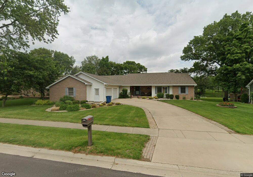
700 Michael Dr Morris, IL 60450
Estimated Value: $389,000 - $512,000
Studio
--
Bath
2,835
Sq Ft
$161/Sq Ft
Est. Value
About This Home
This home is located at 700 Michael Dr, Morris, IL 60450 and is currently estimated at $456,013, approximately $160 per square foot. 700 Michael Dr is a home with nearby schools including Saratoga Elementary School, Morris Community High School, and Immaculate Conception School.
Create a Home Valuation Report for This Property
The Home Valuation Report is an in-depth analysis detailing your home's value as well as a comparison with similar homes in the area
Tax History
| Year | Tax Paid | Tax Assessment Tax Assessment Total Assessment is a certain percentage of the fair market value that is determined by local assessors to be the total taxable value of land and additions on the property. | Land | Improvement |
|---|---|---|---|---|
| 2024 | $10,275 | $141,584 | $25,682 | $115,902 |
| 2023 | $9,659 | $133,093 | $24,142 | $108,951 |
| 2022 | $8,650 | $125,193 | $22,709 | $102,484 |
| 2021 | $8,192 | $117,200 | $21,259 | $95,941 |
| 2020 | $7,861 | $110,566 | $20,056 | $90,510 |
| 2019 | $7,810 | $110,566 | $20,056 | $90,510 |
| 2018 | $5,560 | $80,185 | $20,113 | $60,072 |
| 2017 | $5,414 | $78,490 | $19,688 | $58,802 |
| 2016 | $5,230 | $76,063 | $21,509 | $54,554 |
| 2015 | $5,009 | $74,984 | $21,204 | $53,780 |
| 2014 | $4,844 | $71,250 | $20,148 | $51,102 |
| 2013 | $4,983 | $73,980 | $20,920 | $53,060 |
Source: Public Records
Map
Nearby Homes
- 1810 Jana Ln
- 523 Bedford Rd
- 936 Thomas Dr
- 957 Thomas Dr
- 85 Carriage Dr
- 00 U S 6
- 1301 Union St
- Lot 1 W Commercial St
- 1246 Wauponsee St
- 109 Doe Cir
- 1466 Mollie Dr
- Lot 3 Heron Lake Ct
- 2380 Chestnut Ln
- 1595 W Us Rte 6
- 1.88 Acres Rd
- 1112 & 1112 1/2 Butler St
- 1368 Heritage Dr
- 1220 Liberty St
- 0000 Lakewood Dr
- 1180 Lakewood Dr
Your Personal Tour Guide
Ask me questions while you tour the home.