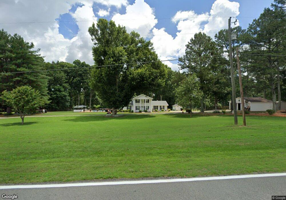
700 Ode Peppers Rd Winder, GA 30680
Estimated Value: $342,776 - $377,000
3
Beds
3
Baths
1,823
Sq Ft
$196/Sq Ft
Est. Value
About This Home
This home is located at 700 Ode Peppers Rd, Winder, GA 30680 and is currently estimated at $356,694, approximately $195 per square foot. 700 Ode Peppers Rd is a home located in Barrow County with nearby schools including Bethlehem Elementary School, Haymon-Morris Middle School, and Apalachee High School.
Ownership History
Date
Name
Owned For
Owner Type
Purchase Details
Closed on
Feb 24, 2011
Sold by
Peppers Robbie Wayne
Bought by
Peppers Robbie Wayne
Current Estimated Value
Purchase Details
Closed on
Jun 22, 2001
Sold by
Chevy Chase Bank Fsb
Bought by
Federal Home Loan
Purchase Details
Closed on
Mar 6, 2001
Sold by
Elizabe Donald Merry
Bought by
Chevy Chase Bank Fsb
Purchase Details
Closed on
Apr 7, 1994
Bought by
Elizabe Donald Merry
Purchase Details
Closed on
Jan 6, 1992
Bought by
Donald Terry Lee
Create a Home Valuation Report for This Property
The Home Valuation Report is an in-depth analysis detailing your home's value as well as a comparison with similar homes in the area
Home Values in the Area
Average Home Value in this Area
Purchase History
| Date | Buyer | Sale Price | Title Company |
|---|---|---|---|
| Peppers Robbie Wayne | -- | -- | |
| Federal Home Loan | -- | -- | |
| Chevy Chase Bank Fsb | $109,300 | -- | |
| Elizabe Donald Merry | -- | -- | |
| Donald Terry Lee | $100,000 | -- |
Source: Public Records
Tax History Compared to Growth
Tax History
| Year | Tax Paid | Tax Assessment Tax Assessment Total Assessment is a certain percentage of the fair market value that is determined by local assessors to be the total taxable value of land and additions on the property. | Land | Improvement |
|---|---|---|---|---|
| 2024 | $2,288 | $92,578 | $18,000 | $74,578 |
| 2023 | $1,546 | $92,578 | $18,000 | $74,578 |
| 2022 | $1,568 | $62,334 | $14,364 | $47,970 |
| 2021 | $1,634 | $62,334 | $14,364 | $47,970 |
| 2020 | $1,628 | $62,334 | $14,364 | $47,970 |
| 2019 | $1,572 | $58,948 | $14,364 | $44,584 |
| 2018 | $1,542 | $58,948 | $14,364 | $44,584 |
| 2017 | $1,546 | $53,092 | $14,364 | $38,728 |
| 2016 | $1,346 | $53,092 | $14,364 | $38,728 |
| 2015 | $1,352 | $53,092 | $14,364 | $38,728 |
| 2014 | $1,189 | $45,766 | $7,038 | $38,728 |
| 2013 | -- | $43,428 | $7,038 | $36,389 |
Source: Public Records
Map
Nearby Homes
- 378 Dunagan Ct
- 259 Dunagan Ct
- 129 Carnaby St
- 797 Ode Peppers Rd
- 1101 Kailie Dr
- 0 Argonne Rd Unit 7647986
- 0 Argonne Rd Unit 10602413
- 898 Harrison Mill Rd
- 633 Skyland Dr
- 182 Nativity Cove Unit 30
- 182 Nativity Cove
- 1224 Palmer Dr
- 328 Advent Dr
- 1301 Palmer Ln
- 966 David Ave
- 463 Gin Mill Dr
- 106 Charlie Way
- 71 Charlie Way Unit 18
- 1207 Jeannine Ln
- 692 Ode Peppers Rd
- 693 Ode Peppers Rd
- 1280 Highway 82
- 689 Ode Peppers Rd
- 686 Ode Peppers Rd
- 311 Dragonfly Way
- 316 Dunagan Ct Unit 21
- 378 Dunagan Ct Unit 20
- 254 Dunagan Ct Unit 22
- 297 Dunagan Ct Unit 8
- 371 Dunagan Ct Unit 10
- 316 Dunagan Ct
- 445 Dunagan Ct
- 254 Dunagan Ct
- 371 Dunagan Ct
- 297 Dunagan Ct
- 282 Knightsbridge Ln
- 223 Dunagan Ct
- 570 Knightsbridge Ln
- 590 Knightsbridge Ln