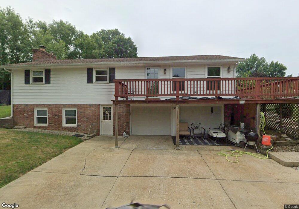
700 Sycamore Dr Louisville, OH 44641
Estimated Value: $199,706 - $230,000
3
Beds
2
Baths
1,350
Sq Ft
$158/Sq Ft
Est. Value
About This Home
This home is located at 700 Sycamore Dr, Louisville, OH 44641 and is currently estimated at $213,177, approximately $157 per square foot. 700 Sycamore Dr is a home located in Stark County with nearby schools including Louisville High School and St. Thomas Aquinas High School & Middle School.
Ownership History
Date
Name
Owned For
Owner Type
Purchase Details
Closed on
Aug 10, 1998
Sold by
Corcodel John
Bought by
Ashbaugh Michael L and Ashbaugh Dawn M
Current Estimated Value
Home Financials for this Owner
Home Financials are based on the most recent Mortgage that was taken out on this home.
Original Mortgage
$90,000
Outstanding Balance
$18,988
Interest Rate
7.05%
Mortgage Type
New Conventional
Estimated Equity
$194,189
Create a Home Valuation Report for This Property
The Home Valuation Report is an in-depth analysis detailing your home's value as well as a comparison with similar homes in the area
Home Values in the Area
Average Home Value in this Area
Purchase History
| Date | Buyer | Sale Price | Title Company |
|---|---|---|---|
| Ashbaugh Michael L | $116,000 | -- |
Source: Public Records
Mortgage History
| Date | Status | Borrower | Loan Amount |
|---|---|---|---|
| Open | Ashbaugh Michael L | $90,000 |
Source: Public Records
Tax History Compared to Growth
Tax History
| Year | Tax Paid | Tax Assessment Tax Assessment Total Assessment is a certain percentage of the fair market value that is determined by local assessors to be the total taxable value of land and additions on the property. | Land | Improvement |
|---|---|---|---|---|
| 2025 | -- | $49,840 | $16,870 | $32,970 |
| 2024 | -- | $49,840 | $16,870 | $32,970 |
| 2023 | $1,752 | $40,740 | $11,620 | $29,120 |
| 2022 | $1,757 | $40,740 | $11,620 | $29,120 |
| 2021 | $1,762 | $40,740 | $11,620 | $29,120 |
| 2020 | $1,456 | $36,550 | $10,470 | $26,080 |
| 2019 | $1,462 | $41,660 | $10,470 | $31,190 |
| 2018 | $1,659 | $41,660 | $10,470 | $31,190 |
| 2017 | $1,502 | $36,370 | $8,820 | $27,550 |
| 2016 | $1,533 | $36,370 | $8,820 | $27,550 |
| 2015 | $1,537 | $36,370 | $8,820 | $27,550 |
| 2014 | $1,615 | $35,530 | $8,610 | $26,920 |
| 2013 | $811 | $35,530 | $8,610 | $26,920 |
Source: Public Records
Map
Nearby Homes
- 2015 E Main St
- 0 Michigan Blvd
- 1812 E Broad St
- 1170 Winding Ridge Ave
- 308 Superior St
- 910 Crosswyck Cir
- 641 S Nickelplate St
- 520 S Silver St
- 325 Lincoln Ave
- 728 E Broad St
- 2110 Edmar St
- 316 E Reno Dr
- 210 E Gorgas St
- 428 Honeycrisp Dr NE
- 3047 Mcintosh Dr NE
- 432 Honeycrisp Dr NE
- 2962 Mcintosh Dr NE
- 2963 Mcintosh Dr NE
- 430 Honeycrisp Dr NE
- 2957 Mcintosh Dr NE
- 1801 Airpark Dr
- 502 Sycamore Dr
- 701 Sycamore Dr
- 511 Sycamore Dr
- 1749 Airpark Dr
- 1830 Airpark Dr
- 404 Sycamore Dr
- 503 Sycamore Dr
- 1739 Airpark Dr
- 405 Sycamore Dr
- 312 Sycamore Dr
- 1760 Washington Blvd
- 1750 Washington Blvd
- 313 Sycamore Dr
- 1723 Airpark Dr
- 304 Sycamore Dr
- 1740 Washington Blvd
- 305 Sycamore Dr
- 1905 E Main St
- 1730 Washington Blvd