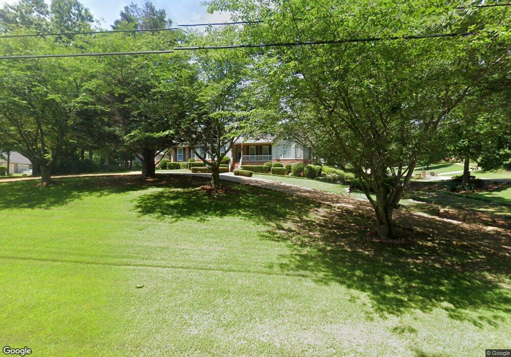
700 The Trace W Jasper, AL 35504
Estimated Value: $322,000 - $465,000
3
Beds
3
Baths
2,549
Sq Ft
$158/Sq Ft
Est. Value
About This Home
This home is located at 700 The Trace W, Jasper, AL 35504 and is currently estimated at $403,819, approximately $158 per square foot. 700 The Trace W is a home located in Walker County with nearby schools including T. R. Simmons Elementary School, Memorial Park Elementary School, and Maddox Intermediate School.
Ownership History
Date
Name
Owned For
Owner Type
Purchase Details
Closed on
Jul 24, 2006
Sold by
Jasper District United Methodist Church
Bought by
Forbus Bobby J and Forbus Patsy
Current Estimated Value
Home Financials for this Owner
Home Financials are based on the most recent Mortgage that was taken out on this home.
Original Mortgage
$232,000
Outstanding Balance
$137,961
Interest Rate
6.68%
Estimated Equity
$265,858
Create a Home Valuation Report for This Property
The Home Valuation Report is an in-depth analysis detailing your home's value as well as a comparison with similar homes in the area
Home Values in the Area
Average Home Value in this Area
Purchase History
| Date | Buyer | Sale Price | Title Company |
|---|---|---|---|
| Forbus Bobby J | -- | -- |
Source: Public Records
Mortgage History
| Date | Status | Borrower | Loan Amount |
|---|---|---|---|
| Open | Forbus Bobby J | $232,000 |
Source: Public Records
Tax History Compared to Growth
Tax History
| Year | Tax Paid | Tax Assessment Tax Assessment Total Assessment is a certain percentage of the fair market value that is determined by local assessors to be the total taxable value of land and additions on the property. | Land | Improvement |
|---|---|---|---|---|
| 2024 | $1,412 | $42,680 | $2,500 | $40,180 |
| 2023 | $1,412 | $38,060 | $2,500 | $35,560 |
| 2022 | $968 | $29,440 | $2,500 | $26,940 |
| 2021 | $946 | $27,186 | $2,500 | $24,686 |
| 2020 | $893 | $27,200 | $2,500 | $24,700 |
| 2019 | $856 | $26,080 | $2,500 | $23,580 |
| 2018 | $960 | $29,180 | $2,500 | $26,680 |
| 2017 | $960 | $29,180 | $2,500 | $26,680 |
| 2016 | $960 | $29,180 | $2,500 | $26,680 |
| 2015 | $919 | $27,960 | $2,500 | $25,460 |
| 2014 | $903 | $27,500 | $2,500 | $25,000 |
| 2013 | $903 | $27,500 | $2,500 | $25,000 |
Source: Public Records
Map
Nearby Homes
- 0 Woodland Cir
- 0 Hwy 195n Unit 24-1497
- 1490 Alabama 195
- 0 Lot #25 the Brooks Subdivision
- 197 Highway 5
- 41 Brooks Chase
- 0 Lot #39 the Brooks Subdivision
- 0 Lot #28 the Brooks Subdivision
- 0 Lot #20 the Brooks Subdivision
- 0 Lot #130 the Brooks Subdivisio
- 0 Lot #5 the Brooks Subdivision
- 0 Lot #24 the Brooks Subdivision
- 0 Lot #12 the Brooks Subdivision
- 0 Lot #7 the Brooks Subdivision
- 6 Brooks Chase
- 0 Lot #131 the Brooks Subdivisio Unit 13-633
- 0 Lot #26 the Brooks Subdivision
- 0 Lot #42 Unit 13-541
- 0 Lot #21the Brooks Subdivision Unit 13-572
- 0 Lot #31 the Brooks Subdivision
- 702 The Trace W
- 701 Woodland Trace Way
- 703 Woodland Trace Way
- 903 Virginia Dr
- 618 Loblolly Ln
- 700 Woodland Trace Way
- 704 The Trace W
- 704 The Trace W
- 702 Woodland Trace Way
- 608 Woodland Trace Way
- 606 Loblolly Ln
- 602 The Trace W
- 619 Loblolly Ln
- 610 Loblolly Ln
- 706 The Trace W
- 502 The Trace W
- 704 Woodland Trace Way
- 902 Virginia Dr
- 902 Virginia Dr
- 902 Virginia Dr