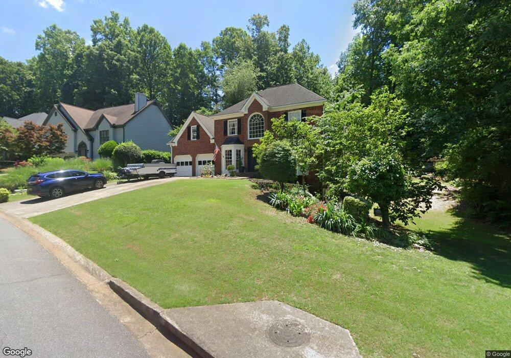
700 Walt Ln NE Unit 2C Woodstock, GA 30188
Sandy Plains NeighborhoodEstimated Value: $432,000 - $445,000
4
Beds
3
Baths
2,422
Sq Ft
$181/Sq Ft
Est. Value
About This Home
This home is located at 700 Walt Ln NE Unit 2C, Woodstock, GA 30188 and is currently estimated at $438,803, approximately $181 per square foot. 700 Walt Ln NE Unit 2C is a home located in Cobb County with nearby schools including Nicholson Elementary School, McCleskey Middle School, and Kell High School.
Ownership History
Date
Name
Owned For
Owner Type
Purchase Details
Closed on
Aug 31, 2005
Sold by
Mazza Mary K
Bought by
Keosoukanh Souksy and Keosoukanh Khittapone
Current Estimated Value
Home Financials for this Owner
Home Financials are based on the most recent Mortgage that was taken out on this home.
Original Mortgage
$184,500
Outstanding Balance
$97,838
Interest Rate
5.71%
Mortgage Type
VA
Estimated Equity
$340,965
Purchase Details
Closed on
Aug 26, 1998
Sold by
Mitchell Jeffrey T and Mitchell Judy
Bought by
Fortner Mary K and Fortner James
Home Financials for this Owner
Home Financials are based on the most recent Mortgage that was taken out on this home.
Original Mortgage
$153,900
Interest Rate
6.92%
Mortgage Type
New Conventional
Create a Home Valuation Report for This Property
The Home Valuation Report is an in-depth analysis detailing your home's value as well as a comparison with similar homes in the area
Home Values in the Area
Average Home Value in this Area
Purchase History
| Date | Buyer | Sale Price | Title Company |
|---|---|---|---|
| Keosoukanh Souksy | $186,000 | -- | |
| Fortner Mary K | $163,900 | -- |
Source: Public Records
Mortgage History
| Date | Status | Borrower | Loan Amount |
|---|---|---|---|
| Open | Keosoukanh Souksy | $184,500 | |
| Previous Owner | Fortner Mary K | $153,900 |
Source: Public Records
Tax History Compared to Growth
Tax History
| Year | Tax Paid | Tax Assessment Tax Assessment Total Assessment is a certain percentage of the fair market value that is determined by local assessors to be the total taxable value of land and additions on the property. | Land | Improvement |
|---|---|---|---|---|
| 2024 | $4,259 | $178,496 | $32,000 | $146,496 |
| 2023 | $2,940 | $142,704 | $28,000 | $114,704 |
| 2022 | $3,509 | $142,704 | $28,000 | $114,704 |
| 2021 | $2,969 | $118,028 | $22,000 | $96,028 |
| 2020 | $2,634 | $102,728 | $18,000 | $84,728 |
| 2019 | $2,524 | $97,724 | $18,000 | $79,724 |
| 2018 | $2,350 | $89,780 | $14,000 | $75,780 |
| 2017 | $2,244 | $89,780 | $14,000 | $75,780 |
| 2016 | $1,897 | $74,876 | $14,000 | $60,876 |
| 2015 | $1,946 | $74,876 | $14,000 | $60,876 |
| 2014 | $1,673 | $65,156 | $0 | $0 |
Source: Public Records
Map
Nearby Homes
- 5142 Farm Place Dr NE
- 639 Tigers Eye Terrace
- The Gavin E Plan at The Village at Shallowford - Signature Series
- The Marion A Plan at The Village at Shallowford - Classic Series
- The Cary A Plan at The Village at Shallowford - Classic Series
- 4669 Blue Topaz Trail
- 4793 Moonstone Trace
- 4785 Moonstone Trace
- 4778 Moonstone Trace
- 4704 Lincoln Dr NE
- 707 Smokey Quartz Way
- 710 Smokey Quartz Way
- 694 Smokey Quartz Way
- 4785 Moonstone NE
- 703 Smokey Quartz Way
- 706 Smokey Quartz Way
- 702 Smokey Quartz Way
- 704 Walt Ln NE
- 0 Walt Ln NE Unit 7522471
- 0 Walt Ln NE Unit 7016972
- 0 Walt Ln NE Unit 8614057
- 0 Walt Ln NE Unit 8397748
- 0 Walt Ln NE Unit 7522406
- 0 Walt Ln NE Unit 3217580
- 708 Walt Ln NE
- 705 Walt Ln NE Unit 2
- 4910 Farm Valley Dr NE
- 701 Walt Ln NE
- 750 Jamie Way NE Unit IIA
- 751 Farm Hill Ct NE
- 712 Walt Ln NE
- 753 Farm Hill Ct NE
- 709 Walt Ln NE
- 748 Jamie Way NE
- 4915 Farm Valley Dr NE
- 4915 Farm Valley Dr NE Unit 2A
- 755 Farm Hill Ct NE