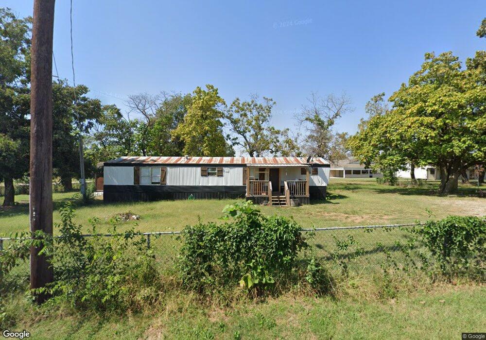
700 Wilson Rock Rd Muldrow, OK 74948
Estimated Value: $49,000
3
Beds
2
Baths
2,415
Sq Ft
$20/Sq Ft
Est. Value
About This Home
This home is located at 700 Wilson Rock Rd, Muldrow, OK 74948 and is currently estimated at $49,000, approximately $20 per square foot. 700 Wilson Rock Rd is a home located in Sequoyah County with nearby schools including Muldrow Elementary School, Muldrow Middle School, and Muldrow High School.
Ownership History
Date
Name
Owned For
Owner Type
Purchase Details
Closed on
May 26, 2023
Sold by
Laster Family Trust
Bought by
Laster Seth
Current Estimated Value
Purchase Details
Closed on
Jul 5, 2022
Sold by
Laster Family Trust
Bought by
Shell Patrick Buck
Purchase Details
Closed on
Jun 14, 2022
Sold by
Laster Family Trust
Bought by
Shell Shelly and Shell Natalie
Purchase Details
Closed on
Mar 26, 2019
Sold by
Laster Family Trust
Bought by
Laster Shane F and Laster Jamie
Create a Home Valuation Report for This Property
The Home Valuation Report is an in-depth analysis detailing your home's value as well as a comparison with similar homes in the area
Home Values in the Area
Average Home Value in this Area
Purchase History
| Date | Buyer | Sale Price | Title Company |
|---|---|---|---|
| Laster Seth | -- | None Listed On Document | |
| Shell Patrick Buck | -- | -- | |
| Shell Shelly | -- | -- | |
| Shell Shelly | -- | None Listed On Document | |
| Laster Shane F | -- | Valley Land Title | |
| Laster Fred M | -- | None Available |
Source: Public Records
Tax History Compared to Growth
Tax History
| Year | Tax Paid | Tax Assessment Tax Assessment Total Assessment is a certain percentage of the fair market value that is determined by local assessors to be the total taxable value of land and additions on the property. | Land | Improvement |
|---|---|---|---|---|
| 2024 | $4 | $112 | $112 | $0 |
| 2023 | $8 | $107 | $107 | $0 |
| 2022 | $12 | $246 | $246 | $0 |
| 2021 | $0 | $11,363 | $1,342 | $10,021 |
| 2020 | $778 | $11,279 | $1,342 | $9,937 |
| 2019 | $778 | $10,951 | $1,342 | $9,609 |
| 2018 | $0 | $11,347 | $1,342 | $10,005 |
| 2017 | $720 | $11,127 | $1,342 | $9,785 |
| 2016 | $742 | $11,436 | $1,876 | $9,560 |
| 2015 | $718 | $11,103 | $1,795 | $9,308 |
| 2014 | $699 | $10,832 | $1,239 | $9,593 |
Source: Public Records
Map
Nearby Homes
- 505 Juniper Ln
- 503 S Dogwood St
- 302 E Shawntel Smith Blvd
- 473925 E 1117 Rd
- 1114 S Dogwood St
- 107 7th St
- 701 S Ada St
- 806 S Ada St
- 201 9th St
- 103756 Oklahoma 64b
- 304 Oakdale Rd
- 101 NE 2nd St
- 103 NE 1st St
- 110662 S 4750 Rd
- TBD Treat Rd
- 1 Oklahoma 64b
- 404 W Sequoyah St
- 1312 S Caddo
- 903 S Fargo St
- 300 S Fargo St
- 801 E Shawntel Smith Blvd
- 805 Maple St
- 805 Maple St
- 810 Wilson Rock Rd
- 808 Wilson Rock Rd
- 300 E Sequoyah St
- 808 N Maple St
- 808 Maple St
- 520 Juniper Ln
- 102 Juniper Ln
- 517 Juniper Ln
- 810 Maple St
- 1001 SE 10th St
- 106 Meadowbrook
- 516 Juniper Ln
- 1005 SE 10th St
- 513 Juniper Ln
- 1007 SE 10th St
- 511 Juniper Ln
- 512 Juniper Ln