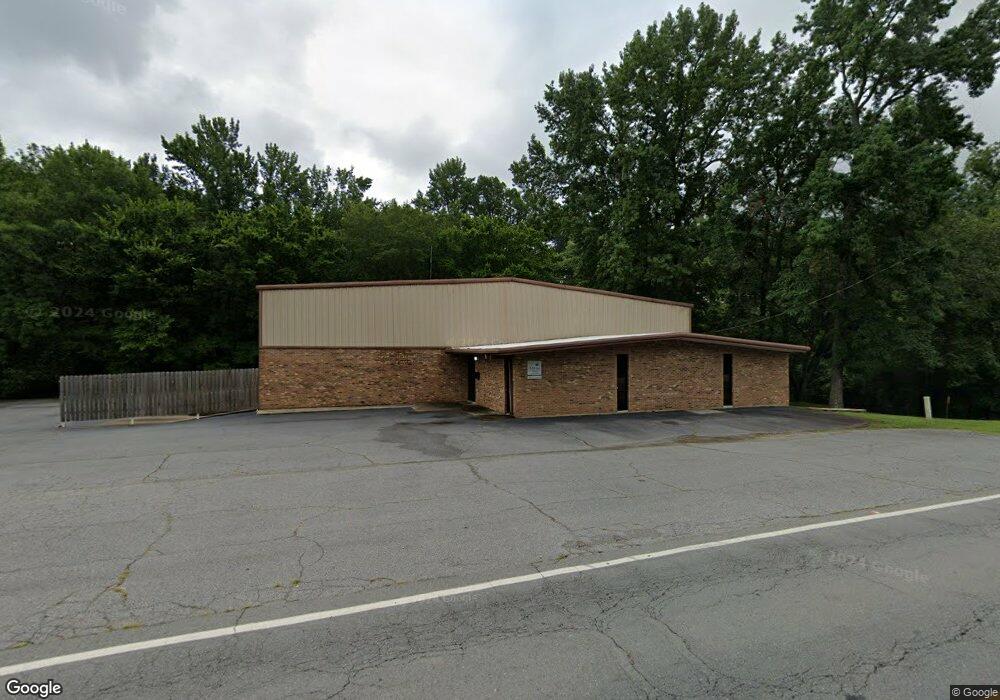
7000 Remount Rd North Little Rock, AR 72118
Estimated Value: $357,301
--
Bed
--
Bath
7,356
Sq Ft
$49/Sq Ft
Est. Value
About This Home
This home is located at 7000 Remount Rd, North Little Rock, AR 72118 and is currently estimated at $357,301, approximately $48 per square foot. 7000 Remount Rd is a home located in Pulaski County with nearby schools including Sylvan Hills Elementary School, Sylvan Hills Middle School, and Sylvan Hills High School.
Ownership History
Date
Name
Owned For
Owner Type
Purchase Details
Closed on
Nov 19, 2012
Sold by
B E E Investments Llc
Bought by
City Of North Little Rock
Current Estimated Value
Purchase Details
Closed on
Aug 7, 2009
Sold by
Garrett Richard
Bought by
B E E Investments Llc
Home Financials for this Owner
Home Financials are based on the most recent Mortgage that was taken out on this home.
Original Mortgage
$161,500
Interest Rate
5.19%
Mortgage Type
Future Advance Clause Open End Mortgage
Create a Home Valuation Report for This Property
The Home Valuation Report is an in-depth analysis detailing your home's value as well as a comparison with similar homes in the area
Home Values in the Area
Average Home Value in this Area
Purchase History
| Date | Buyer | Sale Price | Title Company |
|---|---|---|---|
| City Of North Little Rock | $2,125 | None Available | |
| B E E Investments Llc | $222,000 | Lenders Title Company |
Source: Public Records
Mortgage History
| Date | Status | Borrower | Loan Amount |
|---|---|---|---|
| Previous Owner | B E E Investments Llc | $161,500 |
Source: Public Records
Tax History Compared to Growth
Tax History
| Year | Tax Paid | Tax Assessment Tax Assessment Total Assessment is a certain percentage of the fair market value that is determined by local assessors to be the total taxable value of land and additions on the property. | Land | Improvement |
|---|---|---|---|---|
| 2025 | $2,808 | $47,430 | $11,109 | $36,321 |
| 2024 | $2,808 | $47,430 | $11,109 | $36,321 |
| 2023 | $2,808 | $47,430 | $11,109 | $36,321 |
| 2022 | $2,808 | $47,430 | $11,109 | $36,321 |
| 2021 | $2,808 | $47,430 | $10,930 | $36,500 |
| 2020 | $2,808 | $47,430 | $10,930 | $36,500 |
| 2019 | $2,808 | $47,430 | $10,930 | $36,500 |
| 2018 | $2,808 | $47,430 | $10,930 | $36,500 |
| 2017 | $2,808 | $47,430 | $10,930 | $36,500 |
| 2016 | $2,788 | $47,090 | $13,160 | $33,930 |
| 2015 | $2,788 | $47,090 | $13,160 | $33,930 |
| 2014 | $2,788 | $47,090 | $13,160 | $33,930 |
Source: Public Records
Map
Nearby Homes
- 501 Silverwood Trail
- 807 Cobblestone Cir
- 47 Perin Rd
- 0 Timberline Dr
- 126 Cobblestone Cir
- 10 Silverwood Ct
- 60 Oakview Dr
- 9 Blackstone Cir
- 13 Stanwood Loop
- 1010 Claycut Cir
- 6312 Rolling Hills Dr
- 34 Jaynelle Place
- 1100 Talihana Dr
- 6317 Rolling Hills Dr
- 5732 Camp Robinson Rd
- 1204 N Point Ln
- 813 Silver Hill Rd
- 104 Lindenhurst Dr
- 1209 Silverwood Trail
- 1115 Claycut Cir
- 7004 Remount Rd
- 104 Remount Rd
- 517 Silverwood Trail
- 521 Silverwood Trail
- 525 Silverwood Trail
- 513 Silverwood Trail
- 204 Remount Rd
- 7104 Scotthaven Dr
- 102 Remount Rd
- 512 Silverwood Trail
- 520 Silverwood Trail
- 533 Silverwood Trail
- 7112 Scotthaven Dr
- 524 Silverwood Trail
- 509 Silverwood Trail
- 508 Silverwood Trail
- 528 Silverwood Trail
- 509 Waterford Dr
- 7115 Scotthaven Dr
- 0 Scotthaven Dr Unit 17004268