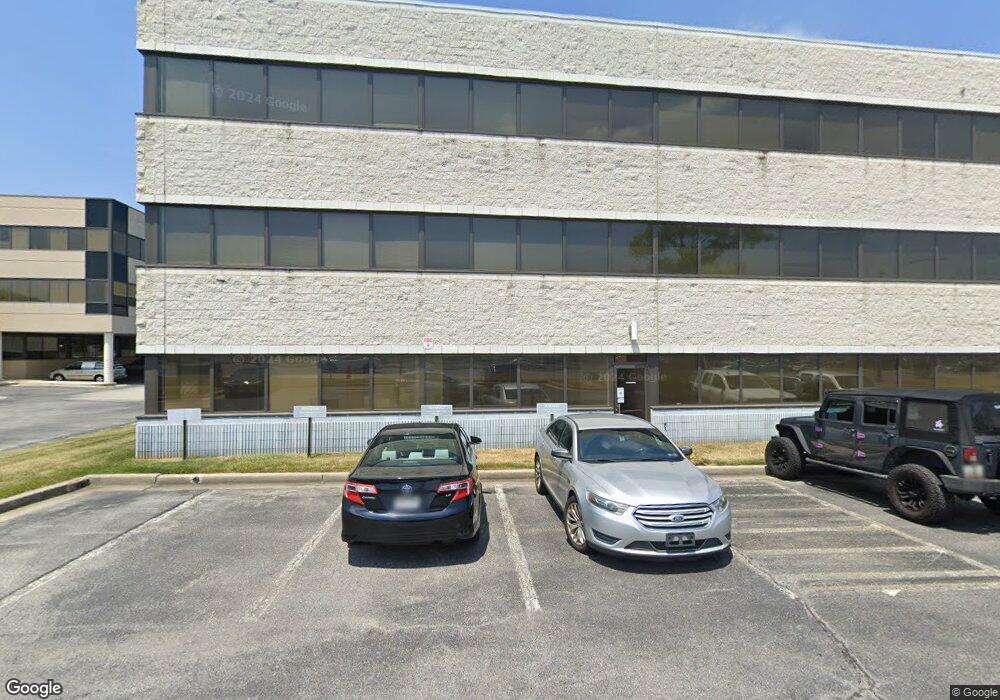
7000 Security Blvd Baltimore, MD 21244
Estimated Value: $9,144,090
Studio
--
Bath
--
Sq Ft
249,599
Sq Ft Lot
About This Home
This home is located at 7000 Security Blvd, Baltimore, MD 21244 and is currently estimated at $9,144,090. 7000 Security Blvd is a home located in Baltimore County with nearby schools including Featherbed Lane Elementary, Windsor Mill Middle School, and Woodlawn High School.
Ownership History
Date
Name
Owned For
Owner Type
Purchase Details
Closed on
May 6, 2013
Sold by
Cmlt 2008-Ls1 Security Boulevard Llc
Bought by
Security Office Park Llc
Current Estimated Value
Purchase Details
Closed on
Dec 28, 2000
Sold by
Security Office Park Associates
Bought by
Brit & Security Llc
Purchase Details
Closed on
Oct 3, 1991
Sold by
S O P M Limited Partnership
Bought by
Security Office Park Associates
Create a Home Valuation Report for This Property
The Home Valuation Report is an in-depth analysis detailing your home's value as well as a comparison with similar homes in the area
Home Values in the Area
Average Home Value in this Area
Purchase History
| Date | Buyer | Sale Price | Title Company |
|---|---|---|---|
| Security Office Park Llc | $5,617,500 | First American Title Ins Co | |
| Cmlt 2008-Ls1 Security Boulevard Llc | $4,250,000 | None Available | |
| Brit & Security Llc | -- | -- | |
| Security Office Park Associates | $4,700,000 | -- |
Source: Public Records
Tax History
| Year | Tax Paid | Tax Assessment Tax Assessment Total Assessment is a certain percentage of the fair market value that is determined by local assessors to be the total taxable value of land and additions on the property. | Land | Improvement |
|---|---|---|---|---|
| 2025 | $81,854 | $6,200,300 | -- | -- |
| 2024 | $81,854 | $5,495,000 | $0 | $0 |
| 2023 | $36,745 | $4,789,700 | $2,005,500 | $2,784,200 |
| 2022 | $76,351 | $4,789,700 | $2,005,500 | $2,784,200 |
| 2021 | $75,711 | $4,789,700 | $2,005,500 | $2,784,200 |
| 2020 | $75,711 | $4,789,700 | $2,005,500 | $2,784,200 |
| 2019 | $79,465 | $4,789,700 | $2,005,500 | $2,784,200 |
| 2018 | $89,226 | $4,789,700 | $2,005,500 | $2,784,200 |
| 2017 | $117,714 | $9,050,000 | $0 | $0 |
| 2016 | $111,025 | $8,736,000 | $0 | $0 |
| 2015 | $111,025 | $8,422,000 | $0 | $0 |
| 2014 | $111,025 | $8,108,000 | $0 | $0 |
Source: Public Records
Map
Nearby Homes
- 22 Kettle Ct
- 2004 Wildlife Dr
- 2000 Wildlife Dr
- 10 Sharrow Ct
- 8 Middleview Ct
- 1912 Greengage Rd
- 7213 Johnnycake Rd
- 2305 Kevsway Ct
- 49 Rocky Brook Ct
- 6945 Rockfield Rd
- 7 Rocky Brook Ct
- 7205 Bogley Rd Unit 202
- 7205 Bogley Rd Unit 303
- 7206 Bogley Rd Unit 102
- 6601 Dogwood Rd
- 6604 Dogwood Rd
- 6 Bright Cir
- 2612 Camberwell Ct
- 6735 Kincheloe Ave
- 6503 Gilmore St
- 7008 Security Blvd
- 2034 Lord Baltimore Dr Unit R
- 6970 Security Blvd
- 1809 N Rolling Rd
- 1811 N Rolling Rd
- 2001 N Rolling Rd
- 2015 Lord Baltimore Dr
- 7100 Security Blvd
- 2066 Lord Baltimore Dr
- 7091 Security Blvd
- 7101 Security Blvd
- 2008 N Rolling Rd
- 1800 N Rolling Rd
- 2010 N Rolling Rd
- 2012 N Rolling Rd
- 6965 Security Blvd
- 7173 Security Blvd
- 2014 N Rolling Rd
- 2021 Lord Baltimore Dr
- 2003 Kennicott Rd
Your Personal Tour Guide
Ask me questions while you tour the home.