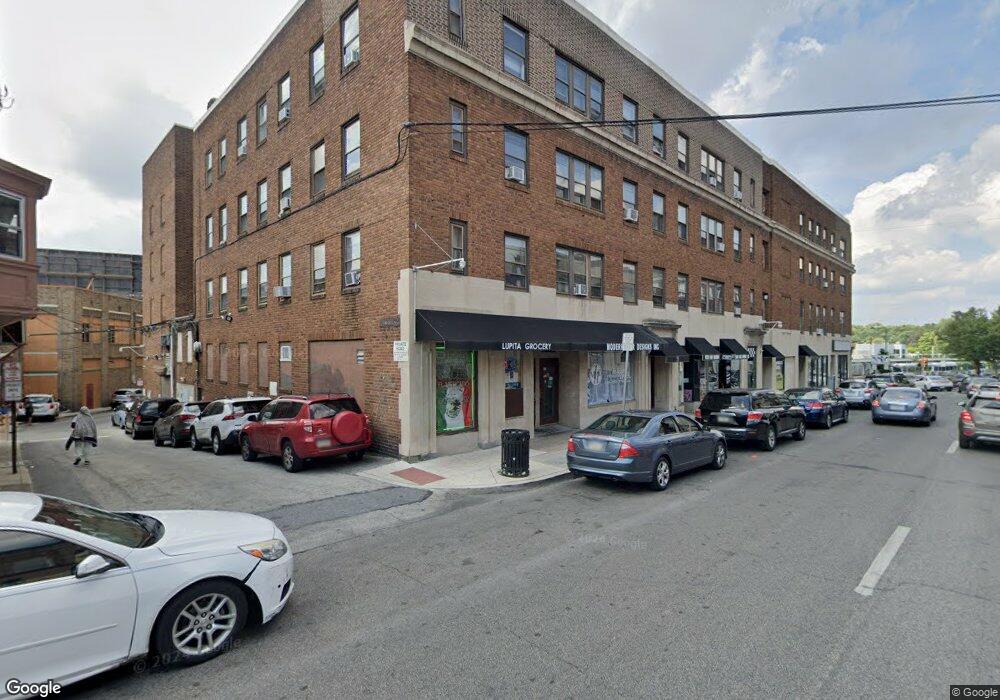
7000 Terminal Square Upper Darby, PA 19082
Estimated Value: $7,328,019
--
Bed
--
Bath
69,383
Sq Ft
$106/Sq Ft
Est. Value
About This Home
This home is located at 7000 Terminal Square, Upper Darby, PA 19082 and is currently estimated at $7,328,019, approximately $105 per square foot. 7000 Terminal Square is a home located in Delaware County with nearby schools including Bywood Elementary School, Upper Darby Kdg Center, and Upper Darby High School.
Ownership History
Date
Name
Owned For
Owner Type
Purchase Details
Closed on
Aug 23, 2002
Sold by
Stsb Inc
Bought by
850 W C P Llc
Current Estimated Value
Purchase Details
Closed on
Jun 29, 1998
Sold by
Hankey Robert E
Bought by
Stsb Inc
Home Financials for this Owner
Home Financials are based on the most recent Mortgage that was taken out on this home.
Original Mortgage
$1,150,000
Interest Rate
7.04%
Mortgage Type
Commercial
Create a Home Valuation Report for This Property
The Home Valuation Report is an in-depth analysis detailing your home's value as well as a comparison with similar homes in the area
Home Values in the Area
Average Home Value in this Area
Purchase History
| Date | Buyer | Sale Price | Title Company |
|---|---|---|---|
| 850 W C P Llc | $2,880,000 | -- | |
| Stsb Inc | $937,500 | Commonwealth Land Title Ins |
Source: Public Records
Mortgage History
| Date | Status | Borrower | Loan Amount |
|---|---|---|---|
| Previous Owner | Stsb Inc | $1,150,000 |
Source: Public Records
Tax History Compared to Growth
Tax History
| Year | Tax Paid | Tax Assessment Tax Assessment Total Assessment is a certain percentage of the fair market value that is determined by local assessors to be the total taxable value of land and additions on the property. | Land | Improvement |
|---|---|---|---|---|
| 2025 | $184,854 | $1,968,000 | $264,520 | $1,703,480 |
| 2024 | $184,854 | $4,370,950 | $264,520 | $4,106,430 |
| 2023 | $183,111 | $4,370,950 | $264,520 | $4,106,430 |
| 2022 | $178,188 | $4,370,950 | $264,520 | $4,106,430 |
| 2021 | $240,263 | $4,370,950 | $264,520 | $4,106,430 |
| 2020 | $82,960 | $1,282,500 | $300,590 | $981,910 |
| 2019 | $81,504 | $1,282,500 | $300,590 | $981,910 |
| 2018 | $80,565 | $1,282,500 | $0 | $0 |
| 2017 | $78,471 | $1,282,500 | $0 | $0 |
| 2016 | $7,038 | $1,282,500 | $0 | $0 |
| 2015 | $7,182 | $1,282,500 | $0 | $0 |
| 2014 | $7,182 | $1,282,500 | $0 | $0 |
Source: Public Records
Map
Nearby Homes
- 27 Glendale Rd
- 53 N Keystone Ave
- 77 N Keystone Ave
- 101 Copley Rd
- 34 N Keystone Ave
- 62 Richfield Rd
- 513 Spruce Ave
- 42 Kent Rd
- 7281 Walnut St
- 512 Fairfield Ave
- 240 Glendale Rd
- 7325 Miller Ave
- 7252 Brent Rd
- 214 Kingston Rd
- 228 Long Ln
- 134 Heather Rd
- 212 Huntley Rd
- 234 Long Ln
- 24 Sunshine Rd
- 268 Hampden Rd
- 15 Garrett Rd
- 7028 Terminal Square
- 7032 Terminal Square
- 7028 Garrett Rd
- 52 Garrett Rd
- 25 Garrett Rd
- 15XX Garrett Rd
- 29 Garrett Rd
- 33-35 Garrett Rd
- 33 Garrett Rd
- 33 Garrett Rd
- 7038 Garrett Rd
- 7022 Garrett Rd
- 7026 Garrett Rd
- 7040 Garrett Rd Unit 2
- 7040 Garrett Rd Unit 1
- 7040 Garrett Rd
- 28 Garrett Rd
- 28 30 Garrett Rd
- 37 Garrett Rd