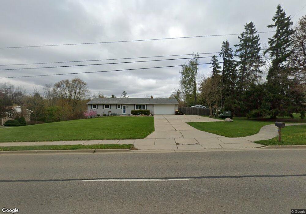
7000 W St Joseph Hwy Lansing, MI 48917
Estimated Value: $240,000 - $279,000
4
Beds
2
Baths
1,773
Sq Ft
$150/Sq Ft
Est. Value
About This Home
This home is located at 7000 W St Joseph Hwy, Lansing, MI 48917 and is currently estimated at $266,427, approximately $150 per square foot. 7000 W St Joseph Hwy is a home located in Eaton County with nearby schools including Delta Center Elementary School, Leon W. Hayes Middle School, and Grand Ledge High School.
Ownership History
Date
Name
Owned For
Owner Type
Purchase Details
Closed on
Dec 7, 2018
Sold by
Cowsert Christyn and Kogut Christyn
Bought by
Mackowiak Mitchell V
Current Estimated Value
Home Financials for this Owner
Home Financials are based on the most recent Mortgage that was taken out on this home.
Original Mortgage
$169,484
Outstanding Balance
$145,560
Interest Rate
3.62%
Mortgage Type
VA
Estimated Equity
$120,867
Purchase Details
Closed on
Aug 29, 2018
Sold by
Cowsert Shaun
Bought by
Kogut Christyn and Cowsert Christyn
Purchase Details
Closed on
Sep 9, 2016
Sold by
Yang Pahoua and Schroeder Pahoua
Bought by
Cowsert Shaun and Cowsert Christyn
Home Financials for this Owner
Home Financials are based on the most recent Mortgage that was taken out on this home.
Original Mortgage
$135,859
Interest Rate
3.48%
Mortgage Type
VA
Purchase Details
Closed on
Mar 14, 2011
Sold by
Fifth Third Mortgage Company
Bought by
Yang Pahoua
Home Financials for this Owner
Home Financials are based on the most recent Mortgage that was taken out on this home.
Original Mortgage
$84,696
Interest Rate
4.62%
Mortgage Type
FHA
Purchase Details
Closed on
Sep 30, 2010
Sold by
Crowner Donald and Crowner Donald L
Bought by
Fifth Third Mortgage Company
Purchase Details
Closed on
Mar 9, 2004
Sold by
Burnham Betty Lea and Crowner Donald L
Bought by
Crowner Donald L
Home Financials for this Owner
Home Financials are based on the most recent Mortgage that was taken out on this home.
Original Mortgage
$126,000
Interest Rate
5.74%
Mortgage Type
New Conventional
Purchase Details
Closed on
Sep 16, 2003
Sold by
Burnham Betty Lea and Crowner Donald L
Bought by
Burnham Betty Lea and Crowner Donald L
Home Financials for this Owner
Home Financials are based on the most recent Mortgage that was taken out on this home.
Original Mortgage
$123,900
Interest Rate
6.23%
Mortgage Type
Purchase Money Mortgage
Create a Home Valuation Report for This Property
The Home Valuation Report is an in-depth analysis detailing your home's value as well as a comparison with similar homes in the area
Home Values in the Area
Average Home Value in this Area
Purchase History
| Date | Buyer | Sale Price | Title Company |
|---|---|---|---|
| Mackowiak Mitchell V | $164,070 | None Available | |
| Kogut Christyn | -- | None Available | |
| Cowsert Shaun | $133,000 | Midstate Title Agency Llc | |
| Yang Pahoua | $86,900 | Prism Title & Closing Servic | |
| Fifth Third Mortgage Company | $62,300 | None Available | |
| Crowner Donald L | -- | Trans | |
| Burnham Betty Lea | -- | -- |
Source: Public Records
Mortgage History
| Date | Status | Borrower | Loan Amount |
|---|---|---|---|
| Open | Mackowiak Mitchell V | $169,484 | |
| Previous Owner | Cowsert Shaun | $135,859 | |
| Previous Owner | Yang Pahoua | $84,696 | |
| Previous Owner | Crowner Donald L | $126,000 | |
| Previous Owner | Burnham Betty Lea | $123,900 |
Source: Public Records
Tax History Compared to Growth
Tax History
| Year | Tax Paid | Tax Assessment Tax Assessment Total Assessment is a certain percentage of the fair market value that is determined by local assessors to be the total taxable value of land and additions on the property. | Land | Improvement |
|---|---|---|---|---|
| 2025 | $3,029 | $106,300 | $0 | $0 |
| 2024 | $1,582 | $102,200 | $0 | $0 |
| 2023 | $1,473 | $95,500 | $0 | $0 |
| 2022 | $2,550 | $82,800 | $0 | $0 |
| 2021 | $2,435 | $78,400 | $0 | $0 |
| 2020 | $2,403 | $73,900 | $0 | $0 |
| 2019 | $2,369 | $64,946 | $0 | $0 |
| 2018 | $2,039 | $58,200 | $0 | $0 |
| 2017 | $2,008 | $57,300 | $0 | $0 |
| 2016 | -- | $51,000 | $0 | $0 |
| 2015 | -- | $48,800 | $0 | $0 |
| 2014 | -- | $45,200 | $0 | $0 |
| 2013 | -- | $44,900 | $0 | $0 |
Source: Public Records
Map
Nearby Homes
- 7115 Ravenna Trail Unit 74
- 7119 Ravenna Trail Unit 73
- 7327 Golf Gate Dr
- 229 Williamsburg Rd
- 611 S Canal Rd
- 7520 Williamsburg Rd
- 7635 Blue Spruce Ln
- 110 N Canal Rd
- 6019 Montevideo Dr Unit D
- 6036 Madeira Dr Unit 100
- 6025 Madeira Dr Unit 111
- 2122 NE 14th Place
- 1010 Grenoble Cir
- 1005 Grenoble Dr Unit H
- 929 Grenoble Dr Unit B
- Lot 30 Doe Pass
- Lot 61 Doe Pass
- Lot 47 Doe Pass
- Lot 60 Doe Pass
- 5538 W St Joe Hwy
- 7000 W St Joe Hwy
- 6916 W St Joe Hwy
- 7020 W St Joe Hwy
- 608 Meade Dr
- 6921 W Saint Joseph Hwy
- 6921 W St Joe Hwy
- 7014 W St Joe Hwy
- 602 Meade Dr
- 6946 Ravenna Trail Unit 60
- 6905 W St Joe Hwy
- 6948 Ravenna Trail Unit 59
- 7101 W St Joe Hwy
- 7101 W St Joe Hwy
- 540 Gettysburg Dr
- 621 Meade Dr
- 6841 W St Joe Hwy
- 524 Gettysburg Dr
- 607 Meade Dr
- 516 Gettysburg Dr