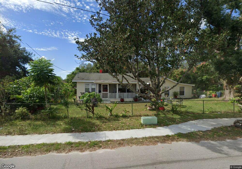
7001 121st Ave E Parrish, FL 34219
Estimated Value: $240,000 - $314,000
2
Beds
2
Baths
1,726
Sq Ft
$164/Sq Ft
Est. Value
About This Home
This home is located at 7001 121st Ave E, Parrish, FL 34219 and is currently estimated at $283,302, approximately $164 per square foot. 7001 121st Ave E is a home located in Manatee County with nearby schools including Barbara A. Harvey Elementary School, Buffalo Creek Middle School, and Parrish Community High School.
Ownership History
Date
Name
Owned For
Owner Type
Purchase Details
Closed on
Jun 20, 2012
Sold by
Federal Home Loan Mortgage Corporation
Bought by
Arellano Martha L Pascual
Current Estimated Value
Purchase Details
Closed on
Mar 21, 2012
Sold by
Bank Of America Na
Bought by
Federal Home Loan Mortgage Corporation
Purchase Details
Closed on
Jan 19, 2012
Sold by
Catlett Jesse James
Bought by
Bank Of America N A
Purchase Details
Closed on
Oct 24, 2001
Sold by
Edwards Charles R and Edwards Rhonda L
Bought by
Catlett Jesse James and Catlett Dana Mae R
Home Financials for this Owner
Home Financials are based on the most recent Mortgage that was taken out on this home.
Original Mortgage
$84,900
Interest Rate
6.74%
Create a Home Valuation Report for This Property
The Home Valuation Report is an in-depth analysis detailing your home's value as well as a comparison with similar homes in the area
Home Values in the Area
Average Home Value in this Area
Purchase History
| Date | Buyer | Sale Price | Title Company |
|---|---|---|---|
| Arellano Martha L Pascual | $45,000 | Ras Title Llc | |
| Federal Home Loan Mortgage Corporation | -- | Ras Title Llc | |
| Bank Of America N A | -- | None Available | |
| Catlett Jesse James | $87,600 | -- |
Source: Public Records
Mortgage History
| Date | Status | Borrower | Loan Amount |
|---|---|---|---|
| Previous Owner | Catlett Jesse James | $84,900 |
Source: Public Records
Tax History
| Year | Tax Paid | Tax Assessment Tax Assessment Total Assessment is a certain percentage of the fair market value that is determined by local assessors to be the total taxable value of land and additions on the property. | Land | Improvement |
|---|---|---|---|---|
| 2025 | $1,911 | $152,100 | $85,000 | $67,100 |
| 2023 | $1,911 | $138,866 | $59,925 | $78,941 |
| 2022 | $1,636 | $107,129 | $40,000 | $67,129 |
| 2021 | $1,499 | $99,445 | $35,000 | $64,445 |
| 2020 | $1,287 | $76,375 | $15,000 | $61,375 |
| 2019 | $1,168 | $66,311 | $15,000 | $51,311 |
| 2018 | $1,098 | $61,401 | $15,000 | $46,401 |
| 2017 | $983 | $56,912 | $0 | $0 |
| 2016 | $968 | $55,084 | $0 | $0 |
Source: Public Records
Map
Nearby Homes
- 7121 122nd Ave E
- 12300 Parrish Cemetary Rd
- 6927 Indus Valley Cir
- 7107 Indus Valley Cir
- 12345 Parrish Cemetary Rd
- 12346 U S 301
- 11880 Us Highway 301 N
- 12310 Oak Hill Way
- 11809 Catawba Cove
- 12342 Oak Hill Way
- 6209 116th Ave E
- 12369 Oak Hill Way
- 12373 Oak Hill Way
- 12355 Doris Rd
- 12377 Oak Hill Way
- 12350 Oak Hill Way
- 12358 Oak Hill Way
- 6306 115th Ave E
- 12362 Oak Hill Way
- 12366 Oak Hill Way
- 6923 121st Ave E
- 7005 121st Ave E
- 6917 121st Ave E
- 6917 Avenue E
- 12026 71st St E
- 12020 71st St E
- 6907 121st Ave E
- 7114 121st Ave E
- 12014 69th St E
- 12110 71st St E
- 6929 122nd Ave E
- 7117 121st Ave E
- 12010 69th St E
- 7118 121st Ave E
- 12012 71st St E
- 6821 121st Ave E
- 6921 122nd Ave E
- 7121 121st Ave E
- 12006 69th St E
- 7125 122nd Ave E
Your Personal Tour Guide
Ask me questions while you tour the home.