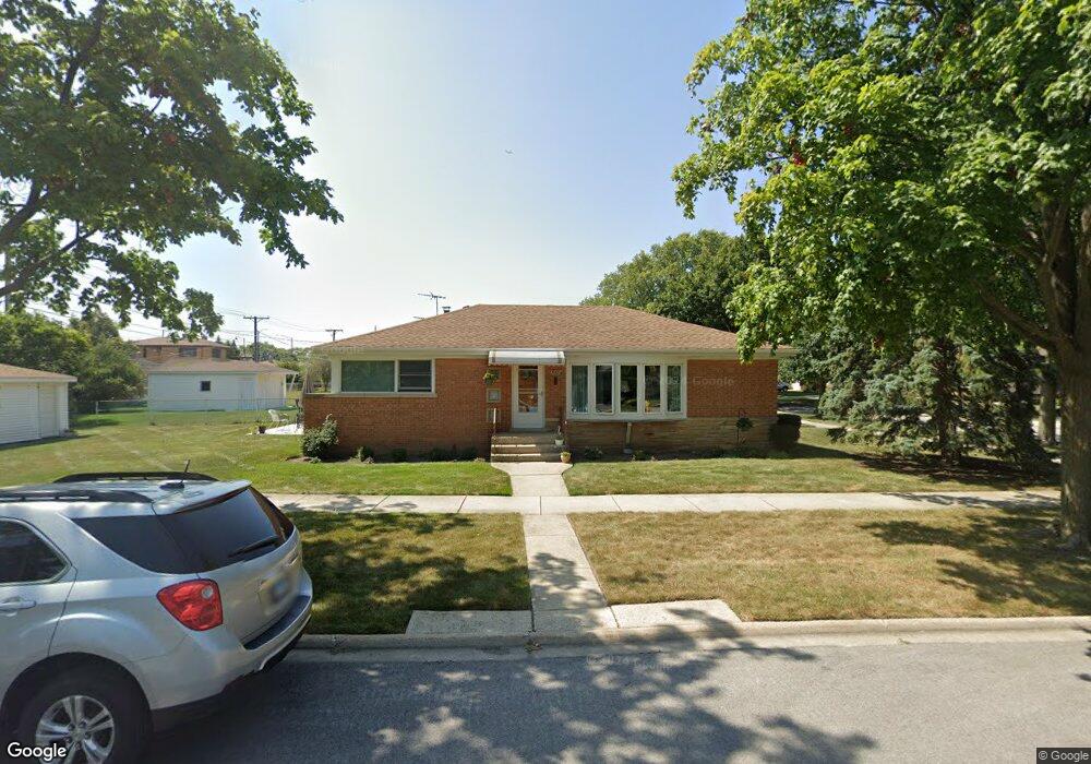
7001 W Dobson St Niles, IL 60714
Lawrencewood Gardens NeighborhoodEstimated Value: $414,000 - $425,000
3
Beds
2
Baths
1,175
Sq Ft
$356/Sq Ft
Est. Value
About This Home
This home is located at 7001 W Dobson St, Niles, IL 60714 and is currently estimated at $418,583, approximately $356 per square foot. 7001 W Dobson St is a home located in Cook County with nearby schools including Clarence E Culver School, Niles West High School, and Logos Christian Academy.
Ownership History
Date
Name
Owned For
Owner Type
Purchase Details
Closed on
May 6, 2024
Sold by
Barbara A Blickhahn Declaration Of Trust and Blickhahn Barbara A
Bought by
Thomas C Blickhahn C and Thomas Barbara A
Current Estimated Value
Purchase Details
Closed on
Apr 23, 2009
Sold by
Blickhahn Thomas C and Blickhahn Barbara A
Bought by
Declaratio Blickhahn Barbara A and Barbara A Blickhahn Declaration Of Trust
Create a Home Valuation Report for This Property
The Home Valuation Report is an in-depth analysis detailing your home's value as well as a comparison with similar homes in the area
Home Values in the Area
Average Home Value in this Area
Purchase History
| Date | Buyer | Sale Price | Title Company |
|---|---|---|---|
| Thomas C Blickhahn C | -- | None Listed On Document | |
| Declaratio Blickhahn Barbara A | -- | None Available |
Source: Public Records
Tax History Compared to Growth
Tax History
| Year | Tax Paid | Tax Assessment Tax Assessment Total Assessment is a certain percentage of the fair market value that is determined by local assessors to be the total taxable value of land and additions on the property. | Land | Improvement |
|---|---|---|---|---|
| 2024 | $6,048 | $32,001 | $9,248 | $22,753 |
| 2023 | $5,628 | $32,001 | $9,248 | $22,753 |
| 2022 | $5,628 | $32,001 | $9,248 | $22,753 |
| 2021 | $4,889 | $25,725 | $6,507 | $19,218 |
| 2020 | $4,730 | $25,725 | $6,507 | $19,218 |
| 2019 | $4,738 | $28,584 | $6,507 | $22,077 |
| 2018 | $4,466 | $25,330 | $5,651 | $19,679 |
| 2017 | $4,595 | $25,330 | $5,651 | $19,679 |
| 2016 | $5,706 | $25,330 | $5,651 | $19,679 |
| 2015 | $4,386 | $22,785 | $4,795 | $17,990 |
| 2014 | $4,270 | $22,785 | $4,795 | $17,990 |
| 2013 | $4,181 | $22,785 | $4,795 | $17,990 |
Source: Public Records
Map
Nearby Homes
- 7554 N Waukegan Rd
- 7753 N Nordica Ave
- 7450 N Waukegan Rd Unit 206
- 7421 N Oconto Ave
- 6882 W Touhy Ave Unit D
- 6914 W Oakton Ct
- 6600 W Wood River Dr Unit B201B
- 7232 W Oakton St
- 7875 N Caldwell Ave Unit 302
- 7021 W Touhy Ave Unit 509B
- 7021 W Touhy Ave Unit 207B
- 7091 W Touhy Ave Unit 209
- 7091 W Touhy Ave Unit 505
- 7448 W Jonquil Terrace
- 6964 W Cleveland St
- 8239 N New England Ave
- 8049 N Osceola Ave
- 8206 N Octavia Ave
- 6425 W Touhy Ave Unit 2B
- 7458 W Touhy Ave
- 7007 W Dobson St
- 7013 W Dobson St
- 6957 W Dobson St
- 7000 W Howard St
- 7000 W Howard St
- 7006 W Howard St
- 7006 W Howard St
- 7017 W Dobson St
- 6958 W Howard St
- 7012 W Howard St
- 6951 W Dobson St
- 6951 W Dobson St
- 6954 W Howard St
- 6954 W Howard St
- 7023 W Dobson St
- 7000 W Dobson St
- 7016 W Howard St
- 7006 W Dobson St
- 7012 W Dobson St
- 6945 W Dobson St