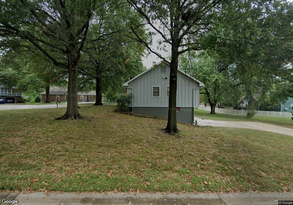
7006 E 132nd St Grandview, MO 64030
Estimated Value: $269,000 - $354,000
2
Beds
3
Baths
1,748
Sq Ft
$175/Sq Ft
Est. Value
About This Home
This home is located at 7006 E 132nd St, Grandview, MO 64030 and is currently estimated at $306,762, approximately $175 per square foot. 7006 E 132nd St is a home located in Jackson County with nearby schools including Meadowmere Elementary School, Grandview Middle, and Grandview High School.
Ownership History
Date
Name
Owned For
Owner Type
Purchase Details
Closed on
Dec 29, 1995
Sold by
Marsh Randy W and Marsh Carol A
Bought by
Asberry Mark A and Asberry Detra Karla
Current Estimated Value
Home Financials for this Owner
Home Financials are based on the most recent Mortgage that was taken out on this home.
Original Mortgage
$90,000
Outstanding Balance
$2,001
Interest Rate
8.25%
Mortgage Type
Purchase Money Mortgage
Estimated Equity
$304,761
Create a Home Valuation Report for This Property
The Home Valuation Report is an in-depth analysis detailing your home's value as well as a comparison with similar homes in the area
Home Values in the Area
Average Home Value in this Area
Purchase History
| Date | Buyer | Sale Price | Title Company |
|---|---|---|---|
| Asberry Mark A | -- | Chicago Title Insurance Co |
Source: Public Records
Mortgage History
| Date | Status | Borrower | Loan Amount |
|---|---|---|---|
| Open | Asberry Mark A | $90,000 |
Source: Public Records
Tax History
| Year | Tax Paid | Tax Assessment Tax Assessment Total Assessment is a certain percentage of the fair market value that is determined by local assessors to be the total taxable value of land and additions on the property. | Land | Improvement |
|---|---|---|---|---|
| 2025 | $3,921 | $51,007 | $7,421 | $43,586 |
| 2024 | $3,854 | $48,218 | $5,012 | $43,206 |
| 2023 | $3,854 | $48,218 | $5,204 | $43,014 |
| 2022 | $3,312 | $38,570 | $5,558 | $33,012 |
| 2021 | $3,309 | $38,570 | $5,558 | $33,012 |
| 2020 | $2,844 | $35,113 | $5,558 | $29,555 |
| 2019 | $2,742 | $35,113 | $5,558 | $29,555 |
| 2018 | $2,019 | $24,056 | $2,874 | $21,182 |
| 2017 | $2,019 | $24,056 | $2,874 | $21,182 |
| 2016 | $2,053 | $23,952 | $3,410 | $20,542 |
| 2014 | $2,041 | $23,482 | $3,343 | $20,139 |
Source: Public Records
Map
Nearby Homes
- 13213 Winchester Ave
- 13218 Craig Ave
- 13008 Crystal Ave
- 6712 E 134th St
- 13012 Bristol Ave
- 13408 Bristol Ave
- 13001 Bristol Ave
- 13429 Winchester Ave
- 7601 High Grove Rd
- 12217 Bennington Ave
- 7505 E 130th St
- 6905 E 129th St
- 6404 E 133rd Terrace
- 12901 Byars Rd
- 7403 E 134th Terrace
- 13420 Belmeade Ave
- 13413 Lowell Ave
- 12200 Craig Dr
- 13321 Applewood Dr
- 7820 E 130th Ct
- 7004 E 132nd St
- 7008 E 132nd St
- 7002 E 132nd St
- 13110 Corrington Ave
- 13112 Corrington Ave
- 7000 E 132nd St
- 13108 Corrington Ave
- 7005 E 132nd St
- 13200 Corrington Ave
- 7007 E 132nd St
- 7007 E 132 St
- 13106 Corrington Ave
- 13117 Winchester Ave
- 13115 Winchester Ave
- 13119 Winchester Ave
- 7001 High Grove Rd
- 13113 Winchester Ave
- 13109 Corrington Ave
- 13121 Winchester Ave
- 13104 Corrington Ave
Your Personal Tour Guide
Ask me questions while you tour the home.