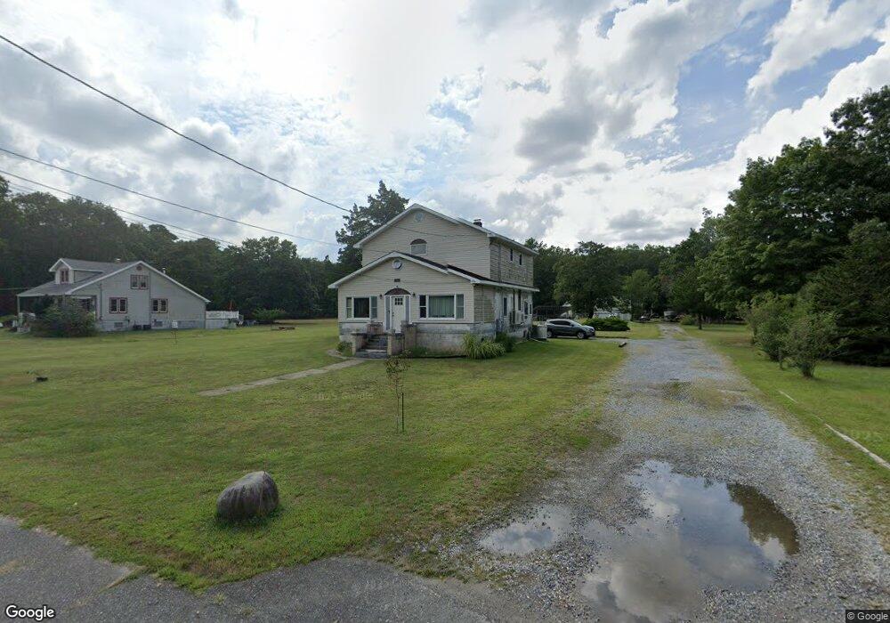
7008 Sheppard Ave Mays Landing, NJ 08330
Estimated Value: $273,368 - $457,000
--
Bed
--
Bath
1,960
Sq Ft
$189/Sq Ft
Est. Value
About This Home
This home is located at 7008 Sheppard Ave, Mays Landing, NJ 08330 and is currently estimated at $369,842, approximately $188 per square foot. 7008 Sheppard Ave is a home located in Atlantic County with nearby schools including Joseph Shaner School, George L. Hess Educational Complex, and William Davies Middle School.
Ownership History
Date
Name
Owned For
Owner Type
Purchase Details
Closed on
Feb 12, 1993
Sold by
Pluguez Michael A
Bought by
Pluguez Michael A and Pluguez Barbara L
Current Estimated Value
Purchase Details
Closed on
Oct 17, 1991
Sold by
Pluguez Mary V
Bought by
Pluguez Michael A
Create a Home Valuation Report for This Property
The Home Valuation Report is an in-depth analysis detailing your home's value as well as a comparison with similar homes in the area
Home Values in the Area
Average Home Value in this Area
Purchase History
| Date | Buyer | Sale Price | Title Company |
|---|---|---|---|
| Pluguez Michael A | -- | -- | |
| Pluguez Michael A | -- | -- |
Source: Public Records
Tax History Compared to Growth
Tax History
| Year | Tax Paid | Tax Assessment Tax Assessment Total Assessment is a certain percentage of the fair market value that is determined by local assessors to be the total taxable value of land and additions on the property. | Land | Improvement |
|---|---|---|---|---|
| 2025 | $5,761 | $167,900 | $29,700 | $138,200 |
| 2024 | $5,761 | $167,900 | $29,700 | $138,200 |
| 2023 | $5,416 | $167,900 | $29,700 | $138,200 |
| 2022 | $5,416 | $167,900 | $29,700 | $138,200 |
| 2021 | $5,405 | $167,900 | $29,700 | $138,200 |
| 2020 | $5,405 | $167,900 | $29,700 | $138,200 |
| 2019 | $5,418 | $167,900 | $29,700 | $138,200 |
| 2018 | $5,228 | $167,900 | $29,700 | $138,200 |
| 2017 | $5,146 | $167,900 | $29,700 | $138,200 |
| 2016 | $4,996 | $167,700 | $29,500 | $138,200 |
| 2015 | $4,826 | $167,700 | $29,500 | $138,200 |
| 2014 | $4,863 | $185,100 | $35,600 | $149,500 |
Source: Public Records
Map
Nearby Homes
- 1516 Thirty Third St
- 1362 Annapolis Ave
- 6917 Market St
- 1368 Sitka Ave
- 0 0 Strand Ave
- 0 St Petersburg Ave Unit NJAC2011842
- 0 St Petersburg Ave Unit NJAC2011840
- 6422 Strand Ave
- 0 San Francisco Ave
- 6414 Strand Ave
- 0 Division Ave
- 0 Railroad Blvd
- 6839 Harding Hwy
- 1 Belmont Ave
- 0 South Ave
- 6361 Beacon Ave
- 328 Llewellyn Ave
- 0 Merton Ave Unit NJAC2020566
- 968 Main Ave
- First 1st Ave
- 7018 Sheppard St
- 7017 Sheppard Ave
- 7020 Sheppard Ave
- 7004 Sheppard Ave
- 1472 Mizpah Rd
- 7025 Sheppard Ave
- 7036 Sheppard Ave
- 7033 Sheppard Ave
- 1439 Nashville Ave
- 6948 Sheppard Ave
- 1426 Brooklyn Ave
- 6952 Casale Blvd
- 6957 Sheppard Ave
- 6960 Cole Ave
- 6952 Casale Blvd
- 6996 Strand Ave
- 6954 Cole Ave
- 6985 Cole Ave
- 0 Casale Blvd
- 0 Twenty Fifth St Unit 1006365822