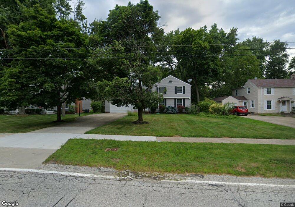
7009 Brookside Rd Independence, OH 44131
Estimated Value: $232,000 - $329,000
4
Beds
3
Baths
1,436
Sq Ft
$192/Sq Ft
Est. Value
About This Home
This home is located at 7009 Brookside Rd, Independence, OH 44131 and is currently estimated at $275,139, approximately $191 per square foot. 7009 Brookside Rd is a home located in Cuyahoga County with nearby schools including Independence Primary School, Independence Middle School, and Independence High School.
Ownership History
Date
Name
Owned For
Owner Type
Purchase Details
Closed on
May 1, 1984
Sold by
Kindl Franklin T and Kindl Evelyn
Bought by
Shallcross John W and Shallcross Karen A
Current Estimated Value
Purchase Details
Closed on
Jan 1, 1975
Bought by
Kindl Franklin T and Kindl Evelyn
Create a Home Valuation Report for This Property
The Home Valuation Report is an in-depth analysis detailing your home's value as well as a comparison with similar homes in the area
Home Values in the Area
Average Home Value in this Area
Purchase History
| Date | Buyer | Sale Price | Title Company |
|---|---|---|---|
| Shallcross John W | $106,000 | -- | |
| Kindl Franklin T | -- | -- |
Source: Public Records
Tax History
| Year | Tax Paid | Tax Assessment Tax Assessment Total Assessment is a certain percentage of the fair market value that is determined by local assessors to be the total taxable value of land and additions on the property. | Land | Improvement |
|---|---|---|---|---|
| 2025 | $3,649 | $79,030 | $13,020 | $66,010 |
| 2024 | $3,780 | $79,030 | $13,020 | $66,010 |
| 2023 | $3,840 | $72,950 | $13,270 | $59,680 |
| 2022 | $3,818 | $72,940 | $13,265 | $59,675 |
| 2021 | $3,763 | $72,940 | $13,270 | $59,680 |
| 2020 | $3,679 | $66,920 | $12,180 | $54,740 |
| 2019 | $3,551 | $191,200 | $34,800 | $156,400 |
| 2018 | $3,381 | $66,920 | $12,180 | $54,740 |
| 2017 | $3,244 | $58,390 | $10,260 | $48,130 |
| 2016 | $3,211 | $58,390 | $10,260 | $48,130 |
| 2015 | $2,970 | $58,390 | $10,260 | $48,130 |
| 2014 | $2,970 | $54,050 | $9,490 | $44,560 |
Source: Public Records
Map
Nearby Homes
- 7003 Brecksville Rd
- SL 23 Kingscote Park
- 6312 E Pleasant Valley Rd
- 7572 Scenicview Dr
- 6119 E Sprague Rd
- 6626 Hawthorne Dr
- 6208 Dora Blvd
- 4730 Eastview Dr
- 6878 W Fitzwater Rd Unit 41
- 4469 Shelly Dr
- 6930 Carriage Hill Dr Unit 101
- 6910 Carriage Hill Dr Unit 101
- 8084 Wright Rd
- 7817 Daniel Dr
- VL TBB Laura Lee Ln
- VL Laura Lee Ln
- 8001 Robin Ln
- 0 Brecksville Rd
- 7571 Pleasant Run Dr
- 2441 Vezber Dr
- 7017 Brookside Rd
- 7001 Brookside Rd
- 6923 Highland Dr
- 7023 Brookside Rd
- 6919 Highland Dr
- 6938 Brookside Rd
- 6933 Brookside Rd
- 7476 Brecksville Rd
- 7016 Brookside Rd
- 6934 Brookside Rd
- 7484 Brecksville Rd
- 7468 Brecksville Rd
- 6915 Highland Dr
- 7022 Brookside Rd
- 6928 Brookside Rd
- 6911 Brookside Rd
- 7460 Brecksville Rd
- 6924 Highland Dr
- 6911 Highland Dr
- 6916 Brookside Rd
Your Personal Tour Guide
Ask me questions while you tour the home.