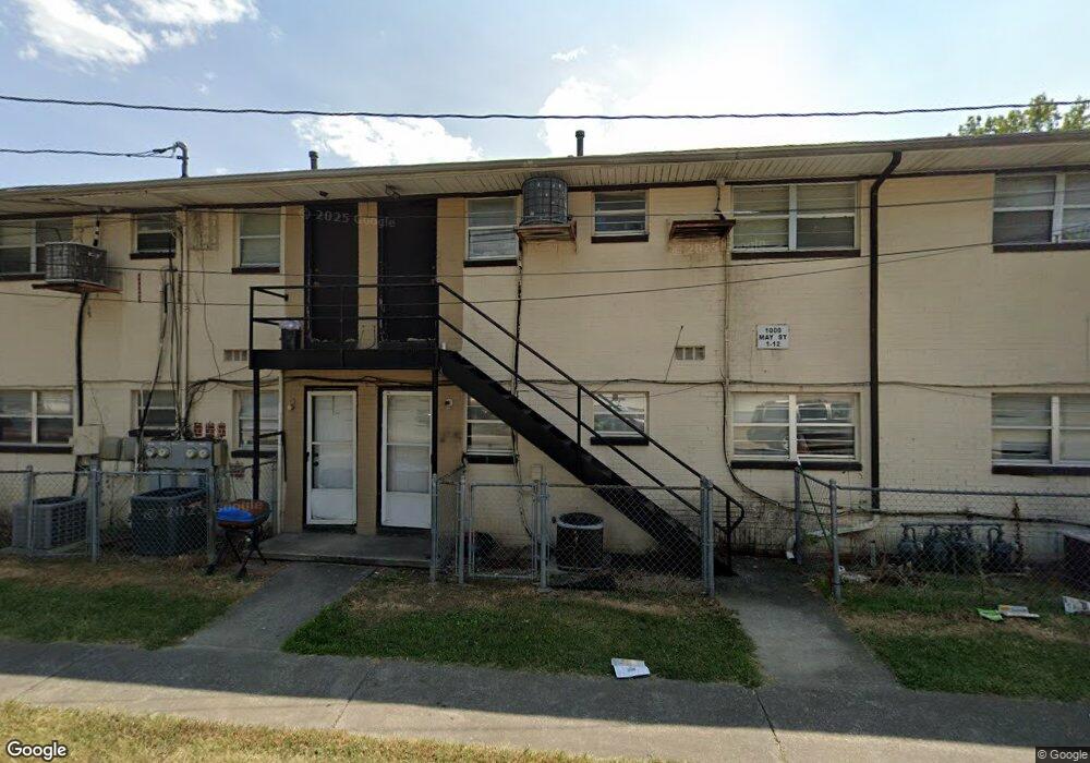
701 5th Ave Dalton, GA 30721
Estimated Value: $9,145,000
Studio
--
Bath
28,000
Sq Ft
$327/Sq Ft
Est. Value
About This Home
This home is located at 701 5th Ave, Dalton, GA 30721 and is currently priced at $9,145,000, approximately $326 per square foot. 701 5th Ave is a home located in Whitfield County with nearby schools including Blue Ridge Elementary School, Dalton High School, and Rock Hill School.
Ownership History
Date
Name
Owned For
Owner Type
Purchase Details
Closed on
Nov 11, 2025
Sold by
C & A Investment Properties Llc
Bought by
A & A Memphis Properties Group
Current Estimated Value
Purchase Details
Closed on
Oct 26, 2020
Sold by
Pramukh Vaml Inc
Bought by
Atlanta Deferred Exchange Inc
Purchase Details
Closed on
Apr 26, 2017
Sold by
Not Provided
Bought by
Pramukh Varni Inc
Purchase Details
Closed on
Dec 15, 2006
Sold by
Not Provided
Bought by
5Th Avenue Apartment Complex L
Purchase Details
Closed on
Jan 1, 2006
Sold by
Not Provided
Bought by
5Th Avenue Apartment Complex L
Create a Home Valuation Report for This Property
The Home Valuation Report is an in-depth analysis detailing your home's value as well as a comparison with similar homes in the area
Purchase History
| Date | Buyer | Sale Price | Title Company |
|---|---|---|---|
| A & A Memphis Properties Group | -- | None Listed On Document | |
| Atlanta Deferred Exchange Inc | $2,000,000 | -- | |
| Pramukh Varni Inc | $1,500,000 | -- | |
| 5Th Avenue Apartment Complex L | $4,750,000 | -- | |
| 5Th Avenue Apartment Complex L | -- | -- | |
| 5Th Avenue Apartment Complex L | -- | -- | |
| 5Th Avenue Apartment Complex L | -- | -- |
Source: Public Records
Tax History
| Year | Tax Paid | Tax Assessment Tax Assessment Total Assessment is a certain percentage of the fair market value that is determined by local assessors to be the total taxable value of land and additions on the property. | Land | Improvement |
|---|---|---|---|---|
| 2025 | $23,726 | $762,914 | $47,200 | $715,714 |
| 2024 | $23,726 | $762,914 | $47,200 | $715,714 |
| 2023 | $16,278 | $456,169 | $18,436 | $437,733 |
| 2022 | $11,721 | $340,293 | $18,436 | $321,857 |
| 2021 | $11,738 | $340,293 | $18,436 | $321,857 |
| 2020 | $10,604 | $295,951 | $18,436 | $277,515 |
| 2019 | $10,933 | $295,951 | $18,436 | $277,515 |
| 2018 | $11,098 | $295,951 | $18,436 | $277,515 |
| 2017 | $6,423 | $177,963 | $18,436 | $159,527 |
| 2016 | $6,465 | $177,963 | $18,436 | $159,527 |
| 2014 | $5,874 | $177,972 | $18,436 | $159,535 |
| 2013 | -- | $177,971 | $18,436 | $159,535 |
Source: Public Records
Map
Nearby Homes
- 626 Fifth Ave
- 1104 May St
- 432 4th Ave
- 902 Mattie Dr
- 303 Janice St
- 1118 Dozier St
- 1112 Riverbend Dr
- 514 Sheridan Ave
- 306 Robinwood Dr
- 204 N Bogle St
- 519 Abigail St
- 208 E Walnut Ave
- 230 Henderson St
- 301B Fields Ave
- 429 S Glenwood Ave
- 406 Lester Ave
- 1302 Jackson Rd
- 825 Martin Luther King jr Blvd
- 436 Whitener Dr
- trac 3 Roosevelt Dr
Your Personal Tour Guide
Ask me questions while you tour the home.