N
Seller's Agent in 2014
Non Member
Estimated Value: $178,913 - $249,000
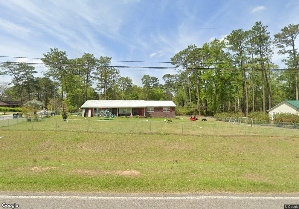
This home is located at 701 Airport Rd, Cairo, GA 39828 since 16 December 2014 and is currently estimated at $227,978, approximately $152 per square foot. 701 Airport Rd is a home located in Grady County with nearby schools including Cairo High School.
Last Agent to Sell the Property
Non Member
Brokerage Phone: Listed on: 12/16/2014
| Date | Buyer | Sale Price | Title Company |
|---|---|---|---|
| Meissner Amy D | -- | -- | |
| Dunham Amy Renee | $95,350 | -- | |
| Ocwen Loan Servicing Llc | -- | -- | |
| Federal National Mtg Associati | $61,463 | -- | |
| Ocwen Loan Servicing Llc | $61,463 | -- | |
| Carter Tina A | $78,000 | -- | |
| Federal National Mtg Associati | $76,361 | -- | |
| Chase Home Finance Llc | $73,361 | -- | |
| Mitchell Lonnie F | $91,600 | -- | |
| Mason Ansu G | -- | -- | |
| Mason Ansu G | $53,000 | -- |
| Date | Status | Borrower | Loan Amount |
|---|---|---|---|
| Open | Meissner Amy D | $70,000 | |
| Previous Owner | Dunham Amy Renee | $97,295 | |
| Previous Owner | Carter Tina A | $78,000 | |
| Previous Owner | Mitchell Lonnie F | $91,550 |
| Date | Event | Price | List to Sale | Price per Sq Ft | Prior Sale |
|---|---|---|---|---|---|
| 12/17/2014 12/17/14 | Sold | $95,350 | 0.0% | $64 / Sq Ft | |
| 12/17/2014 12/17/14 | Sold | $95,350 | +3.1% | $64 / Sq Ft | View Prior Sale |
| 12/16/2014 12/16/14 | For Sale | $92,500 | 0.0% | $62 / Sq Ft | |
| 09/03/2014 09/03/14 | Pending | -- | -- | -- | |
| 07/31/2014 07/31/14 | For Sale | $92,500 | -- | $62 / Sq Ft |
| Year | Tax Paid | Tax Assessment Tax Assessment Total Assessment is a certain percentage of the fair market value that is determined by local assessors to be the total taxable value of land and additions on the property. | Land | Improvement |
|---|---|---|---|---|
| 2024 | $1,808 | $61,680 | $3,840 | $57,840 |
| 2023 | $1,316 | $37,210 | $4,700 | $32,510 |
| 2022 | $1,456 | $39,418 | $4,700 | $34,718 |
| 2021 | $1,460 | $39,418 | $4,700 | $34,718 |
| 2020 | $1,464 | $39,418 | $4,700 | $34,718 |
| 2019 | $1,464 | $39,418 | $4,700 | $34,718 |
| 2018 | $1,392 | $39,418 | $4,700 | $34,718 |
| 2017 | $1,339 | $39,418 | $4,700 | $34,718 |
| 2016 | $1,175 | $34,020 | $4,700 | $29,321 |
| 2015 | $1,219 | $34,020 | $4,700 | $29,321 |
| 2014 | $1,219 | $34,020 | $4,700 | $29,321 |
| 2013 | -- | $31,594 | $4,699 | $26,895 |
N
Seller's Agent in 2014
Non Member
L
Seller's Agent in 2014
Linda Collins Gri,Abr,Ars,Asp
Premier Group Realty
(229) 254-9096
25 Total Sales
L
Buyer's Agent in 2014
Lisa Taylor
KeySouth Real Estate Group, Inc
(229) 221-5980
Source: Thomasville Area Board of REALTORS®
MLS Number: 907519
APN: C0400-00000-011-000
Ask me questions while you tour the home.
