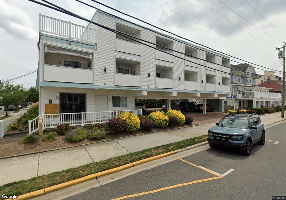
701 Atlantic Ave Unit 201 Ocean City, NJ 08226
Estimated Value: $336,000 - $396,000
--
Bed
--
Bath
474
Sq Ft
$749/Sq Ft
Est. Value
About This Home
This home is located at 701 Atlantic Ave Unit 201, Ocean City, NJ 08226 and is currently estimated at $355,082, approximately $749 per square foot. 701 Atlantic Ave Unit 201 is a home located in Cape May County with nearby schools including Ocean City Primary School, Ocean City Intermediate School, and Ocean City High School.
Ownership History
Date
Name
Owned For
Owner Type
Purchase Details
Closed on
Oct 15, 2010
Sold by
Mcburnie John D and Mcburnie Theresa I
Bought by
Clayton Smith Neill L
Current Estimated Value
Home Financials for this Owner
Home Financials are based on the most recent Mortgage that was taken out on this home.
Original Mortgage
$116,000
Outstanding Balance
$76,626
Interest Rate
4.37%
Mortgage Type
New Conventional
Estimated Equity
$278,456
Purchase Details
Closed on
May 10, 1997
Sold by
Phase Iv Development Co
Bought by
Mcburnie John D
Home Financials for this Owner
Home Financials are based on the most recent Mortgage that was taken out on this home.
Original Mortgage
$31,000
Interest Rate
8.12%
Create a Home Valuation Report for This Property
The Home Valuation Report is an in-depth analysis detailing your home's value as well as a comparison with similar homes in the area
Home Values in the Area
Average Home Value in this Area
Purchase History
| Date | Buyer | Sale Price | Title Company |
|---|---|---|---|
| Clayton Smith Neill L | $145,000 | Shore Title Agency Inc | |
| Mcburnie John D | $41,000 | -- |
Source: Public Records
Mortgage History
| Date | Status | Borrower | Loan Amount |
|---|---|---|---|
| Open | Clayton Smith Neill L | $116,000 | |
| Previous Owner | Mcburnie John D | $31,000 |
Source: Public Records
Tax History Compared to Growth
Tax History
| Year | Tax Paid | Tax Assessment Tax Assessment Total Assessment is a certain percentage of the fair market value that is determined by local assessors to be the total taxable value of land and additions on the property. | Land | Improvement |
|---|---|---|---|---|
| 2025 | $1,519 | $135,400 | $69,300 | $66,100 |
| 2024 | $1,519 | $135,400 | $69,300 | $66,100 |
| 2023 | $1,450 | $135,400 | $69,300 | $66,100 |
| 2022 | $1,393 | $135,400 | $69,300 | $66,100 |
| 2021 | $1,010 | $135,400 | $69,300 | $66,100 |
| 2020 | $1,324 | $135,400 | $69,300 | $66,100 |
| 2019 | $1,309 | $135,400 | $69,300 | $66,100 |
| 2018 | $1,297 | $135,400 | $69,300 | $66,100 |
| 2017 | $1,277 | $135,400 | $69,300 | $66,100 |
| 2016 | $1,228 | $135,400 | $69,300 | $66,100 |
| 2015 | $1,212 | $135,400 | $69,300 | $66,100 |
| 2014 | $1,194 | $135,400 | $69,300 | $66,100 |
Source: Public Records
Map
Nearby Homes
- 811 A E 7 Ave
- 811 E 7th St
- 825 Plymouth Place Unit 16
- 858 E 7th St Unit 5
- 871 E 7th St Unit 29
- 618 Atlantic Ave Unit 2nd Floor
- 807 E 8th St Unit 515
- 616 Atlantic Ave Unit 1st Floor
- 853-71 Plymouth Place Unit 13
- 875 Plymouth Place Unit 35
- 875 Plymouth Place Unit 33
- 816 E 6th St Unit 1 St Unit 1
- 713 E 8th St Unit B
- 701 E 8th St Unit B1
- 710 Ocean Ave Unit B3
- 870 E 7th St Unit 215
- 726 Ocean Ave
- 611 E 7th St
- 724 Ocean Ave
- 617 E 8th St
- 701 Atlantic Ave Unit 200
- 701 Atlantic Ave Unit 305
- 701 Atlantic Ave
- 701 Atlantic Ave
- 701 Atlantic Ave Unit 302
- 701 Atlantic Ave
- 701 Atlantic Ave
- 701 Atlantic Ave
- 701 Atlantic Ave
- 701 Atlantic Ave
- 701 Atlantic Ave
- 701 Atlantic Ave Unit 101
- 701 Atlantic Ave Unit 205
- 804 E 7th St Unit 1
- 804 E 7th St Unit 6
- 807 Plymouth Place Unit 2
- 801 Plymouth Place
- 805 Plymouth Place Unit 1
- 805 Plymouth Place Unit 7
- 805 Plymouth Place Unit 7