Estimated Value: $229,000 - $243,000
3
Beds
2
Baths
970
Sq Ft
$240/Sq Ft
Est. Value
About This Home
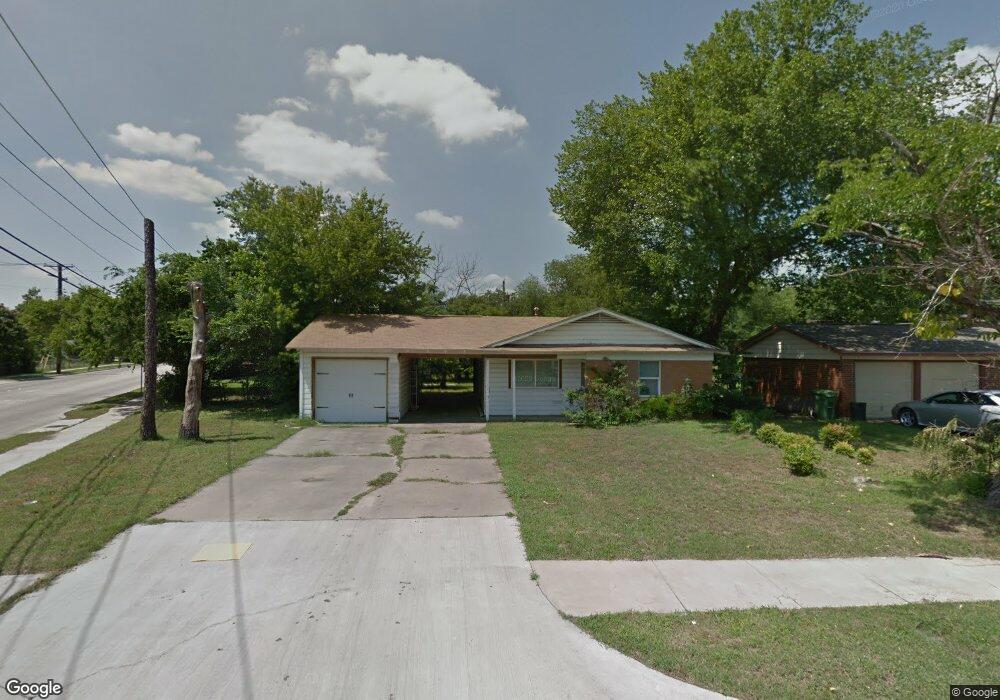
This home is located at 701 Brookfield Dr, Hurst, TX 76053 and is currently estimated at $233,257, approximately $240 per square foot. 701 Brookfield Dr is a home located in Tarrant County with nearby schools including Bellaire Elementary School, Hurst J High School, and L.D. Bell High School.
Ownership History
Date
Name
Owned For
Owner Type
Purchase Details
Closed on
May 9, 2017
Sold by
Hard Right Llc
Bought by
Demery Melinda M
Current Estimated Value
Home Financials for this Owner
Home Financials are based on the most recent Mortgage that was taken out on this home.
Original Mortgage
$61,500
Outstanding Balance
$51,326
Interest Rate
4.23%
Mortgage Type
New Conventional
Estimated Equity
$181,931
Purchase Details
Closed on
Aug 17, 2009
Sold by
Sperry Robert and Sperry Robert M
Bought by
Hard Right Llc
Create a Home Valuation Report for This Property
The Home Valuation Report is an in-depth analysis detailing your home's value as well as a comparison with similar homes in the area
Home Values in the Area
Average Home Value in this Area
Purchase History
| Date | Buyer | Sale Price | Title Company |
|---|---|---|---|
| Demery Melinda M | -- | Capital Title | |
| Hard Right Llc | -- | None Available |
Source: Public Records
Mortgage History
| Date | Status | Borrower | Loan Amount |
|---|---|---|---|
| Open | Demery Melinda M | $61,500 |
Source: Public Records
Tax History
| Year | Tax Paid | Tax Assessment Tax Assessment Total Assessment is a certain percentage of the fair market value that is determined by local assessors to be the total taxable value of land and additions on the property. | Land | Improvement |
|---|---|---|---|---|
| 2025 | $801 | $202,684 | $50,000 | $152,684 |
| 2024 | $801 | $202,684 | $50,000 | $152,684 |
| 2023 | $3,648 | $182,092 | $35,000 | $147,092 |
| 2022 | $3,910 | $180,121 | $35,000 | $145,121 |
| 2021 | $3,724 | $173,844 | $35,000 | $138,844 |
| 2020 | $3,377 | $140,362 | $35,000 | $105,362 |
| 2019 | $3,190 | $139,798 | $35,000 | $104,798 |
| 2018 | $1,690 | $118,491 | $15,000 | $103,491 |
| 2017 | $2,391 | $94,468 | $15,000 | $79,468 |
| 2016 | $2,785 | $110,069 | $15,000 | $95,069 |
| 2015 | $983 | $37,500 | $15,000 | $22,500 |
| 2014 | $983 | $37,500 | $15,000 | $22,500 |
Source: Public Records
Map
Nearby Homes
- 705 Timbercreek Dr
- 740 Shady Ln
- 42 Page St
- 413 Wanda Way
- 4106 Hollow Oak Dr
- 1302 Woodridge Cir
- 1306 Driftwood Dr
- 212 E Ellen Ave
- 1309 Driftwood Dr
- 424 Holder Dr
- 312 E Ellen Ave
- 840 Forest Hollow Dr
- 260 Corinna Ct
- 108 Donald Dr
- 808 Lee Dr
- 205 Corinna Ct
- 552 Norwood Dr
- 832 Chateau Valee Cir
- 803 Glenda Dr
- 47 Donald Ct
- 705 Brookfield Dr
- 709 Brookfield Dr
- 704 Greenway Dr
- 623 Brookfield Dr
- 708 Greenway Dr
- 700 Greenway Dr
- 712 Greenway Dr
- 713 Brookfield Dr
- 708 Brookfield Dr
- 619 Brookfield Dr
- 716 Greenway Dr
- 628 Brookfield Dr
- 620 Greenway Dr
- 717 Brookfield Dr
- 624 Brookfield Dr
- 716 Brookfield Dr
- 615 Brookfield Dr
- 720 Greenway Dr
- 616 Greenway Dr
- 620 Brookfield Dr
Your Personal Tour Guide
Ask me questions while you tour the home.