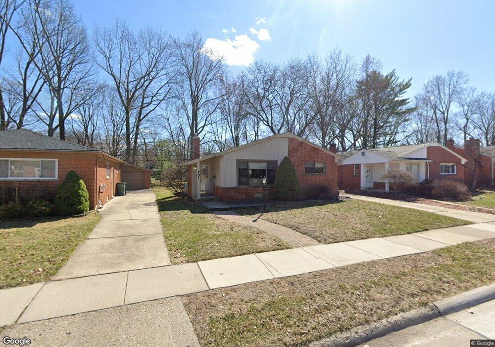
701 Butternut Ave Royal Oak, MI 48073
Estimated Value: $333,090 - $387,000
3
Beds
2
Baths
1,112
Sq Ft
$323/Sq Ft
Est. Value
About This Home
This home is located at 701 Butternut Ave, Royal Oak, MI 48073 and is currently estimated at $358,773, approximately $322 per square foot. 701 Butternut Ave is a home located in Oakland County with nearby schools including Addams Elementary, Royal Oak Middle School, and Royal Oak High School.
Ownership History
Date
Name
Owned For
Owner Type
Purchase Details
Closed on
Mar 31, 2004
Sold by
Christiansen Lance
Bought by
Porter Lynne M
Current Estimated Value
Home Financials for this Owner
Home Financials are based on the most recent Mortgage that was taken out on this home.
Original Mortgage
$214,307
Outstanding Balance
$100,850
Interest Rate
5.66%
Mortgage Type
FHA
Estimated Equity
$257,923
Purchase Details
Closed on
Jul 25, 2003
Sold by
Gerard Thomas A and Gerard Annemarie
Bought by
Christiansen Lance
Purchase Details
Closed on
Jun 30, 1998
Sold by
Harris Jeffrey A
Bought by
Gerard Thomas
Home Financials for this Owner
Home Financials are based on the most recent Mortgage that was taken out on this home.
Original Mortgage
$127,900
Interest Rate
7.13%
Create a Home Valuation Report for This Property
The Home Valuation Report is an in-depth analysis detailing your home's value as well as a comparison with similar homes in the area
Home Values in the Area
Average Home Value in this Area
Purchase History
| Date | Buyer | Sale Price | Title Company |
|---|---|---|---|
| Porter Lynne M | $216,000 | Parks Title | |
| Christiansen Lance | $215,000 | Metro Title Corp | |
| Gerard Thomas | $159,900 | -- |
Source: Public Records
Mortgage History
| Date | Status | Borrower | Loan Amount |
|---|---|---|---|
| Open | Porter Lynne M | $214,307 | |
| Previous Owner | Gerard Thomas | $127,900 |
Source: Public Records
Tax History Compared to Growth
Tax History
| Year | Tax Paid | Tax Assessment Tax Assessment Total Assessment is a certain percentage of the fair market value that is determined by local assessors to be the total taxable value of land and additions on the property. | Land | Improvement |
|---|---|---|---|---|
| 2024 | $2,594 | $129,820 | $0 | $0 |
| 2022 | $3,065 | $112,890 | $0 | $0 |
| 2020 | $2,521 | $101,770 | $0 | $0 |
| 2018 | $3,065 | $93,790 | $0 | $0 |
| 2017 | $2,946 | $93,790 | $0 | $0 |
| 2015 | -- | $85,580 | $0 | $0 |
| 2014 | -- | $78,740 | $0 | $0 |
| 2011 | -- | $68,610 | $0 | $0 |
Source: Public Records
Map
Nearby Homes
- 816 Royal Ave
- 922 Butternut Ave
- 1123 Royal Ave
- 1012 W Windemere Ave
- 306 W 13 Mile Rd
- 2931 N Main St
- 3553 Marais Ave
- 1304 W Windemere Ave
- 3303 Vinsetta Blvd
- 140 E Lawrence Ave
- 817 Magnolia Ave
- 1433 Royal Ave
- 3316 Vinsetta Blvd
- 2814 Crooks Rd
- 206 E Windemere Ave
- 142 Midland Blvd
- 1211 Smith Ave
- 306 Charlotte Ave
- 411 W Sunnybrook Dr
- 2115 Marywood Dr
- 631 Butternut Ave
- 709 Butternut Ave
- 627 Butternut Ave
- 623 Butternut Ave
- 702 Butternut Ave
- 3003 Sylvan Dr
- 638 Royal Ave
- 634 Royal Ave
- 619 Butternut Ave
- 706 Butternut Ave
- 715 Butternut Ave
- 632 Royal Ave
- 706 Royal Ave
- 708 Butternut Ave
- 3007 Sylvan Dr
- 719 Butternut Ave
- 712 Royal Ave
- 626 Royal Ave
- 622 Royal Ave
- 714 Butternut Ave